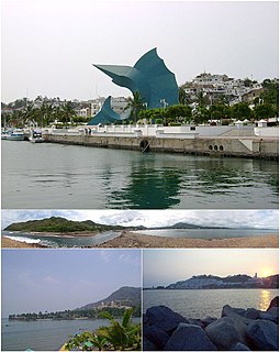
Manzanillo is a city, seat of Manzanillo Municipality, in the Mexican state of Colima. The city, located on the Pacific Ocean, contains Mexico's busiest port that is responsible for handling Pacific cargo for the Mexico City area. It is the largest producing municipality for the business sector and tourism in the state of Colima.

The Jalisco Stadium is a football stadium located in Guadalajara, Mexico. It is the third largest Mexican football stadium behind Estadio Azteca and Estadio Olímpico Universitario. The facility is located in the city of Guadalajara, Jalisco, 400 kilometers north-west of Mexico City, and has a maximum capacity of 55,110 spectators.
The Plaza de Toros Nuevo Progreso is a bull ring in the Mexican city of Guadalajara, Jalisco. It is currently used for bull fighting and also for hosting professional wrestling events. The stadium holds 20,000 people and was built in 1967.
Pihuamo is a town and municipality located in the state of Jalisco in Mexico.
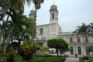
The Roman Catholic Diocese of Colima is a suffragan diocese of the Archdiocese of Guadalajara.

Ciudad de Villa de Álvarez is a city in the Mexican state of Colima. It is the municipal seat of Villa de Álvarez municipality. The city is adjacent to the northwest side of the state capital city of Colima and the two can be considered as "twin cities", with Ciudad de Villa de Álvarez having a 2005 census population of 97,701 and Colima having a population of 123,597. They are both part of the Colima-Villa de Álvarez metropolitan area, which includes the population of Colima municipality (132,237) and Villa de Álvarez municipality (100,121). The city and the municipality of Villa de Álvarez both rank third in the state in their respective categories in population, behind only Colima itself and Manzanillo. Villa de Álvarez municipality has an area of 428.4 km².
Chinicuila is a municipality located in the southwestern region of the Mexican state of Michoacán. The municipality has an area of 928.64 square kilometres and is bordered to the north by the state of Jalisco, to the east by Coalcomán, to the south by Aquila, and to the west by Coahuayana and the state of Colima. The municipality had a population of 5,343 inhabitants according to the 2005 census. Its municipal seat is the city of Villa Victoria.
Coahuayana is a municipality located in the southwest region of the Mexican state of Michoacán. The municipality has an area of 362.34 square kilometres and is bordered to the north by the municipality of Chinicuila, to the south by Aquila and the Pacific Ocean, and to the west and northwest by the state of Colima. The municipality had a population of 11,632 inhabitants according to the 2005 census. Its municipal seat is the city of the same name.

Armería is a municipality in the south-central part of the Mexican state of Colima. Ciudad de Armería is a city and the seat of Armería municipality. The municipality reported 29,599 inhabitants in the 2015 census and has an area of 341.60 km². Its municipal seat is Ciudad de Armería.
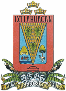
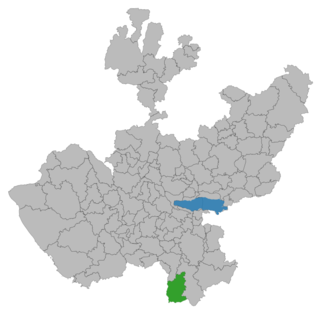
Ixtlahuacán is a municipality in the Mexican state of Colima. The municipal seat lies at Ixtlahuacán. The municipality covers an area of 468.7 km².
Buen Pais is a small town located in the state of Jalisco, Mexico. It has about 300 citizens. It's close to two major cities, Colima and Guadalajara.
Tuxpan is a town and municipality in the Mexican state of Jalisco. The name "Tuxpan" comes from the Nahuatl word tochpan, a word used to describe where rabbits live or possibly place of abundant rabbits. Some others translate it as a location above the river.

The Instituto Nacional de Bellas Artes y Literatura, located in the Palacio de Bellas Artes in Mexico City, is the Mexican institution in charge of coordinating artistic and cultural activities in the country.
Marie-Jean-Eudes Ecological Reserve is an ecological reserve in Quebec, Canada. It was established on April 15, 1992. It is located near La Mauricie National Park, northwest of the city of Shawinigan.

Memorial Hall in Albert Square, Manchester, England, was constructed in 1863–1866 by Thomas Worthington. It was built to commemorate the bicentennial anniversary of the 1662 Act of Uniformity, when the secession of some 2,000 Anglican clergy led to the birth of Nonconformism It is a Grade II* listed building as of 14 February 1972.

Stueng Hav is one of four districts of Preah Sihanouk Province in Cambodia. According to the 1998 census of Cambodia, it had a population of 13,108.

Museo Universitario de Artes Populares María Teresa Pomar is a museum dedicated to Mexico's handcrafts and folk art tradition, called “artesanía.” It is part of the University of Colima in the city of Colima, founded by artesanía collector and promoter María Terea Pomar. It contains one of the most important collections of its type in Mexico, covering traditions from around the country as well as the artesanía and traditions of the state of Colima.
The small town Los Mazos is situated in the Municipality of Tuxpan, Jalisco. It has approximately 190 inhabitants. Los Mazos sits at a height of 1,780 meters. Located on the skirts of a couple of volcanoes, an inactive one called El Nevado de Colima and an active one called the Volcan de Colima, also known as the Volcan de Fuego or "fire volcano". It is located near the city of Tuxpan and is located within its municipality. The town of Los Mazos once belonged to a bigger hacienda and shares a common water system and storage pools called "tanques" with Las Canoas, another few tanques are located throughout the region. The tanques are constructed with cement and stone, and coated in a mixture of cement and ox blood giving them a dark ocher look, these tanques were used to store potable, cattle and plant water.
Laguna El Jabalí is a lagoon located in Colima State, México. It is an ecological reserve in an area of forest protection and shelter for wildlife. Its objectives are:

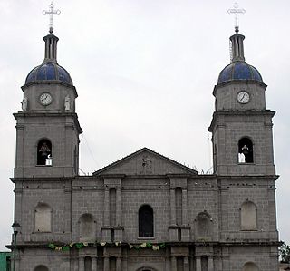
The St. Joseph Cathedral Also Ciudad Guzmán Cathedral It is a Catholic cathedral in Mexico that serves as the mother church of the Roman Catholic Diocese of Ciudad Guzmán and the seat of its bishop. Built at the end of the 19th century, it was completed around 1900.


