Fayette County, Virginia has existed twice in the U.S. state of Virginia's history. Formed in 1780, and 1831, respectively, both counties were named in honor of the Marquis de Lafayette, who had played a key role assisting the Continental Army during the American Revolutionary War, and each was separated from Virginia due to the creation of a new state, partitioned in accordance with Article IV, Section 3, Clause 1 of the United States Constitution. The two counties continued in existence as:

In the United States, a state is a constituent political entity, of which there are currently 50. Bound together in a political union, each state holds governmental jurisdiction over a separate and defined geographic territory and shares its sovereignty with the federal government. Due to this shared sovereignty, Americans are citizens both of the federal republic and of the state in which they reside. State citizenship and residency are flexible, and no government approval is required to move between states, except for persons restricted by certain types of court orders. Four states use the term commonwealth rather than state in their full official names.

Virginia, officially the Commonwealth of Virginia, is a state in the Southeastern and Mid-Atlantic regions of the United States located between the Atlantic Coast and the Appalachian Mountains. The geography and climate of the Commonwealth are shaped by the Blue Ridge Mountains and the Chesapeake Bay, which provide habitat for much of its flora and fauna. The capital of the Commonwealth is Richmond; Virginia Beach is the most populous city, and Fairfax County is the most populous political subdivision. The Commonwealth's estimated population as of 2018 is over 8.5 million.

In the United States, an administrative or political subdivision of a state is a county, which is a region having specific boundaries and usually some level of governmental authority. The term "county" is used in 48 U.S. states, while Louisiana and Alaska have functionally equivalent subdivisions called parishes and boroughs respectively.
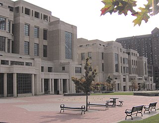
Fayette County is a county located in the U.S. state of Kentucky. As of the 2010 census, the population was 295,803, making it the second-most populous county in the commonwealth. Its territory, population and government are coextensive with the city of Lexington, which also serves as the county seat.
Fayette County is a county in the U.S. state of West Virginia. As of the 2010 census, the population was 46,039. Its county seat is Fayetteville. It is part of the Beckley, WV Metropolitan Statistical Area in Southern West Virginia.
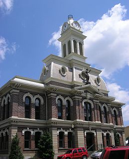
Scott County is a county located in the U.S. state of Kentucky. As of the 2010 census, the population was 47,173. Its county seat is Georgetown.

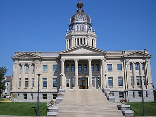
Lewis County is a county located in the U.S. state of Kentucky. As of the 2010 census, the population was 13,870. Its county seat is Vanceburg.
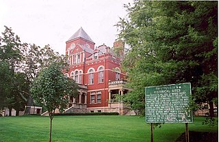
Bourbon County is a county located in the U.S. state of Kentucky. As of the 2010 census, the population was 19,985. Its county seat is Paris.

In the context of the American Civil War (1861–65), the border states were slave states that did not declare a secession from the Union and did not join the Confederacy. To their north they bordered free states of the Union and to their south they bordered Confederate slave states. Of the 34 U.S. states in 1861, nineteen were free states and fifteen were slave states. Two slave states never declared a secession or adopted an ordinance: Delaware and Maryland. Four others did not declare secession until after the Battle of Fort Sumter and were briefly considered to be border states: Arkansas, North Carolina, Tennessee and Virginia—after this, they were less frequently called "border states". Also included as a border state during the war is West Virginia, which was formed from 50 counties of Virginia and became a new state in the Union in 1863.

In the history of the United States, a slave state was a U.S. state in which the practice of slavery was legal, and a free state was one in which slavery was prohibited or being legally phased out. Historically, in the 17th century, slavery was established in a number of English overseas possessions. In the 18th century, it existed in all the British colonies of North America. In 1776, slavery was legal throughout the Thirteen Colonies; starting with Pennsylvania in 1780, about half the states abolished slavery during the Revolutionary War or in the first decades of the new country. Slavery became a divisive issue; it was a major issue during the writing of the U.S. Constitution, and slavery was the primary cause of the American Civil War. The Thirteenth Amendment to the United States Constitution, ratified in December 1865, abolished slavery throughout all of the United States.

Christopher Greenup was an American politician who served as a U.S. Representative and the third Governor of Kentucky. Little is known about his early life; the first reliable records about him are documents recording his service in the Revolutionary War where he served as a lieutenant in the Continental Army and a colonel in the Virginia militia.
John Todd was a frontier military officer during the American Revolutionary War and the first administrator of the Illinois County of the U.S. state of Virginia before that state ceded the territory to the federal government.

Kentucky County was formed by the Commonwealth of Virginia from the western portion of Fincastle County effective December 31, 1776. During the three and one-half years of Kentucky County's existence, its seat of government was Harrodstown.
Jefferson County, Virginia has existed twice in the U.S. state of Virginia's history. Formed in 1780, and 1801, respectively, both counties were named for one of that state's most revered sons, Thomas Jefferson, and each was separated from Virginia due to the creation of a new state, partitioned in accordance with Article IV, Section 3, Clause 1 of the United States Constitution. The two counties continued in existence as:

George William Summers was an attorney, politician, and judge from Virginia.

The Huntington–Ashland metropolitan area is the largest metropolitan statistical area in West Virginia and includes seven counties across three states: West Virginia, Kentucky, and Ohio. New definitions from February 28, 2013 placed the population at 361,580. The MSA is nestled along the banks of the Ohio River within the Appalachian Plateau region. The area is referred to locally as the "Tri-State area". In addition, the three largest cities are referred to as the River Cities.
U.S. Route 27 (US 27) in Kentucky runs 190.785 miles (307.039 km) from the Tennessee border to the Ohio border at Cincinnati. It crosses into the state in the Lake Cumberland area, passing near or through many small towns, including Somerset, Stanford, and Nicholasville. The road then passes straight through the heart of Lexington, including past the University of Kentucky (UK) and Transylvania University. North of Lexington it passes through Cynthiana and Falmouth before entering Campbell County and passing through many Northern Kentucky suburbs before ending at the Ohio state line on the Taylor Southgate Bridge in Cincinnati.

The Admission to the Union Clause of the United States Constitution, often called the New States Clause, found at Article IV, Section 3, Clause 1, authorizes the Congress to admit new states into the United States beyond the thirteen already in existence at the time the Constitution went into effect.
Mason County, Virginia has existed twice in the U.S. state of Virginia's history. Formed in 1788, and 1804, respectively, both counties were named for George Mason, a Virginia delegate to the 1787 Constitutional Convention, and each was separated from Virginia due to the creation of a new state, partitioned in accordance with Article IV, Section 3, Clause 1 of the United States Constitution. The two counties continued in existence as:
Mercer County, Virginia has existed twice in the U.S. state of Virginia's history. Formed in 1785, and 1837, respectively, both counties were named for Revolutionary War General Hugh Mercer, who was killed at the Battle of Princeton in 1777, and each was separated from Virginia due to the creation of a new state, partitioned in accordance with Article IV, Section 3, Clause 1 of the United States Constitution. The two counties continued in existence as:

Alfred Beckley was the founder of Beckley, West Virginia, and a Brigadier General in the Virginia militia during the American Civil War. He named the city of Beckley in honor of his father, John James Beckley, who was the first librarian of the United States Congress.
This page is based on this
Wikipedia article Text is available under the
CC BY-SA 4.0 license; additional terms may apply.
Images, videos and audio are available under their respective licenses.