Felben

Last updated

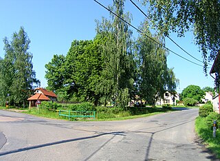
Felben is a village and former municipality in the canton of Thurgau, Switzerland.

Canton of Thurgau Canton of Switzerland

The canton of Thurgau is a northeast canton of Switzerland.

Switzerland federal republic in Western Europe

Switzerland, officially the Swiss Confederation, is a country situated in western, central and southern Europe. It consists of 26 cantons, and the city of Bern is the seat of the federal authorities. The sovereign state is a federal republic bordered by Italy to the south, France to the west, Germany to the north, and Austria and Liechtenstein to the east. Switzerland is a landlocked country geographically divided between the Alps, the Swiss Plateau and the Jura, spanning a total area of 41,285 km2 (15,940 sq mi). While the Alps occupy the greater part of the territory, the Swiss population of approximately 8.5 million people is concentrated mostly on the plateau, where the largest cities are to be found: among them are the two global cities and economic centres Zürich and Geneva.

It was first recorded in year 1178 as Veluen. In 1433 it was known as Felwan.

The municipality had 200 inhabitants in 1850, which increased to 281 in 1900, 424 in 1950 and 525 in 1980.

In 1983 the municipality was merged with the neighboring municipality Wellhausen to form a new and larger municipality Felben-Wellhausen.

Wellhausen is a village and former municipality in the canton of Thurgau, Switzerland.

Felben-Wellhausen Place in Thurgau, Switzerland

Felben-Wellhausen is a municipality in the district of Frauenfeld in the canton of Thurgau in Switzerland.

Related Research Articles

Grafhorst is a small town about 3 km north of Kampen, in the Dutch province of Overijssel. It received city rights in 1333.

Zurzach District is a district in the Swiss Canton of Aargau. The district capital is Bad Zurzach. It covers the Studenland area and is located in the northeastern part of the canton. It has a population of 34,073.

Bern District District in Switzerland

Bern District was an administrative district in the canton of Bern, Switzerland. It had an area of 233 km2 (90 sq mi) and a population of 237,919.

Žarnov Municipality of Košice–okolie District in Slovakia

Žarnov is a village and municipality in Košice-okolie District in the Kosice Region of eastern Slovakia.

Sikenička municipality of Slovakia

Sikenička is a village and municipality in the Nové Zámky District in the Nitra Region of south-west Slovakia.

Bichelsee

Bichelsee is a village and former municipality in the canton of Thurgau, Switzerland. It takes its name from the nearby lake, Bichelsee.

Ponto Valentino is a village and former municipality in the canton of Ticino, Switzerland.

Mianos is a municipality located in the province of Zaragoza, Aragon, Spain. According to the 2004 census (INE), the municipality has a population of 45 inhabitants.

Castro is a village and former municipality in the canton of Ticino, Switzerland.

Uesslingen is a village and former municipality in the canton of Thurgau, Switzerland.

S8 (ZVV) rail line of Zurcher Verkehrsverbund

The S8 is a regional railway line of the S-Bahn Zürich on the Zürcher Verkehrsverbund (ZVV), Zürich transportation network, and is one of the network's lines connecting the cantons of Thurgau, Zürich and Schwyz.

Křížkový Újezdec Municipality and village in Central Bohemian Region, Czech Republic

Křížkový Újezdec is a village and municipality in Prague-East District in the Central Bohemian Region of the Czech Republic. The municipality covers an area of 4.85 square kilometres (1.87 sq mi) and as of 2010 it had a population of 213. First written notice about the village is from year 1349.

Banderilla is a municipality located in the central zone of the State of Veracruz, Mexico, about 9 km from the state capital, Xalapa. It has a surface area of 22.21 km². It is located at 19°35′N96°56′W. Tradition has it that the name alludes to a small flag (banderilla) that thieves would hoist on the summit of the hill of La Martinica as a signal to their accomplices that a valuable goods were being moved along the royal highway.

Tepexi de Rodríguez (municipality) is a town and municipality in Puebla in south-eastern Mexico.

Emmental District in the Canton of Bern was created on 1 January 2010. It is part of the Emmental-Oberaargau administrative region. It contains 40 municipalities with an area of 690.45 km2 (266.58 sq mi) and a population of 97,057.

Ööriku is a village in Saaremaa Parish, Saare County in western Estonia.

Cserhátszentiván is a village and municipality in the comitat of Nógrád, Hungary.

S30 (ZVV) line of the Zurich S-Bahn

The S30 is a regional railway line of the Zürich S-Bahn on the ZVV. It connects the cantons of Zürich and Thurgau, Switzerland, with some services extending to the canton of St. Gallen.

References

<i>Historical Dictionary of Switzerland</i> encyclopedia on the history of Switzerland

The Historical Dictionary of Switzerland is an encyclopedia on the history of Switzerland that aims to take into account the results of modern historical research in a manner accessible to a broader audience.

Coordinates: 47°35′N8°56′E / 47.583°N 8.933°E / 47.583; 8.933

Geographic coordinate system Coordinate system

A geographic coordinate system is a coordinate system that enables every location on Earth to be specified by a set of numbers, letters or symbols. The coordinates are often chosen such that one of the numbers represents a vertical position and two or three of the numbers represent a horizontal position; alternatively, a geographic position may be expressed in a combined three-dimensional Cartesian vector. A common choice of coordinates is latitude, longitude and elevation. To specify a location on a plane requires a map projection.