Related Research Articles

The aurochs, also known as urus or ure, is an extinct species of large wild cattle that inhabited Asia, Europe, and North Africa. It is the ancestor of domestic cattle; it has also been suggested as an ancestor genetically to the modern European bison, which crossbred with steppe bison. The species survived in Europe until 1627, when the last recorded aurochs died in the Jaktorów Forest, Poland.

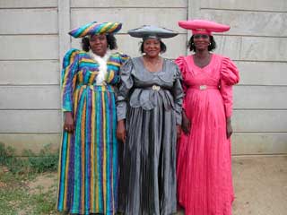
KwaZulu-Natal is a province of South Africa that was created in 1994 when the Zulu bantustan of KwaZulu and Natal Province were merged. It is located in the southeast of the country, enjoying a long shoreline beside the Indian Ocean and sharing borders with three other provinces and the countries of Mozambique, Eswatini and Lesotho. Its capital is Pietermaritzburg and its largest city is Durban. It is the 2nd most populous province in South Africa, with slightly fewer residents than Gauteng.
The University of the Witwatersrand, Johannesburg, is a multi-campus South African public research university situated in the northern areas of central Johannesburg. It is more commonly known as Wits University or Wits. The university has its roots in the mining industry, as do Johannesburg and the Witwatersrand in general. Founded in 1896 as the South African School of Mines in Kimberley, it is the third oldest South African university in continuous operation.

Masvingo is a province in southeastern Zimbabwe. It has a population of 1.485 million as of the 2012 census, ranking fifth out of Zimbabwe's ten provinces. Established as Victoria Province by the British South Africa Company, it was one of the five original provinces of Southern Rhodesia. In 1982, two years after Zimbabwean independence, it was renamed Masvingo Province. The Great Zimbabwe national monuments, a world heritage site are located in the northern part of the province near Masvingo City. The province is divided into seven districts, including Masvingo District, which contains the provincial capital Masvingo City.

The Cradle of Humankind is a paleoanthropological site about 50 km (31 mi) northwest of Johannesburg, South Africa, in the Gauteng province. Declared a World Heritage site by UNESCO in 1999, the site currently occupies 47,000 hectares (180 sq mi) and contains a complex of limestone caves. The registered name of the site in the list of World Heritage sites is Fossil Hominid Sites of South Africa.
The Nuer people are a Nilotic ethnic group primarily inhabiting the Nile Valley. They are concentrated in South Sudan, with some also found in southwestern Ethiopia. They speak the Nuer language, which belongs to the Nilo-Saharan family. One of the largest ethnic groups in southern Sudan, the Nuer people are pastoralists who herd cattle for a living. Their cattle serve as companions and define their lifestyle. The Nuer call themselves "Nath".
The Herero, also known as Ovaherero, are an ethnic group inhabiting parts of Southern Africa. The majority reside in Namibia, with the remainder found in Botswana and Angola. There were an estimated 250,000 Herero people in Namibia in 2013. They speak Otjiherero, a Bantu language.

Anna Creek Station is the world's largest working cattle station. It is located in the Australian state of South Australia.

The Kingdom of Mapungubwe (c.1075–1220) was a medieval state in Southern Africa located at the confluence of the Shashe and Limpopo rivers, south of Great Zimbabwe. The name is derived from either TjiKalanga and Tshivenda. The name might mean "Hill of Jackals". The kingdom was the first stage in a development that would culminate in the creation of the Kingdom of Zimbabwe in the 13th century, and with gold trading links to Rhapta and Kilwa Kisiwani on the African east coast. The Kingdom of Mapungubwe lasted about 80 years, and at its height the capital's population was about 5000 people. The Mapungubwe Collection is a museum collection of artifacts found at the archaeological site and is housed in the Mapungubwe Museum in Pretoria.
Ouma is a South African rusk made from a traditional buttermilk recipe. It was first produced in the rural town of Molteno, in the Eastern Cape, by Elizabeth Ann Greyvenstyn in 1939, in response to an initiative by the town's pastor to help the entrepreneurial efforts of the women in his congregation. The brand currently dominates the relatively-small local rusk market, and is manufactured in the same town it was first produced.

Wee Jasper is a village in the Goodradigbee valley at the western foot of the Brindabella Ranges, near Burrinjuck Dam in New South Wales, Australia in Yass Valley Shire. It is located about 90 km north-west of Canberra and 60 km south-west of Yass. At the 2016 census, Wee Jasper and the surrounding area had a population of 100.
Makapansgat (/mɐkɐˈpɐnsxɐt/) is an archaeological location within the Makapansgat and Zwartkrans Valleys, northeast of Mokopane in Limpopo province, South Africa. It is an important palaeontological site, with the local limeworks containing Australopithecus-bearing deposits dating to between 3.0 and 2.6 million years BP. The whole Makapan Valley has been declared a South African Heritage Site. Makapansgat belongs to the Cradle of Humankind.

The Tirari Desert is a 15,250 square kilometres (5,888 sq mi) desert in the eastern part of the Far North region of South Australia. It stretches 212 km from north to south and 153 km from east to west.
The Blaauboschkraal stone ruins, also known as Adam's Calendar are a provincial heritage site in Waterval Boven in the Mpumalanga province of South Africa. The site was originally declared a national monument on 18 April 1975.
Borehole UC 65 is a provincial heritage site near Evander in the Mpumalanga province of South Africa.
The Elandsputte cattle dip is a provincial heritage site in Lichtenburg in the North West province of South Africa.
Cordillo Downs or Cordillo Downs Station is both a pastoral lease currently operating as a cattle station and a formal bounded locality in South Australia. It is located about 116 kilometres (72 mi) north of Innamincka and 155 kilometres (96 mi) south east of Birdsville. The name and boundaries of the locality were created on 26 April 2013 for the long established local name.

Dhambalin is an archaeological site in the northwestern Togdheer province of Somaliland. The sandstone rock shelter contains rock art depicting various animals such as horned cattle and goats, as well as giraffes, an animal no longer found in the Somaliland region. The site also features the earliest known pictures of sheep in Somalia. Discovered in autumn 2007, residents of Beenyo Dhaadheer reported the rock art to the Somali archaeologist Sada Mire, Director of the Department of Archaeology within the Ministry of Tourism and Culture of Somaliland.
Muloorina is both a pastoral lease that operates as a cattle station and a formal bounded locality in South Australia. The name and boundaries of the locality were created on 26 April 2013 after the long-established local name.

Peachester Public Dip is a heritage-listed cattle dip at Peachester Road, Peachester, Sunshine Coast Region, Queensland, Australia. It was built in 1915. It was added to the Queensland Heritage Register on 3 April 2009.
References
Coordinates: 29°45′24″S30°16′07″E / 29.756707°S 30.268522°E
| This article about a South African building or structure is a stub. You can help Wikipedia by expanding it. |