
The Cree or nehinaw are a North American Indigenous people. They live primarily in Canada, where they form one of the country's largest First Nations. More than 350,000 Canadians are Cree or have Cree ancestry. The major proportion of Cree in Canada live north and west of Lake Superior, in Ontario, Manitoba, Saskatchewan, Alberta, and the Northwest Territories. About 27,000 live in Quebec.

The Saulteaux, otherwise known as the Plains Ojibwe, are a First Nations band government in Ontario, Manitoba, Saskatchewan, Alberta and British Columbia, Canada. They are a branch of the Ojibwe who pushed west. They formed a mixed culture of woodlands and plains Indigenous customs and traditions.

The Fishing Lakes, also called the Calling Lakes or the Qu'Appelle Lakes, are a chain of four lakes in the Qu'Appelle Valley cottage country about 40 miles (64 km) to the north-east of Regina in the Canadian province of Saskatchewan. The lakes are in a region called the Prairie Pothole Region of North America, which extends throughout three Canadian provinces and five U.S. states. It is also within Palliser's Triangle and the Great Plains ecoregion. The Fishing Lakes all follow the course of the Qu'Appelle River, which flows from the west to the east and is part of the Hudson Bay drainage basin. The lakes sit in the deep-cut Qu'Appelle Valley that was formed about 14,000 years ago during the last ice age. Meltwater from the glaciers carved out the valley and as water levels rose and fell, alluvium was left in the wake. These piles of alluvium are what created the separations between the lakes.

Treaty 4 is a treaty established between Queen Victoria and the Cree and Saulteaux First Nation band governments. The area covered by Treaty 4 represents most of current day southern Saskatchewan, plus small portions of what are today western Manitoba and southeastern Alberta. This treaty is also called the Qu'Appelle Treaty, as its first signings were conducted at Fort Qu'Appelle, North-West Territories, on 15 September 1874. Additional signings or adhesions continued until September 1877. This treaty is the only indigenous treaty in Canada that has a corresponding indigenous interpretation.
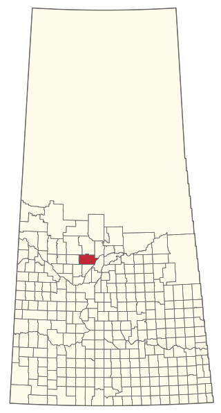
The Rural Municipality of Leask No. 464 is a rural municipality (RM) in the Canadian province of Saskatchewan within Census Division No. 16 and SARM Division No. 5. It is located west of the city of Prince Albert.

The Bigstone Cree Nation is a First Nations band government in Alberta, Canada. As Woodland Cree, they are a western branch of the larger Cree nation, and are a party to Treaty 8 with Canada. The Bigstone Cree Nation was divided into two bands in 2010, with one group continuing under the former name, and the other becoming the Peerless Trout First Nation.

The Rural Municipality of North Qu'Appelle No. 187 is a rural municipality (RM) in the Canadian province of Saskatchewan within Census Division No. 6 and SARM Division No. 1. It is located in the south-east portion of the province.
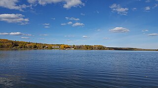
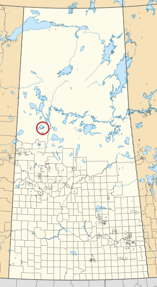
Missinipe, meaning "big water" or "difficult river", is a northern settlement in northern Saskatchewan located in Treaty 10 territory and along the western shore of Otter Lake. The hamlet is situated 80 km (50 mi) north of La Ronge along Saskatchewan Highway 102.The hamlet is located within the Northern Saskatchewan Administration District and the provincial Census Division No. 18.
Canoe Lake 165 is an Indian reserve of the Canoe Lake Cree First Nation in the boreal forest of northern Saskatchewan, Canada. Its location is on Canoe Lake approximately thirty miles west of Beauval, within the ancient hunting grounds of the Woodland Cree. In the 2016 Canadian Census, it recorded a population of 912 living in 250 of its 273 total private dwellings. In the same year, its Community Well-Being index was calculated at 53 of 100, compared to 58.4 for the average First Nations community and 77.5 for the average non-Indigenous community. The reserve includes the settlement of Canoe Narrows. The name of the reserve and the settlement in Cree is nêhiyaw-wapâsihk ᓀᐦᐃᔭᐤ ᐘᐹᓯᕽ.
Muskowekwan First Nation is a Saulteaux (Ojibway) First Nation who inhabit approximately 100 km northwest of Melville, Saskatchewan, Canada. As of May, 2008, the First Nation has 1,517 registered people, of which their on-reserve population was 400.
The Cold Lake First Nations is a First Nations band government. This band is the governing body for people descended from several different historic groups, hence the plural, nations, used in the band's name. In August 2019, there were 2,960 members of this band, of which 1,322 lived within five reserves, about 220 square kilometres (85 sq mi) large within the province of Alberta.
Fishing Lake is a closed basin freshwater lake in the Canadian province of Saskatchewan. The lake is 22 kilometres (14 mi) north of the town of Foam Lake, and 24 kilometres (15 mi) east of the town of Wadena and is accessed from Highways 5 and 310. The northern and eastern shore is in the RM of Sasman No. 336 and the southern and western shore is in the RM of Foam Lake No. 276. The north-east portion of the lake–on the east side of McCormick Bay–is designated as Fishing Lake Wildlife Refuge.
Fishing Lake First Nation is a First Nation of the Saulteaux branch of the Ojibwe nation. Fishing Lake First Nation are Anishinabek people. The band can trace their origins to central Canada, and were pushed westward to avoid encroachment by European settlers. The First Nation was originally part of the Yellow-quill Saulteaux Band, a Treaty Band named after a Treaty 4 signatory Chief Ošāwaškokwanēpi, whose name means "Green/Blue-quill." However, due to "š" merging with "s" in Nakawēmowin, this led to a mistranslation of his name as "Yellow-quill"—"yellow" being osāw-, while "green/blue" being ošāwaško-. The band was given three reserves, at Fishing and Nut Lakes and Kinistino, Saskatchewan. The Fishing Lake Indian Reserve 89 was approximately 22,850 acres (92.5 km2). Soon after the death of Chief Ošāwaškokwanēpi, the Band divided into three groups, the Fishing Lake First Nation, the Yellow Quill First Nation, and the Kinistin Saulteaux Nation
Little Buffalo is an Indian settlement and hamlet in northern Alberta, Canada within Northern Sunrise County. It is located on Highway 986, approximately 100 kilometres (62 mi) northeast of the Town of Peace River and 47 kilometres (29 mi) west of Highway 88. Little Buffalo Lake is to the south of the community.

The Treaty Four Reserve Grounds 77 are an Indian reserve in Saskatchewan, Canada, shared by 33 band governments from Saskatchewan and Manitoba. The Reserve Grounds are located adjacent to and west of Fort Qu'Appelle. In the 2016 Canadian Census, they recorded a population of 15 living in 6 of their 8 total private dwellings.

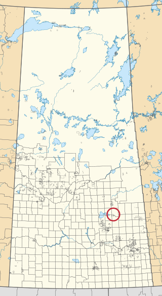
Fishing Lake 89 is an Indian reserve of the Fishing Lake First Nation in Saskatchewan. It is 119 kilometres (74 mi) north of Fort Qu'Appelle. In the 2016 Canadian Census, it recorded a population of 406 living in 128 of its 161 total private dwellings. In the same year, its Community Well-Being index was calculated at 54 of 100, compared to 58.4 for the average First Nations community and 77.5 for the average non-Indigenous community.

Fishing Lake 89A is an Indian reserve of the Fishing Lake First Nation in Saskatchewan, Canada. It is Section 13 and the south-east portion of Section 14, Township 33, Range 12, west of the Second Meridian. In the 2016 Canadian Census, it recorded a population of 0 living in 0 of its 0 total private dwellings.
Fishing Lake 89D1 is an Indian reserve of the Fishing Lake First Nation in Saskatchewan.

Muscowpetung 80 is an Indian reserve of the Muscowpetung First Nation in Saskatchewan. It is 31 kilometres (19 mi) west of Fort Qu'Appelle along the south-west shore of Pasqua Lake, which is one of four Fishing Lakes. In the 2016 Canadian Census, it recorded a population of 275 living in 87 of its 112 total private dwellings. In the same year, its Community Well-Being index was calculated at 54 of 100, compared to 58.4 for the average First Nations community and 77.5 for the average non-Indigenous community.
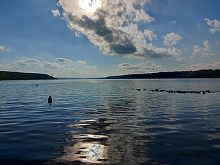
Pasqua Lake is a lake along the course of the Qu'Appelle River in the Canadian province of Saskatchewan. Pasqua Lake was named after Chief Joseph Pasqua who formed what became the Pasqua First Nation. It is one of four lakes that make up the Fishing Lakes, which are all in the Qu'Appelle Valley. The Qu'Appelle Valley was formed about 14,000 years ago during the last ice age as meltwater from the glaciers carved out the valley. As water levels rose and fell, alluvium was left in the wake. These piles of alluvium are what created the separations between the lakes.