Meade County is a county in the U.S. state of South Dakota. As of the 2020 United States Census, the population was 29,852. Its county seat is Sturgis. The county was created in 1889 and named for Fort Meade, which was garrisoned as a United States military post in the area in 1878 and itself named for General George Meade.

Fort Meade is a city in Polk County, Florida, United States. As of 2018, the population recorded by the U.S. Census Bureau is 6,203. It is part of the Lakeland–Winter Haven Metropolitan Statistical Area. The city was named for George Meade, at the time an Army lieutenant serving in Florida following the Second Seminole War. Fort Meade is home to Fort Meade Middle-Senior High School, several historic buildings, Streamsong resort and Patterson Park. The area is popular with kayakers and canoers.

Odenton is a census-designated place (CDP) in Anne Arundel County, Maryland, United States, located approximately 10–20 minutes from the state capital, Annapolis. The population was 37,132 at the 2010 census, up from 20,534 at the 2000 census. The town's population growth rate of 80.8% between 2000 and 2010 was the greatest of any town in western Anne Arundel County. Odenton is located west of Annapolis, south of Baltimore, and northeast of Washington.

Sturgis is a city in Meade County, South Dakota, United States. The population was 7,020 as of the 2020 census. It is the county seat of Meade County and is named after Civil War general Samuel D. Sturgis.
Baker House may refer to:

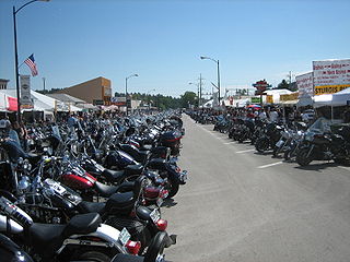
The Sturgis Motorcycle Rally is a motorcycle rally held annually in Sturgis, South Dakota, and the surrounding Black Hills region of the United States. It began in 1938 by a group of Indian Motorcycle riders and was originally held for stunts and races. Since then, the rally has become a pluralistic endeavor that consists of events put on by many different groups. Attendance has historically been around 500,000 people, reaching a high of over 700,000 in 2015. The event takes place over 10 days and generates around $800 million in annual revenue.

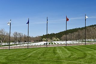
Black Hills National Cemetery is a United States National Cemetery in South Dakota, located three miles (5 km) southeast of Sturgis in Meade County. It encompasses 105.9 acres (42.9 ha), and as 2021, had over 30,000 interments. Located at exit 34 of Interstate 90, it is administered by the U.S. Department of Veterans Affairs, which also administers the nearby Fort Meade National Cemetery. It is one of three national cemeteries in South Dakota.

Fort Meade National Cemetery is a United States National Cemetery located near the city of Sturgis in Meade County, South Dakota. Administered by the United States Department of Veterans Affairs, it encompasses 1.9 acres (0.77 ha). It is maintained by Black Hills National Cemetery.
America's 11 Most Endangered Places or America's 11 Most Endangered Historic Places is a list of places in the United States that the National Trust for Historic Preservation considers the most endangered. It aims to inspire Americans to preserve examples of architectural and cultural heritage that could be "relegated to the dustbins of history" without intervention.
Woodwardville is an unincorporated community situated in western Anne Arundel County, Maryland, United States, containing 27 structures, 16 of which are historic and included in the Woodwardville Historic District, listed on the National Register of Historic Places in 2003. Most of the structures are located adjacent to Patuxent Road, which runs through the center of the community. On the north end of the district, a small street, 5th Avenue, runs west from Patuxent Road underneath the train tracks. Prior to the establishment of what would be later known as Fort George G. Meade in 1917, the road once continued on to Laurel. Three of the seven buildings along 5th Avenue are historic. Woodwardville's building stock consists principally of late-19th and early-20th century domestic architecture. Good examples of the Bungalow, Foursquare, Tudor Revival, and Queen Anne styles are present, as well as older traditional vernacular classifications such as the I-house. These older forms are supplemented by a handful of post-World War II era structures. Woodwardville also features several public or commercial buildings including a church, a former schoolhouse, the ruins of a store and storage or service buildings associated with the railroad. Many of Woodwardville's older buildings fell into decline following World War II, but in recent years, due to its close proximity to commuter rail service, Woodwardville has evolved into a bedroom community for persons working in Washington and Baltimore. Investment by new residents resulted in the restoration and renovation of many buildings which had formerly been in deteriorating condition. Despite the intense development a mile away in Piney Orchard, this quaint community retains its ability to communicate its historic qualities and distinct sense of place.

The Black Hills are a small and isolated mountain range rising from the Great Plains of North America in western South Dakota and extending into Wyoming, United States. Black Elk Peak, which rises to 7,244 feet (2,208 m), is the range's highest summit. The Black Hills encompass the Black Hills National Forest. The name "Black Hills" is a translation of the Lakota Pahá Sápa. The hills are so called because of their dark appearance from a distance, as they are covered in evergreen trees.

Fort Meade is a former United States Army post located just east of Sturgis, South Dakota. The fort was active from 1878 to 1944; the cantonment is currently home to a Veterans Health Administration hospital and South Dakota Army National Guard training facilities. Much of the former reservation is now managed by the Bureau of Land Management as the Fort Meade Recreation Area. It is also home of Fort Meade National Cemetery. Fort Meade was established in 1878 to protect illegal white settlements on the Great Sioux Reservation in the northern Black Hills, especially the nearby gold mining area around Deadwood. Several stage and freighting routes passed through Fort Meade en route to Deadwood.
Sturgis Brown High School is located in Sturgis, South Dakota and is part of the Meade School District. Located east of Sturgis at 12930 E. Hwy 34, the school draws students from all over the city.

Sturgis Williams Middle School is a middle school located at 1425 Cedar Street in Sturgis, South Dakota, United States, and is part of the Meade School District. The school draws students from all over the city.

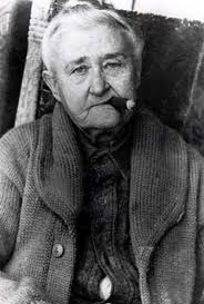
Alice Ivers Duffield Tubbs Huckert, better known as Poker Alice, Poker Alice Ivers or Poker Alice Tubbs, was an English poker and faro player in the American West.

Rex A. Terry was a banker and politician in the United States state of South Dakota. He served as a member of the South Dakota State Senate and as Lieutenant Governor of South Dakota.

Raymond W. Carpenter is a retired United States Army major general who served as acting Director of the Army National Guard.
Tilford is an unincorporated community located in Meade County, South Dakota, United States. Tilford is located at Exit 40 off I-90, approximately 9.2 miles (14.8 km) south of Sturgis, the county seat. Although Tilford is unincorporated, it has its own ZIP code of 57769.


