
The Gulf of Saint Lawrence is the outlet of the North American Great Lakes via the Saint Lawrence River into the Atlantic Ocean. The gulf is a semienclosed sea, covering an area of about 226,000 square kilometres (87,000 sq mi) and containing about 34,500 cubic kilometres (8,300 cu mi) of water, which results in an average depth of 152 metres (499 ft).
Division No. 1, Subdivision O is an unorganized subdivision on the Avalon Peninsula in Newfoundland and Labrador, Canada, in Division 1. It's divided into two parts, the northern portion touches Conception Bay. It includes the unincorporated communities of Marysvale and Salmonier Line.

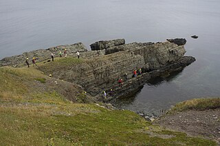
The Burin Peninsula is a peninsula located on the south coast of the island of Newfoundland in the province of Newfoundland and Labrador.

Fortune is a Canadian town located in the province of Newfoundland and Labrador.
Fortune Bay is a fairly large natural bay located in the Gulf of St. Lawrence on the south coast of Newfoundland, Canada. The Bay is bounded by Point Crewe on the Burin Peninsula and Pass Island at the entrance to Hermitage Bay to the northwest for a distance of 56 kilometers. The bay extends in a northeast direction for 105 kilometers ending at Terrenceville.
Harbour Breton is a small fishing community on the Connaigre Peninsula in Fortune Bay, on the south coast of the island of Newfoundland in Canada. It is the largest center on the Connaigre Peninsula and was long considered the unofficial capital of Fortune Bay. Many residents resettled from Sagona Island, Jersey Harbour, Little Bay West, Miller's Passage, Red Cove, and Grole.
Warren Island is an island in the Alexander Archipelago of southeastern Alaska, United States. It lies on the Pacific coast just southwest of the community of Edna Bay. Directly west is Coronation Island and directly north is Kuiu Island. Warren Island has a land area of 47.191 km² and no permanent resident population. The entire island has been designated as the Warren Island Wilderness, a part of Tongass National Forest.
Sargent is an unincorporated community located northwest of Newnan and Arnco Mills in Coweta County, Georgia, United States. The ZIP code of Sargent is 30275.
Dawson's Cove is a small settlement, about 2 km away from a small outport community Hermitage. Located on the southern shore of Newfoundland, Dawson's Cove is in Connaigre Bay — a finger-like projection of Newfoundland's Fortune Bay.
The Bay du Nord River is located on the south coast of the Island of Newfoundland in the Canadian province of Newfoundland and Labrador. Much of the drainage basin is contained within the Middle Ridge Wildlife Reserve and the Bay du Nord Wilderness Reserve of central Newfoundland.

Jackson Township is one of thirteen townships in Putnam County, Indiana. As of the 2010 census, its population was 854 and it contained 376 housing units.
St. Jacques-Coomb's Cove is a town in the Canadian province of Newfoundland and Labrador. The town had a population of 669 in the Canada 2006 Census. It is located on the south coast of the island of Newfoundland on the north side of Fortune Bay, on the southern tip of the Connaigre Peninsula in what is now known as the Coast of Bays Region. The town consists of six communities, St. Jacques, English Hr. West, Mose Ambrose, Boxey, Coomb's Cove and Wreck Cove, nestled within the inlets along the coast. They all had their beginnings in the fisheries and the fisheries have always been the mainstay of employment in the communities. In recent years aquaculture was introduced in the area, providing employment for its residents.
The Connaigre Peninsula is a Canadian peninsula located on the south coast of the island of Newfoundland in the province of Newfoundland and Labrador.
Point Enragée, also known as Point Rosie, is located northwest of Marystown, Newfoundland and Labrador. All residents were resettled to Garnish, Grand Bank and other Fortune Bay outports during the 1960s. It never had a road or rail link, and sometimes the Fortune Bay Nor' easters made leaving the community and getting ashore very risky to life and limb. It had a population of 168 in 1956.
Harbour Mille is a small village located east of Belleoram and north-east of St. Bernard's-Jacques Fontaine on Fortune Bay. In 1882, the first Waymaster was J.R. Croucher. It had a population of 340 in 1956. During the night of January 25, 2010, witnesses in the area reported seeing multiple unidentified flying objects.
English Harbour West is a village located on the south west shore of Fortune Bay. It is noted for its bank fishing and inshore fishing. The Way Office was established in 1866 on April 1. The first Way Master was Albert Stirling. In 1891 it became a Post Office town and William Evans was the first Postmaster. It is now a part of the Town of St. Jacques-Coomb's Cove.
Bay de L'Eau is an abandoned community in Fortune Bay, Newfoundland and Labrador.
The Terreneuvian is the lowermost and oldest series of the Cambrian geological system. Its base is defined by the first appearance datum of the trace fossil Treptichnus pedum around 541 million years ago. Its top is defined as the first appearance of trilobites in the stratigraphic record around 521 million years ago. This series was formally ratified by the International Commission on Stratigraphy in 2012.
The Fortunian stage marks the beginning of the Phanerozoic eon, the Paleozoic era, and the Cambrian period. It is the first of the two stages of the Terreneuvian series. Its base is defined as the first appearance of the trace fossil Treptichnus pedum 541 million years ago. The top of the Fortunian which is the base of the Stage 2 of the Cambrian has not been formally defined yet, but will correspond to the appearance of an Archeocyatha species or "Small shelly fossils" approximately 529 million years ago.

Bay du Nord is an abandoned community in Fortune Bay, Newfoundland and Labrador. The Post Office was established in 1891 and the first Postmaster was Thomas Farrell. In 1968 it was De-populated. It had a population of 188 in 1940 and 149 in 1956.


