
The Arctic Archipelago, also known as the Canadian Arctic Archipelago, is a group of islands north of the Canadian mainland.
German submarine U-551 was a Type VIIC U-boat of Nazi Germany's Kriegsmarine during World War II. The submarine was laid down on 21 November 1939 at the Blohm & Voss yard in Hamburg as yard number 527, launched on 14 September 1940, and commissioned on 7 November 1940 under the command of Kapitänleutnant Karl Schrott.

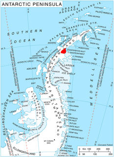
Quito Glacier is a glacier draining the northeast slopes of Mount Plymouth and flowing northeastwards into the sea west of Canto Point in north Greenwich Island, South Shetland Islands. It was named after the capital of Ecuador, c. 1990, by the Ecuadorian Antarctic Expedition.

Westport is a town in the Canadian province of Newfoundland and Labrador. The town had a population of 195 in 2016, down from 220 in the Canada 2011 Census.

Lobster Cove is a fishing village near Rocky Harbour, Newfoundland.

Flask Glacier, is a gently-sloping glacier, 25 nautical miles long, flowing east from Bruce Plateau to enter Scar Inlet between Daggoo Peak and Spouter Peak in Graham Land, Antarctica. The lower reaches of this glacier were surveyed and photographed by the Falklands Islands Dependencies Survey (FIDS) in 1947. The entire glacier was photographed by the Falkland Islands and Dependencies Aerial Survey Expedition in 1955–56, and mapped by the FIDS in 1957. It was named by the UK Antarctic Place-names Committee after the third mate on the Pequod in Herman Melville's Moby-Dick; or, The White Whale.

Nuup Kangerlua is a 160 km (99.4 mi) long fjord in the Sermersooq municipality in southwestern Greenland. It was formerly known by its colonial name as Godthaab Fjord, Gilbert Sound and Baal's River.
Nunatakassak is a nunatak in the Qaasuitsup municipality in northwestern Greenland. It is one of several nunataks in the Melville Bay region of Greenland, where the Greenland ice sheet drains into the bay alongside its entire length apart from an occasional nunatak.
Woodbury Glacier is a glacier just west of Montgolfier Glacier, flowing into Piccard Cove, Wilhelmina Bay, on the west coast of Graham Land. Mapped by the Falkland Islands Dependencies Survey (FIDS) from air photos taken by Hunting Aerosurveys Ltd. in 1956-57. Named by the United Kingdom Antarctic Place-Names Committee (UK-APC) in 1960 for Walter B. Woodbury (1834–1885), English pioneer of photomechanical printing in 1865 and of serial film cameras for use in balloons and kites in 1877.
Ambergris Glacier is a glacier flowing south-southeast from Mount Sara Teodora between Chintulov Ridge and Valkosel Ridge to join Flask Glacier just west of Fluke Ridge in Aristotle Mountains on the east coast of Graham Land, Antarctica. One of several names in the area that reflect a whaling theme, it was named in 1987 by the United Kingdom Antarctic Place-Names Committee from the substance secreted by the sperm whale and used in perfumery.

Anthony Glacier is a glacier which flows in an east-southeast direction to the east coast of Palmer Land where it terminates opposite the south tip of Hearst Island. The upper part of this glacier was seen by a sledge party of the British Graham Land Expedition under John Riddoch Rymill in 1936–37. The glacier was seen from the seaward side in 1940 by a sledging party from the East Base of the United States Antarctic Service, and in 1947 was photographed from the air by the Ronne Antarctic Research Expedition (RARE). It was named by Finn Ronne for Alexander Anthony of the J.P. Stevens Company, New York City, which contributed windproof clothing to the RARE.

Cadman Glacier is a glacier, 1.5 nautical miles (3 km) wide at its mouth and about 7 nautical miles (13 km) long, flowing northwestward into the head of the southern arm of Beascochea Bay south of Plas Point on the west side of the Antarctic Peninsula.

Usher Glacier is a glacier nearly 4 nautical miles (7 km) long, flowing northwest
into the sea between Stigant Point and Davey Point on the north coast of King George Island, in the South Shetland Islands. Named by the United Kingdom Antarctic Place-Names Committee (UK-APC) in 1960 for J. Usher, Master of the Caraquet from Liverpool, who visited the South Shetland Islands in 1821-22.

Mount Osborne is a mountain standing 5 nautical miles (9 km) east of Mount Craddock, at the end of a side ridge running from the latter and featuring Sanchez Peak and Stolnik Peak, in the Sentinel Range, Ellsworth Mountains, Antarctica. It surmounts Thomas Glacier to the northeast and Saltzman Glacier to the south.

Montgolfier Glacier is a glacier situated between Rozier Glacier and Woodbury Glacier and flowing between Balis Ridge and Bacho Kiro Peak into Piccard Cove on the west coast of Graham Land, Antarctica.
Matheson Glacier is a glacier 11 nautical miles (20 km) long, lying 2 nautical miles (4 km) south of Ashton Glacier, which it parallels, and flowing in an easterly direction to the west side of Lehrke Inlet, on the east coast of Palmer Land, Antarctica. It was first sighted by members of the United States Antarctic Service who explored this coast by land and from the air in December 1940, and was first charted by a joint party consisting of members of the Ronne Antarctic Research Expedition and Falkland Islands Dependencies Survey (FIDS) in 1947. The glacier was named by the FIDS for J. Matheson, a member of the FIDS at the Port Lockroy and Hope Bay bases, 1944–46.

Rush Glacier is a glacier in Antarctica. Situated in southern Brabant Island, it is 4 nautical miles (7 km) long, draining the northwest slopes of Solvay Mountains and flowing west between Mount Aciar and Mount Sarnegor into the Buragara Cove of Dallmann Bay in the Palmer Archipelago. It was shown on an Argentine government chart in 1953, but not named. It was photographed by Hunting Aerosurveys Ltd in 1956-57, and mapped from these photos in 1959. The glacier was named by the United Kingdom Antarctic Place-Names Committee (UK-APC) for Benjamin Rush (1745–1813), a noted American physician and philanthropist, and a signatory of the Declaration of Independence.
Rachel Glacier is a glacier on the east coast of Graham Land, 6 nautical miles (11 km) long, flowing east between Krupen Ridge and Padesh Ridge to enter Exasperation Inlet southwest of Mihaylovski Crag. The name, applied by United Kingdom Antarctic Place-Names Committee (UK-APC), is taken from Herman Melville's Moby Dick, the Rachel being a ship from Nantucket which met the Pequod and brought news of a lost whaleboat.


