
Geography of the United States Virgin Islands

The Little Sisters is an informal name for a group of some of the smaller islands of the British Virgin Islands, south of Tortola and southwest of Virgin Gorda. These islands are also called the Southern Islands.

Cruz Bay, U.S. Virgin Islands is the main town on the island of Saint John in the United States Virgin Islands. According to the 2000 census, Cruz Bay had a population of 2,743.
The area code (340) is the local telephone area code of U.S. Virgin Islands. The (340) area code was created during a split from the original (809) area code, which began permissive dialing on 1 June 1997 and ended 30 June 1998.
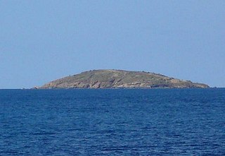
Flanagan Island is an island located within the Virgin Islands archipelago in the Caribbean and forms part of the U.S. Virgin Islands.
The U.S. Virgin Islands Paradise Jam is a college basketball tournament that takes place in late November of each year, with the men usually playing the week before Thanksgiving and the women playing Thanksgiving week. It normally takes place in St. Thomas at the Sports and Fitness Center on the campus of the University of the Virgin Islands.

Mingo Cay is an island part of Central sub-district, in Saint John, United States Virgin Islands. It is located between Saint Thomas and Saint John.
Accokeek Creek is a tidal tributary of Potomac Creek, itself a tributary of the Potomac River, in Stafford County, Virginia, United States. From it headwaters to its mouth, Accokeek Creek is 15.4 miles (24.8 km) in total length.
Shideler is an unincorporated community in Delaware County, Indiana, in the United States.

Hilo Bay is a large bay located on the eastern coast of the island of Hawaiʻi.
John Oley is a settlement on the island of Saint Thomas in the United States Virgin Islands.
Resolution is a settlement on the island of Saint Thomas in the United States Virgin Islands. It is part of the Northside Administrative District. Crown Mountain, the highest point in the US Virgin Islands, is in Resolution.

Annaberg is a former sugar factory and plantation on the island of Saint John in the United States Virgin Islands. It is uninhabited and part of the Annaberg Historic District within the Virgin Islands National Park.
Bordeaux is a neighborhood on the island of Saint John in the United States Virgin Islands. It is named for Mount Bordeaux, the highest point on the island. Most of this area is part of Virgin Islands National Park.
Fish Bay is a bay and neighborhood on the island of Saint John in the United States Virgin Islands. Most of this area is part of Virgin Islands National Park.
Contentment is a settlement on the island of Saint Croix in the United States Virgin Islands.
Madame Carty is a settlement on the island of Saint Croix in the United States Virgin Islands.

Browndale is an unincorporated community in Clay County, Kansas, in the United States. Browndale is located at 39°21′35″N97°21′03″W.
Delina is an unincorporated community in Marshall County, in the U.S. state of Tennessee.


