Related Research Articles

Holmes County is a county located in the northwestern part of the U.S. state of Florida, in the Panhandle. As of the 2020 census, the population was 19,653. Its county seat is Bonifay.
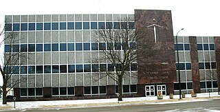
Black Hawk County is a county in the northeastern part of U.S. state of Iowa. As of the 2020 census, the population was 131,144, making it Iowa's fifth-most populous county. The county seat is Waterloo.

Walton County is a county located on the Emerald Coast in the northwestern part of the U.S. state of Florida, with its southern border on the Gulf of Mexico. As of the 2020 census, the population was 75,305. Its county seat is DeFuniak Springs. The county is home to the highest natural point in Florida: Britton Hill, at 345 feet (105 m). Walton County is included in the Crestview–Fort Walton Beach–Destin Metropolitan Statistical Area.

Escambia County is a county located in the south central portion of the U.S. state of Alabama. As of the 2020 census, the population was 36,757. Its county seat is Brewton.

Fish Hawk is an unincorporated area and census-designated place (CDP) in Hillsborough County, Florida, United States. It is a suburb of Tampa, and includes a portion of the community of Lithia. As of the 2020 census, the CDP had a population of 24,625. The place name is derived from Little Fishhawk Creek, a tributary of the Alafia River that joins the Alafia just west of Lithia Springs.

South Miami is a city in Miami-Dade County, Florida, United States. The city is part of the Miami metropolitan area of South Florida. The population was 12,026 as of the 2020 census.

Port Orange is a city in Volusia County, Florida. The city is part of the Deltona–Daytona Beach–Ormond Beach metropolitan area. Port Orange is a principal city in the Fun Coast region of the state of Florida. As of the 2020 census, the city had a population of 62,596.
Newburg is a former census-designated place in Jefferson County, Kentucky, United States. The population was 20,636 at the 2000 census. On January 6, 2003, the area was annexed to the city of Louisville due to a merger between the city and Jefferson County's unincorporated communities. Newburg is now thought to be a neighborhood within the now merged city of Louisville.

Little Haiti, is a neighborhood of Miami, Florida, United States. It is known historically as Lemon City, Little River and Edison. It is home to Haitian immigrant residents, as well as residents from the rest of the Caribbean.
Perrine, Florida was an unincorporated community in Miami-Dade County, Florida, United States, about midway between Miami and Homestead. It is at 25°36′18″N80°21′13″W The community was named after Henry Perrine, who in 1839 had been granted a survey township of land in the area by the United States Congress in recognition of his service as United States Consul in Campeche, Mexico, and to support his plans to introduce new plants from tropical countries into cultivation in the United States.
Hillsborough Community College (HCC) is a public community college in Hillsborough County, Florida. It is part of the Florida College System.
Tumatumari is a community in the Potaro-Siparuni Region of Guyana, located some 15 km upstream of the confluence of the Potaro and Essequibo Rivers.

Winkelbury Hill is a 62.95 hectare biological Site of Special Scientific Interest in Berwick St John parish, south-west Wiltshire, England. The site is on the southern flank of the Ebble valley and was notified in 1971 for its herb-rich unimproved chalk grassland, which has some nationally scarce plants and butterflies.
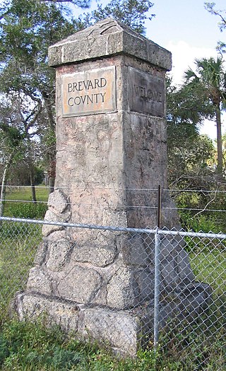
Scottsmoor is an unincorporated community and census-designated place in the north end of Brevard County, Florida, United States. The population with 692 at the 2020 census. The community is part of the Palm Bay–Melbourne–Titusville Metropolitan Statistical Area. It is on U.S. 1, and also the northernmost settlement in the county. It is a farming community east of Interstate 95, similar to Malabar.
For the black settlement in Florida see Freemanville, Florida

Spring Garden is a neighborhood of Miami, Florida, United States. The section of the city is one of the oldest purpose-built single-family residential neighborhoods in Miami and in the Greater Miami area. It is bound by the Dolphin Expressway to the north, the Seybold Canal (formerly Wagner Creek and Northwest Eighth Street Road to the east, by the Miami River to the southwest, and West 12th Avenue to the west.

John Milton Hawks was an abolitionist, surgeon and organizer for the assistance of freed blacks and black soldiers during the U.S. Civil War as well as a businessman and Florida settler in Volusia County. During Reconstruction he was secretary of the board of registration for Volusia County. He was also clerk of the Florida House of Representatives from 1868 to 1870. A plaque in his honor is located at the Edgewater City Hall at 104 North Riverside Drive in Edgewater, Florida. Hawks wrote The East Coast of Florida: A Descriptive Narrative, published in 1887 by L.J. Sweett and/ or Lewis & Winsship He is listed as a Great Floridian. His wife, Esther Hill Hawks, was also a doctor and helped educate black soldiers and their families. She was an 1857 graduate of the New England Female Medical College.
Mount Moriah Baptist Church was built in Port Orange, Florida in 1911. Built to serve black residents, it was located in an area that came to be known as Freemanville and is believed to be the last remaining building from the settlement. Freed blacks settled the area to work at a lumber company started by John Milton Hawks, but sandy soil, corruption, and planning issues led to a rapid decline as the colony struggled. A plaque commemorate the area's history. It is part of the Black Heritage Trail. It has been suggested that Esther Hawks established Florida's first integrated school in the area. An annual Freeman Day Ceremony commemorates the heritage. The church was renovated in 1956.
Golfview was a town in Palm Beach County, Florida, in the United States. Golfview was chartered on June 11, 1937. The town, located near the southeast intersection of Belvedere Road and Military Trail and in very close proximity to the Palm Beach International Airport, remained small in both population and area. The highest recorded population of Golfview was 210 people, according to the 1980 census. By the mid-1980s, expansion of the airport and the surrounding area caused many residents to begin selling their homes. The town of Golfview officially dissolved on September 1, 1998.
Angola was a prosperous community of up to 750 maroons that existed in Florida from 1812 until Florida became a U.S. territory in 1821, at which point it was destroyed. The location was along the Manatee River in Bradenton, Florida, near Manatee Mineral Springs Park. The exact location is expansive, ranging from where the Braden River meets the Manatee River down to Sarasota Bay; archaeological research focuses on the Manatee Mineral Spring—a source of fresh water and later the location of the Village of Manatee two decades after the destruction of the maroon community. Archaeological evidence has been found and the archaeology report by Uzi Baram is on file with the Florida Division of Historical Resources of the Florida Department of State. In 2019, the National Park Service added the excavated location at Manatee Mineral Springs Park to the Network to Freedom.