The Werra, a river in central Germany, is the right-bank headwater of the Weser. "Weser" is a synonym in an old dialect of German. The Werra has its source near Eisfeld in southern Thuringia. After 293 kilometres (182 mi) the Werra joins the river Fulda in the town of Hann. Münden, forming the Weser. If the Werra is included as part of the Weser, the Weser is the longest river entirely within German territory at 744 kilometres (462 mi).
Schmalkalden-Meiningen is a Landkreis in the southwest of Thuringia, Germany. Its neighboring districts are the districts Wartburgkreis, Gotha, Ilm-Kreis, the district-free city Suhl, the district Hildburghausen, the Bavarian district Rhön-Grabfeld, and the district Fulda in Hesse.
Unstrut-Hainich-Kreis is a Kreis (district) in the north of Thuringia, Germany. Neighboring districts are the districts Eichsfeld, Kyffhäuserkreis, Sömmerda, Gotha, Wartburgkreis and the district Werra-Meißner in Hesse.
Wartburgkreis is a Kreis (district) in the west of Thuringia, Germany. Neighboring districts are the districts Unstrut-Hainich-Kreis, Gotha, Schmalkalden-Meiningen, and the districts Fulda, Hersfeld-Rotenburg and Werra-Meißner-Kreis in Hesse. The district has 30 municipalities, including Eisenach.

The Rhön Mountains are a group of low mountains in central Germany, located around the border area where the states of Hesse, Bavaria and Thuringia come together. These mountains, which are at the extreme southeast end of the East Hesse Highlands, are partly a result of ancient volcanic activity. They are separated from the Vogelsberg Mountains by the river Fulda and its valley. The highest mountain in the Rhön is the Wasserkuppe, which is in Hesse. The Rhön Mountains are a popular tourist destination and walking area.
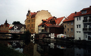
Eschwege, the district seat of the Werra-Meißner-Kreis, is a town in northeastern Hesse, Germany. In 1971, the town hosted the eleventh Hessentag state festival.
Lauterbach is a German name originally meaning "pure/clear stream". It may refer to:

Schmalkalden is a town in the Schmalkalden-Meiningen district, in the southwest of the state of Thuringia, Germany. It is on the southern slope of the Thuringian Forest at the Schmalkalde river, a tributary to the Werra. As of 31 December 2022, the town had a population of 20,065.
Creuzburg is a town and a former municipality on the Werra river in the Wartburgkreis in Thuringia, Germany. Since December 2019, it is part of the town Amt Creuzburg.
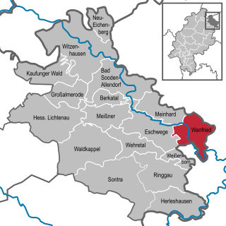
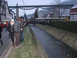
Wanfried is a town in the Werra-Meißner-Kreis in northeasternmost Hesse, Germany. It is classified as a Landstadt, a designation given in Germany to a municipality that is officially a town (Stadt), but whose population is below 5,000. It literally means “country town”.

Philippsthal (Werra) is a market community in Hersfeld-Rotenburg district in eastern Hesse, Germany, right at the boundary with Thuringia.
Schwarzbach is a German name meaning "dark stream."

Herleshausen is a municipality in the Werra-Meißner-Kreis in Hesse, Germany.
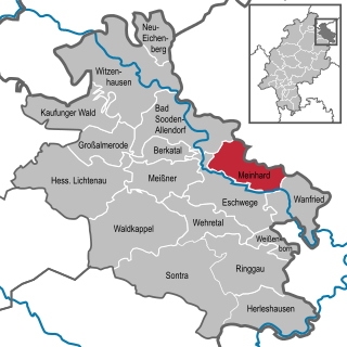
Meinhard is a municipality in the Werra-Meißner-Kreis in Hesse, Germany.
The East Hesse Highlands describes a heavily wooded range of hills lying mainly in the German state of Hesse, but also extending a little way into Lower Saxony to the north, Thuringia to the east and Bavaria to the southeast. The region is sandwiched between the West Hesse Depression to the west, the Weser Uplands to the north, the Thuringian Basin to the northeast, the northwestern edge of the Thuringian Forest to the east, the Spessart to the south and the Wetterau to the southwest.
Suhl is a river of Hesse and Thuringia, Germany. It flows into the Weihe near Berka/Werra.
The Weihe river is an 11.5 km long western tributary of the Werra River in the Hersfeld-Rotenburg district in Hesse and the Wartburg district in Thuringia, Germany. It flows into the Werra in Gerstungen.
The Barony of Bilstein was a dynastic lordship with extensive estates in the region of the present German states of Hesse and Thuringia and a territory of the Holy Roman Empire.