
The Garpel Water is a river near Muirkirk, Scotland. It flows under the Sanquhar bridge and Tibbie's Brig. It flows into the River Ayr.
55°31′N4°05′W / 55.517°N 4.083°W
The Garpel Water is a river near Muirkirk, Scotland. It flows under the Sanquhar bridge and Tibbie's Brig. It flows into the River Ayr.
55°31′N4°05′W / 55.517°N 4.083°W

The geography of France consists of a terrain that is mostly flat plains or gently rolling hills in the north and west and mountainous in the south and the east. Metropolitan France has a total size of 551,695 km2 (213,011 sq mi). It is the third largest country in Europe by area and the largest in Western Europe.

This is a list of the extreme points of Ireland – the points that are farthest north, south, east or west in Ireland. It includes the Republic of Ireland and Northern Ireland.

Eye Water is a river in the Scottish Borders, it flows in a general southeasterly direction from its source in the Lammermuir Hills to its estuary at Eyemouth on the east coast of Scotland, having a length of approximately 35 kilometres (22 mi).
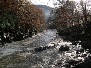
River Llugwy is a tributary of the River Conwy, and has its source at Ffynnon Llugwy, a lake in the Carneddau range of mountains in Snowdonia in north-west Wales.

Altamuskin or Altamooskan is a small village and townland in County Tyrone, Northern Ireland. It is situated in the historic barony of Clogher and the civil parish of Errigal Keerogue and covers an area of 1165 acres. In the 2014 Census Altamuskin had a population of 127 people. It lies within the Fermanagh and Omagh District Council area and is home to St Bridget's Altamuskin. The population of the townland declined during the 19th century:

The River Lemon is a 9.9 miles river in the county of Devon in southwest England. It is a tributary of the River Teign, starting on Dartmoor by Haytor, and ending in Newton Abbot. It rises on the south-east side of Dartmoor near Haytor, joins with the River Sig and the Langworthy Brook at Sigford, then passes the village of Bickington. Lower down, it is joined by the Kestor Brook and it then flows through the woods in Bradley Valley, past the manor house of Bradley, and through the town of Newton Abbot where it flows through a 440-yard-long (400 m) tunnel below the town centre. Just below the town, the river joins the River Teign at 50.517°N 3.607°W, near the head of its estuary.
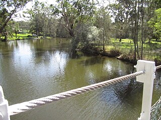
Dora creek is a watercourse that is located in Greater Newcastle in the Hunter region of New South Wales, Australia.

Apartaderos is a small Andean town in Mérida State, Venezuela.
Greenock Water is a river in East Ayrshire, Scotland. It flows out of the Dippal Burn, about 2 miles south of Dungavel Hill. A tributary of the River Ayr, it joins it about 4 miles west of the small town of Muirkirk. It is quite a short river and is not well known.

The Cobequid Mountains, also sometimes referred to as the Cobequid Hills, is a Canadian mountain range located in Nova Scotia in the mainland portion of the province.

Miguel Esteban is a municipality located in the province of Toledo, Castile-La Mancha, Spain. According to the 2006 census (INE), the municipality has a population of 5435 inhabitants.

Husillos is a municipality located in the province of Palencia, Castile and León, Spain. According to the 2004 census (INE), the municipality had a population of 208 inhabitants.
The Nass Ranges are a mountain range north of the Skeena River, west of Hazelton, and northeast of Terrace, British Columbia, Canada. It is a subrange of the Hazelton Mountains, which in turn form part of the Interior Mountains.
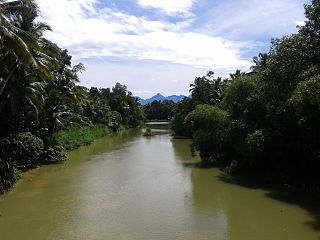
The Neyyar River is 56 km long river which flows through the Thiruvananthapuram district of Kerala in India. It flows from the Agastya Mala (Agastyarkoodam) in the Western Ghats. The town Neyyattinkara in Thiruvananthapuram district, is situated on the banks of the river, is named after this river. The river flows through the Neyyar wildlife sanctuary and into the Neyyar resorvoir. It then flows towards the west through the towns of Kallikkad, Kattakkada, Ottashekharamangalam, Keezharoor, Anavoor, Aruvipuram, Neyyantinkara and Thirupuram. The river then empties into the Arabian Sea at the Poovar estuary. Tributaries include the Kallar, Mullayar, and the Karavaliyar. It has several small canals along the river and the Neyyar Irrigation Project, "Neyyar Dam", is situated in this river. A safari park is located near the river. Neyyar river has been severely affected by sand mining.
The Maguse River is located in the Kivalliq Region of northern Canada's territory of Nunavut. It originates at Maguse Lake and flows 56 km (35 mi) eastward to northwestern Hudson Bay. At one time, there was a trading post at the mouth of the river.
The Caroaebe River is a river of Roraima state in northern Brazil, near the equator.
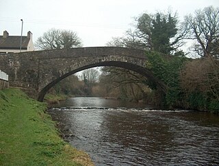
The River Moyola or Moyola River stretches for approximately 27 miles from the Sperrin Mountains to Lough Neagh. The Moyola starts a small river for the first few miles of its length and proceeds to expand to a medium-sized river and then to a large river for its last couple of miles before Lough Neagh. In ancient times, the River Moyola was known as the 'Bior', and served as the border between the Airgiallan kingdoms of Fir Li and Ui Tuirtri.
The Kolinbiné River is a river in West Africa. It arises in southern Mauritania and flows south, forming part of the international boundary between Mauritania and Mali. In Mali, it joins the Sénégal River 5 km upstream from the town of Kayes.

Hara is a village in Lääne-Nigula Parish, Lääne County, in western Estonia. Before the administrative reform in 2017, the village was in Noarootsi Parish.