
Fusagasugá or Fusa is a city and municipality in the department of Cundinamarca, in central Colombia. It is located in the warm valley between the rivers Cuja and Panches, a central region of the Andes Mountains in South America. The municipality has a population of 138,498 and the urban centre a population of 114,722. The municipality itself covers an area of 194 km2 (75 sq mi).

Ciudadela is a city in Greater Buenos Aires, Buenos Aires Province, Argentina. It is located in the Tres de Febrero Partido, immediately to the west of the neighborhood of Liniers in Buenos Aires city proper. It is separated from the city by General Paz avenue.

Estadio La Ciudadela is a football stadium located in the Ciudadela district of San Miguel de Tucumán, Argentina. Inaugurated in 1932, the stadium is owned and operated by C.A. San Martín and has a capacity 30,250 people.

Loja Canton is located in the southeast of the Province of Loja bordering the Podocarpus National Park and the Province of Zamora-Chinchipe in the east and south, and the cantons of Saraguro in the north, Catamayo, Gonzanama, and Quilanga in the west. The principal city is Loja which is also the provincial capital. It is also home to Vilcabamba, the "Valley of Longevity."

Solís Theatre is Uruguay's most important and renowned theater. It opened in 1856 and the building was designed by the Italian architect Carlo Zucchi. It is located in Montevideo's Old Town, right next to the Plaza Independencia. The theatre was named after the explorer Juan Díaz de Solís, who was the first European explorer to land in modern day Uruguay.

The Montevideo Cabildo is the public building in Montevideo that was used as the government house during the colonial times of the Viceroyalty of the River Plate. Today the building is used as a museum and houses the Historical Archive of the city. It is located on Constitution Square, in Ciudad Vieja.

Plaza Independencia is the most important city square in Montevideo, Uruguay, laid out in the 19th century in the area occupied by the Citadel of Montevideo. In its center is a monument to General José Gervasio Artigas, and below it, his mausoleum.
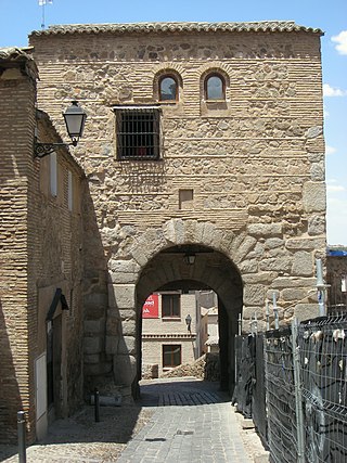
The Puerta Bab al-Mardum, or Puerta de Valmardón, is a city gate of Toledo, Spain. It was built in the 10th century and is one of the oldest gates in the city. Its name 'mardum' is Arabic for 'blocked up'. Perhaps because its function was taken over by the Puerta del Sol. The Spanish name Valmardón is a rough, phonetic imitation of the Arabic. 'Mezquita Bab al-Mardum' is another name for the nearby Mosque of Cristo de la Luz.
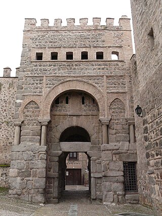
The Puerta de Bisagra is a city gate of Toledo, Spain.

Avenida Rivadavia is one of the principal thoroughfares in Buenos Aires, Argentina, extending 23 miles (37 km) from downtown Buenos Aires to the western suburb of Merlo. It is considered the third longest avenue in the world after Yonge Street (Toronto) and Western Avenue (Chicago).

Avenida Juan Ponce de León, coextensive as Puerto Rico Highway 25 (PR-25) along its entire length, is one of the main thoroughfares in San Juan, Puerto Rico.
Puerta de Corral Quemado is a village and municipality in Catamarca Province in northwestern Argentina.

Colón Sudeste–Abayubá is a composite barrio of Montevideo, Uruguay.
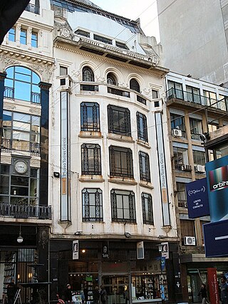
The Museo Torres García is located in the historic Ciudad Vieja of Montevideo where unusual portraits of historical icons and cubist paintings akin to Picasso's paintings, painted by Joaquín Torres García are exhibited. The museum was established by Manolita Piña Torres, the widow of Torres Garcia after his death in 1949 who also set up the García Torres Foundation, a private non-profit organization which organizes the paintings, drawings, original writings, archives, objects and furniture designed by the painter as well as the photographs, magazines and publications related to him.
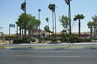
Supermercados Internacionales HEB, S.A. de C.V. is the Mexican division of H-E-B, a private supermarket chain based in San Antonio, Texas, U.S. It competes mainly with Soriana, Walmart México, Bodega Aurrerá, S-Mart, Chedraui and Casa Ley.

The Battle of Cardal, on 20 January 1807, was the main conflict between the Spanish defense forces of Montevideo, Uruguay, and British troops during the siege of Montevideo during the second British invasion of the River Plate. The British won an easy victory over the outnumbered opposing forces, which paved the way for the fall of the city,

Estación Liniers is a railway station located in the Liniers barrio of Buenos Aires, Argentina.
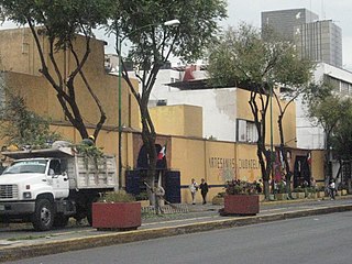
The Ciudadela Market is a traditional style Mexican market which specializes in the sale of Mexican handcrafts and folk art, located in the southwest corner of the historic center of Mexico City. The market is the first of its kind in the country, established just before the 1968 Summer Olympics to promote this aspect of Mexico's cultural heritage. It is home to over 350 vendors, mostly small operators selling to Mexican and foreign tourists.

The Walls of Madrid are the five successive sets of walls that surrounded the city of Madrid from the Middle Ages until the end of the 19th century. Some of the walls had a defensive or military function, while others made it easy to tax goods entering the city. Towards the end of the 19th century the demographic explosion that came with the Industrial Revolution prompted urban expansion throughout Spain. Older walls were torn down to enable the expansion of the city under the grid plan of Carlos María de Castro.

The Alcantara Gate is a city gate located in Toledo, in Castile-La Mancha, Spain. It gives access to the interior of the historic center of the city, passing through its eastern side the surrounding wall. It is in front of the bridge called Puente de Alcántara, that crosses the Tagus river and that in turn is protected by two gates fortified in its ends.


