An inverse problem in science is the process of calculating from a set of observations the causal factors that produced them: for example, calculating an image in X-ray computed tomography, source reconstruction in acoustics, or calculating the density of the Earth from measurements of its gravity field.
Seismic tomography is a technique for imaging the subsurface of the Earth with seismic waves produced by earthquakes or explosions. P-, S-, and surface waves can be used for tomographic models of different resolutions based on seismic wavelength, wave source distance, and the seismograph array coverage. The data received at seismometers are used to solve an inverse problem, wherein the locations of reflection and refraction of the wave paths are determined. This solution can be used to create 3D images of velocity anomalies which may be interpreted as structural, thermal, or compositional variations. Geoscientists use these images to better understand core, mantle, and plate tectonic processes.
Hydrocarbon exploration is the search by petroleum geologists and geophysicists for hydrocarbon deposits beneath the Earth's surface, such as oil and natural gas. Oil and gas exploration are grouped under the science of petroleum geology.

Reflection seismology is a method of exploration geophysics that uses the principles of seismology to estimate the properties of the Earth's subsurface from reflected seismic waves. The method requires a controlled seismic source of energy, such as dynamite or Tovex blast, a specialized air gun or a seismic vibrator, commonly known by the trademark name Vibroseis. Reflection seismology is similar to sonar and echolocation. This article is about surface seismic surveys; for vertical seismic profiles, see VSP.

In statistics, nonlinear regression is a form of regression analysis in which observational data are modeled by a function which is a nonlinear combination of the model parameters and depends on one or more independent variables. The data are fitted by a method of successive approximations.
Exploration geophysics is an applied branch of geophysics and economic geology, which uses physical methods, such as seismic, gravitational, magnetic, electrical and electromagnetic at the surface of the Earth to measure the physical properties of the subsurface, along with the anomalies in those properties. It is most often used to detect or infer the presence and position of economically useful geological deposits, such as ore minerals; fossil fuels and other hydrocarbons; geothermal reservoirs; and groundwater reservoirs.

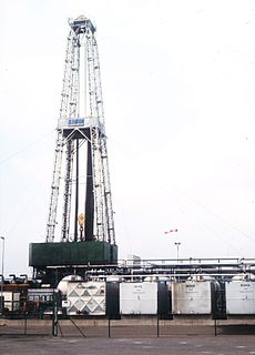
A seismic source is a device that generates controlled seismic energy used to perform both reflection and refraction seismic surveys. A seismic source can be simple, such as dynamite, or it can use more sophisticated technology, such as a specialized air gun. Seismic sources can provide single pulses or continuous sweeps of energy, generating seismic waves, which travel through a medium such as water or layers of rocks. Some of the waves then reflect and refract and are recorded by receivers, such as geophones or hydrophones.
Jens Frahm is Director of the Biomedizinische NMR at the Max Planck Institute for Biophysical Chemistry in Göttingen, Germany.
Inversion or inversions may refer to:
Seismic migration is the process by which seismic events are geometrically re-located in either space or time to the location the event occurred in the subsurface rather than the location that it was recorded at the surface, thereby creating a more accurate image of the subsurface. This process is necessary to overcome the limitations of geophysical methods imposed by areas of complex geology, such as: faults, salt bodies, folding, etc.
Seismic inversion, in geophysics, is the process of transforming seismic reflection data into a quantitative rock-property description of a reservoir. Seismic inversion may be pre- or post-stack, deterministic, random or geostatistical; it typically includes other reservoir measurements such as well logs and cores.
A synthetic seismogram is the result of forward modelling the seismic response of an input earth model, which is defined in terms of 1D, 2D or 3D variations in physical properties. In hydrocarbon exploration this is used to provide a 'tie' between changes in rock properties in a borehole and seismic reflection data at the same location. It can also be used either to test possible interpretation models for 2D and 3D seismic data or to model the response of the predicted geology as an aid to planning a seismic reflection survey. In the processing of wide-angle reflection and refraction (WARR) data, synthetic seismograms are used to further constrain the results of seismic tomography. In earthquake seismology, synthetic seismograms are used either to match the predicted effects of a particular earthquake source fault model with observed seismometer records or to help constrain the Earth's velocity structure. Synthetic seismograms are generated using specialized geophysical software.

In the oil and gas industry, reservoir modeling involves the construction of a computer model of a petroleum reservoir, for the purposes of improving estimation of reserves and making decisions regarding the development of the field, predicting future production, placing additional wells, and evaluating alternative reservoir management scenarios.
In seismology, first-break picking is the detecting or picking the onset arrivals of refracted signals from all the signals received by receiver arrays and produced by a particular source signal generation. It is also called first arrival picking or first break detection. First-break picking can be done automatically, manually or as a combination of both. With the development of computer science and the size of seismic surveys, automatic picking is often preferred.

Interferometry examines the general interference phenomena between pairs of signals in order to gain useful information about the subsurface. Seismic interferometry (SI) utilizes the crosscorrelation of signal pairs to reconstruct the impulse response of a given media. Papers by Keiiti Aki (1957), Géza Kunetz, and Jon Claerbout (1968) helped develop the technique for seismic applications and provided the framework upon which modern theory is based.

Seismic inversion involves the set of methods which seismologists use to infer properties through physical measurements. Surface-wave inversion is the method by which elastic properties, density, and thickness of layers in the subsurface are obtained through analysis of surface-wave dispersion. The entire inversion process requires the gathering of seismic data, the creation of dispersion curves, and finally the inference of subsurface properties.

Inverse modeling is a mathematical technique where the objective is to determine the physical properties of the subsurface of an earth region that has produced a given seismogram. Cooke and Schneider (1983) defined it as calculation of the earth’s structure and physical parameters from some set of observed seismic data. The underlying assumption in this method is that the collected seismic data are from an earth structure that matches the cross-section computed from the inversion algorithm. Some common earth properties that are inverted for include acoustic velocity, formation and fluid densities, acoustic impedance, Poisson's ratio, formation compressibility, shear rigidity, porosity, and fluid saturation.
Kevin M. Short is an American mathematician and entrepreneur. He is a Professor of Applied Mathematics at the University of New Hampshire. He is also co-founder and Chief Technology Officer (CTO) at Setem Technologies, in Newbury, Massachusetts. Since 1994, when he began at UNH, Short's academic research and work has continually focused on tying together nonlinear chaos theory and signal processing so that nonlinearity can play a major role in the future of technology development.


