Goat Island is an island in Galveston County, Texas. It is just north of the Bolivar Peninsula. It was severely damaged by hurricanes in 2008.
An island or isle is any piece of sub-continental land that is surrounded by water. Very small islands such as emergent land features on atolls can be called islets, skerries, cays or keys. An island in a river or a lake island may be called an eyot or ait, and a small island off the coast may be called a holm. A grouping of geographically or geologically related islands, such as the Philippines, is referred to as an archipelago.

Texas is the second largest state in the United States by area and population. Located in the South Central region, Texas shares borders with the states of Louisiana to the east, Arkansas to the northeast, Oklahoma to the north, New Mexico to the west, and the Mexican states of Chihuahua, Coahuila, Nuevo León, and Tamaulipas to the southwest, and has a coastline with the Gulf of Mexico to the southeast.
The 2008 Atlantic hurricane season was the most disastrous Atlantic hurricane season since 2005, causing over 1,000 deaths and nearly $50 billion in damages. It was an above-average season, featuring sixteen named storms, eight of which became hurricanes, and five which further became major hurricanes, the highest number since the record-breaking 2005 season. It officially started on June 1 and ended on November 30. These dates conventionally delimit the period of each year when most tropical cyclones form in the Atlantic basin. However, the formation of Tropical Storm Arthur caused the season to start one day early. This season is the fifth most costly on record, behind only the 2004, 2005, 2012 and 2017 seasons, with over $49.5 billion in damage. It was the only year on record in which a major hurricane existed in every month from July through November in the North Atlantic.Bertha became the longest-lived July tropical cyclone on record for the basin, the first of several long-lived systems during 2008.
Coordinates: 29°28′11″N94°39′56″W / 29.46972°N 94.66556°W
A geographic coordinate system is a coordinate system that enables every location on Earth to be specified by a set of numbers, letters or symbols. The coordinates are often chosen such that one of the numbers represents a vertical position and two or three of the numbers represent a horizontal position; alternatively, a geographic position may be expressed in a combined three-dimensional Cartesian vector. A common choice of coordinates is latitude, longitude and elevation. To specify a location on a plane requires a map projection.
This article about a location in Galveston County, Texas is a stub. You can help Wikipedia by expanding it. |
Crabtree is a census-designated place (CDP) in Salem Township, Westmoreland County, Pennsylvania, United States. The population was 320 at the 2000 census.
Kirkmuirhill is a village in South Lanarkshire, Scotland. It borders Blackwood, near Lanark and is sited near Junction 9 of the M74 motorway. Its postal sector is ML11 9.
Killisnoo Island is a small island in the Alexander Archipelago in southeastern Alaska, at 57°28′11″N134°35′26″W. It is located just off the central west coast of Admiralty Island, south of the city of Angoon. Killisnoo Island, an unincorporated area, is a settlement on the island.
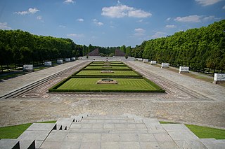
Treptower Park is a park alongside the river Spree in Alt-Treptow, in the district of Treptow-Köpenick, south of central Berlin.
Milroy is a census-designated place in Anderson Township, in the southern part of Rush County, in the U.S. state of Indiana.
Stoneham is an unincorporated community and a U.S. Post Office located in Weld County, Colorado, United States. The Stoneham Post Office has the ZIP Code 80754.
Walden is an unincorporated community in Bibb County, Georgia, United States. It is part of the Macon Metropolitan Statistical Area.
Alverstone Garden Village is a housing estate built between the 1930s and the 1970s; entirely contained within Youngwoods Copse, and thus almost invisible from the older hamlet of Alverstone. At the 2011 Census the Post Office indicated that the population was included in the civil parish of Newchurch, Isle of Wight.
Little Hell is an unincorporated community in Accomack County, Virginia.
Gniewowo is a village in the administrative district of Gmina Śmigiel, within Kościan County, Greater Poland Voivodeship, in west-central Poland. It lies approximately 11 kilometres (7 mi) east of Śmigiel, 8 km (5 mi) south of Kościan, and 46 km (29 mi) south of the regional capital Poznań.
Smithsville is a community in the Canadian province of Nova Scotia, located in the Municipality of the District of Barrington of Shelburne County.
Leedale is a hamlet in central Alberta, Canada within Ponoka County. It is located 6 kilometres (3.7 mi) south of Highway 53, approximately 59 kilometres (37 mi) northwest of Red Deer.
Hilltop is a rural community in the Rural Municipality of Clanwilliam and is a mixed agricultural area.
Seisholtzville is a village located mainly in Hereford Township, Berks County, Pennsylvania, but also in Longswamp Township. It is located on the crest of South Mountain and the Perkiomen Creek begins here. It uses the Macungie zip code of 18062.
Beaumont is an unincorporated community in Powhatan County, in the U.S. state of Virginia.
Victory Hill is an unincorporated community in Gloucester County, in the U. S. state of Virginia.
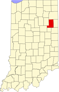
Wellsburg is an unincorporated community in Liberty Township, Wells County, in the U.S. state of Indiana.
Stokley is an unincorporated community in Pettis County, in the U.S. state of Missouri.
Hindostan is an unincorporated community in Northwest Township, Orange County, in the U.S. state of Indiana.
Trumbull is a census-designated place and unincorporated community in Ellis County, Texas, United States.