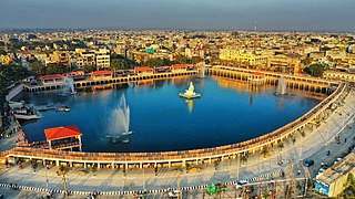
Brahmapur is a city on the eastern coastline of Odisha, India.
Balasore District, also known as Baleswar District, is an administrative district of Odisha state, in eastern India. Balasore is one of the coastal districts of Odisha and lies on the northernmost part of the state.

National Highway 16 is a major National Highway in India that runs along east coast of West Bengal, Odisha, Andhra Pradesh, and Tamil Nadu. It was previously known as National Highway 5.
Gopalpur (Hindi/Bengali/Oriya) or Gopalapuram (Telugu/Tamil/Malayalam) may refer to:

The Rushikulya River is one of the major rivers in the state of Odisha and covers entire catchment area in the districts of Kandhamal and Ganjam of Odisha. The Rushikulya originates at an elevation of about 1000 metres from Rushimala Hills part of Daringbadi hills of the Eastern Ghats range. The place from where the river originates, Daringbadi is called the ' Kashmir of Odisha '. The river lies within the geographical coordinates of 19.07 to 20.19 north latitude and 84.01 to 85.06 east longitude. It meets the Bay of Bengal at Puruna Bandha in Ganjam. Its tributaries are the Baghua, the Dhanei, the Badanadi etc. It has no delta as such at its mouth.

Odisha is one of the 28 states in the Republic of India. Odisha is located in the eastern part of the Indian peninsula and the Bay of Bengal lies to its East while Chhattisgarh shares its border in the west and north-west. The state also shares geographic boundaries with West Bengal in the north-east, Jharkhand in the north and Andhra Pradesh in the south. The state is spread over an area of 1,55,707 km2 and extends for 700 km from north to south and 500 kilometres from east to west. Its coastline is 450 km long. The state is divided into 30 districts which are further subdivided into 317 blocks called tahasil.
Chaumukha is a coastal village in Baliapal block of Baleswar district of the Indian state of Odisha.

Hinjili is a Vidhan Sabha constituency of Ganjam district, Odisha.
Makarajhola is a village and a Gram panchayat in Ganjam district in the Indian state of Odisha.
Gopinathpur is a small village in Tarasingi, Ganjam district, Odisha, India. As of the 2011 Census of India, it had a population of 374 across 83 households.
Kharagpur railway division is one of the four railway divisions under South Eastern Railway zone of Indian Railways. This railway division was formed on 14 April 1952 and its headquarters are located at Kharagpur in the state of West Bengal of India.
Sheragada is a town and Notified Area Council in Ganjam district in the Indian state of Odisha.

Golanthra railway station is a railway station on Khurda Road–Visakhapatnam section, part of the Howrah–Chennai main line under Khurda Road railway division of East Coast Railway zone. It is situated at Gobindanagar, Golanthara in Ganjam district in the Indian state of Odisha.
Gopinathpur is a small village in Hinjili, Ganjam district, Odisha, India. As of the 2011 Census of India, it had a population of 2,036 across 443 households.
Gopinathpur is a small village in Golanthara, Ganjam district, Odisha, India. As of the 2011 Census of India, it had a population of 396 across 86 households.
This page is based on this
Wikipedia article Text is available under the
CC BY-SA 4.0 license; additional terms may apply.
Images, videos and audio are available under their respective licenses.