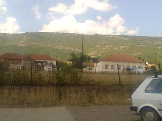
Gottshaus

Last updated

Gottshaus is a village and former municipality in the canton of Thurgau, Switzerland.

Canton of Thurgau Canton of Switzerland

The canton of Thurgau is a northeast canton of Switzerland.

Switzerland federal republic in Central Europe

Switzerland, officially the Swiss Confederation, is a sovereign state situated in the confluence of western, central, and southern Europe. It is a federal republic composed of 26 cantons, with federal authorities seated in Bern. Switzerland is a landlocked country bordered by Italy to the south, France to the west, Germany to the north, and Austria and Liechtenstein to the east. It is geographically divided between the Alps, the Swiss Plateau and the Jura, spanning a total area of 41,285 km2 (15,940 sq mi), and land area of 39,997 km2 (15,443 sq mi). While the Alps occupy the greater part of the territory, the Swiss population of approximately 8.5 million is concentrated mostly on the plateau, where the largest cities are located, among them the two global cities and economic centres of Zürich and Geneva.

It was first recorded somewhere between year 1250 and 1300 as Gottshaus.

The municipality also contained the village Sankt Pelagiberg as well as 40 others. It had 781 inhabitants in 1850, which went up and down over the years to 676 in 1900, 798 in 1950, 707 in 1980 and 811 in 1990.
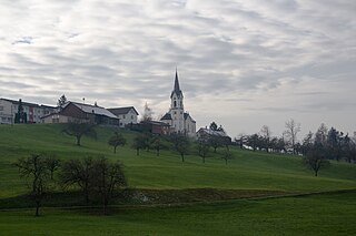
Sankt Pelagiberg

Sankt Pelagiberg is a village in the canton of Thurgau, Switzerland.

In 1996 the municipality was merged with the neighboring municipality Hauptwil to form a new and larger municipality Hauptwil-Gottshaus.

Hauptwil is a village and former municipality in the canton of Thurgau, Switzerland.

Hauptwil-Gottshaus Place in Thurgau, Switzerland

Hauptwil-Gottshaus is a municipality in Weinfelden District in the canton of Thurgau in Switzerland.
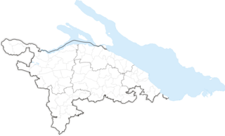
Related Research Articles

Municipalities of the canton of Thurgau Wikimedia list article

The following are the 80 municipalities of the canton of Thurgau, as of 2009.

The Wakker Prize is awarded annually by the Swiss Heritage Society to a Municipality of Switzerland for the development and preservation of its architectural heritage.

Gëzlyubulak Place in Kalbajar, Azerbaijan

Gëzlyubulak is a village in the Kalbajar Rayon of Azerbaijan.

Sor, Azerbaijan Place

Sor is a village in the Khojavend Rayon of Azerbaijan.

Kobyłki Duże Village in Łódź Voivodeship, Poland

Kobyłki Duże is a village in the administrative district of Gmina Grabica, within Piotrków County, Łódź Voivodeship, in central Poland. It lies approximately 8 kilometres (5 mi) south-west of Grabica, 15 km (9 mi) west of Piotrków Trybunalski, and 39 km (24 mi) south of the regional capital Łódź.

Zapole, Sieradz County Village in Łódź Voivodeship, Poland

Zapole is a village in the administrative district of Gmina Brzeźnio, within Sieradz County, Łódź Voivodeship, in central Poland. It lies approximately 3 kilometres (2 mi) east of Brzeźnio, 14 km (9 mi) south-west of Sieradz, and 65 km (40 mi) south-west of the regional capital Łódź.

Lipnik, Opatów County Village in Świętokrzyskie Voivodeship, Poland

Lipnik is a village in Opatów County, Świętokrzyskie Voivodeship, in south-central Poland. It is the seat of the gmina called Gmina Lipnik. It lies approximately 10 kilometres (6 mi) south-east of Opatów and 64 km (40 mi) east of the regional capital Kielce.

Podraczynie Village in Masovian Voivodeship, Poland

Podraczynie is a village in the administrative district of Gmina Przesmyki, within Siedlce County, Masovian Voivodeship, in east-central Poland. It lies approximately 5 kilometres (3 mi) north-east of Przesmyki, 29 km (18 mi) north-east of Siedlce, and 112 km (70 mi) east of Warsaw.

Krzemienica, Pomeranian Voivodeship Village in Pomeranian Voivodeship, Poland

For other places with the same name, see Krzemienica.For the history of the region, see History of Pomerania.

Bom Retiro, Santa Catarina is a municipality in the state of Santa Catarina in the South region of Brazil. As of the 2010 census, Bom Retiro had a population of 8,942.

Grabovica is a village in the municipality of Kladovo, Serbia. According to the 2002 census, the village has a population of 880 people.

Reka is a village in the municipality of Kladovo, Serbia. According to the 2002 census, the village has a population of 278 people.

Luke (Ivanjica) Village in Moravica District, Serbia

Luke is a village in the municipality of Ivanjica, Serbia. According to the 2011 census, the village has a population of 939 inhabitants.

Srednjevo Village in Braničevo District, Serbia

Srednjevo is a village in the municipality of Veliko Gradište, Serbia. According to the 2002 census, the village has a population of 530 people.

Mali Suvodol Village in Pirot District, Serbia

Mali Suvodol is a village in the municipality of Pirot, Serbia. According to the 2002 census, the village has a population of 281 people.

Hauptwil Castle is a castle in the municipality of Hauptwil-Gottshaus of the Canton of Thurgau in Switzerland. It is a Swiss heritage site of national significance.

Borotino is a village in the Municipality of Krivogaštani in North Macedonia.

References

<i>Historical Dictionary of Switzerland</i> encyclopedia on the history of Switzerland

The Historical Dictionary of Switzerland is an encyclopedia on the history of Switzerland that aims to take into account the results of modern historical research in a manner accessible to a broader audience.

Coordinates: 47°29′21″N9°17′21″E / 47.48917°N 9.28917°E / 47.48917; 9.28917

Geographic coordinate system Coordinate system

A geographic coordinate system is a coordinate system that enables every location on Earth to be specified by a set of numbers, letters or symbols. The coordinates are often chosen such that one of the numbers represents a vertical position and two or three of the numbers represent a horizontal position; alternatively, a geographic position may be expressed in a combined three-dimensional Cartesian vector. A common choice of coordinates is latitude, longitude and elevation. To specify a location on a plane requires a map projection.