The Bahamas, known officially as the Commonwealth of The Bahamas, is a country within the Lucayan Archipelago. The archipelagic state consists of more than 700 islands, cays, and islets in the Atlantic Ocean, and is located north of Cuba and Hispaniola, northwest of the Turks and Caicos Islands, southeast of the U.S. state of Florida, and east of the Florida Keys. The capital is Nassau on the island of New Providence. The designation of "the Bahamas" can refer either to the country or to the larger island chain that it shares with the Turks and Caicos Islands. The Royal Bahamas Defence Force describes the Bahamas territory as encompassing 470,000 km2 (180,000 sq mi) of ocean space.
The earliest arrival of humans in the islands now known as The Bahamas was in the first millennium AD. The first inhabitants of the islands were the Lucayans, an Arawakan-speaking Taino people, who arrived between about 500 and 800 AD from other islands of the Caribbean. Their ancestors came from mainland South America, where Arawakan-language peoples were present in most territories, and especially along the northeastern coast.
This article talks about transportation in the Bahamas, a North American archipelagic state in the Atlantic Ocean.

New Providence is the most populous island in The Bahamas, containing more than 70% of the total population. It is the location of the national capital city of Nassau, whose boundaries are coincident with the island; it had a population of 246,329 at the 2010 Census; the latest estimate (2016) is 274,400. The island was originally under Spanish control following Christopher Columbus's discovery of the New World, but the Spanish government showed little interest in developing the island. Nassau, the island's largest city, was formerly known as Charles-town, but it was burned to the ground by the Spanish in 1684. It was laid out and renamed Nassau in 1695 by Nicholas Trott, the most successful Lord Proprietor, in honor of the Prince of Orange-Nassau who became William III of England. The three branches of Bahamian Government: the executive, the legislative, and the judiciary, are all headquartered on New Providence. New Providence functions as the main commercial hub of The Bahamas. It is also home to more than 400 banks and trust companies, and its hotels and port account for more than two-thirds of the four million-plus tourists who visit The Bahamas annually. Other settlements on New Providence include Grants Town, Bain Town, Fox Hill, Adelaide, Yamacraw, South Beach, Coral Harbour, Lyford Cay, Paradise Island, Sea Breeze, Centreville, The Grove (South) and The Grove, Cable Beach, Delaporte, Gambier, Old Fort Bay, and Love Beach.

Eleuthera refers both to a single island in the archipelagic state of The Commonwealth of the Bahamas and to its associated group of smaller islands. Eleuthera forms a part of the Great Bahama Bank. The island of Eleuthera incorporates the smaller Harbour Island. "Eleuthera" derives from the feminine Greek adjective ἐλεύθερος (eleutheros), meaning "free". Known in the 17th century as Cigateo, it lies 80 km east of Nassau. It is long and thin—180 km long and in places little more than 1.6 km wide. Its eastern side faces the Atlantic Ocean, and its western side faces the Great Bahama Bank. The topography of the island varies from wide rolling pink sand beaches to large outcrops of ancient coral reefs, and its population is approximately 11,000. The principal economy of the island is tourism.
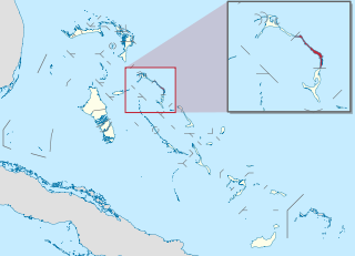
Harbour Island is an island and administrative district in the Bahamas and is located off the northeast coast of Eleuthera Island. It has a population of 1,762.

North Eleuthera is one of the districts of the Bahamas, on the island of Eleuthera. It has a population of 3,247.

South Eleuthera is one of the districts of the Bahamas, on the island of Eleuthera.

Spanish Wells is one of the districts of the Bahamas.
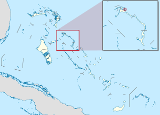
Dunmore Town is a town in the Bahamas. It has a population of 1,762.
Governor's Harbour Airport is an airport in Governor's Harbour on Eleuthera in the Bahamas. It is the second most active of the three airports on Eleuthera, and is about 8 mi (13 km) north of the city.

The effects of Hurricane Andrew in the Bahamas included three direct fatalities and $250 million (1992 USD) in damage. Forming from a tropical wave on August 16, Andrew remained weak until rapidly intensifying on August 22, and late on August 23 it made its first landfall in The Bahamas on Eleuthera as a Category 5 hurricane with winds of 260 km/h (160 mph); early the next day Hurricane Andrew passed through the southern Berry Islands with winds of 240 km/h (150 mph). The hurricane later made a devastating landfall in southern Florida, and after striking southern Louisiana it dissipated over the eastern United States. Andrew was the first major hurricane to affect the nation since Hurricane Betsy in 1965. It caused $250 million in damage, with damage heaviest on Eleuthera and Cat Cay. Four deaths occurred due to the storm, of which one was indirectly related to the hurricane.
The following outline is provided as an overview of and topical guide to the Bahamas:

The following is an alphabetical list of topics related to the Commonwealth of the Bahamas.
Rock Sound is a town and former district of the Bahamas. It corresponds roughly to the current district of South Eleuthera. At the 2010 census, the population was 961. As of 2012 it had a population of 1,075.
Florida Coastal Airlines (FCA) was an airline based in Fort Lauderdale, Florida, USA. It operated services between Florida and the Bahamas, Cuba, and Haiti
Pineapple Air is an airline based in Nassau, Bahamas.
General elections were held in the Bahamas in September 1729, the first elections in the territory.
Savannah Sound is a settlement in Central Eleuthera, the Bahamas. At the 2010 census, the population was 204.