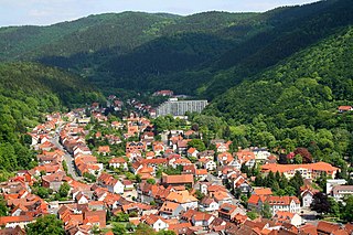
Bad Lauterberg is a town in the district of Göttingen, in Lower Saxony, Germany. It is situated in the southern Harz, approx. 15 km southwest of Braunlage, and 20 km southeast of Osterode am Harz.
The South Harz Railway is a railway line through the German states of Lower Saxony and Thuringia. It runs from Northeim to Nordhausen, via Herzberg am Harz, Bad Lauterberg-Barbis, Bad Sachsa, Walkenried and Ellrich. The line is 69 kilometres (43 mi) long.

The Oder is a 56-kilometre-long (35 mi) river in Lower Saxony, Germany, and a right tributary of the Rhume. Its source is in the Harz mountains, near Sankt Andreasberg. It flows southwest through Bad Lauterberg, Pöhlde and Hattorf am Harz. The Oder flows into the Rhume in Katlenburg-Lindau.
The Aschentalshalbe is a ridge in the Harz Mountains of Germany that is up to 685 m above sea level (NN). It lies south of the village of Sieber in the unincorporated area of Harz in the district of Göttingen in the state of Lower Saxony.

Krumme Lutter is a river of Lower Saxony, Germany.

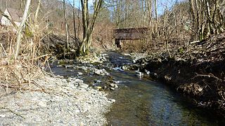
Lutter is a small river that flows near Bad Lauterberg in the district of Göttingen in the north German state of Lower Saxony.

The Sperrlutter is a river in Lower Saxony, Germany, a roughly 12 km (7 mi)-long tributary of the Oder between Sankt Andreasberg and Bad Lauterberg in the Harz Mountains.
The Übelsberg is a 651.3 metre high mountain in the South Harz, which lies southwest of Sieber in the district of Göttingen in Lower Saxony. It sits astride the watershed between the Grade Lutter and the Krumme Lutter rivers. The mountain is linked via a ridge to the Aschentalshalbe in the north and the Mittelberg in the south.

The Große Steinau is a river of Lower Saxony, Germany.
The Kleiner Knollen is a 631 metre high mountain in the southwestern part of the Harz in the German state of Lower Saxony.
The Braakberg is a 645.5 metre high mountain in the Harz in central Germany, in the unincorporated area of Harz in the district of Göttingen in the state of Lower Saxony.
The Breitentalskopf is a hill in the Harz Mountains of central Germany, that rises southeast of Sieber in the district of Göttingen in Lower Saxony. It is 579.1 m high and separates the River Sieber from the Breitental valley, that gave the hill its name. Towards the southeast is the ridge of the Aschentalshalbe.
Heibeek is a small river of Lower Saxony, Germany. It flows into the Lutter near Bad Lauterberg.
Schadenbeek is a small river of Lower Saxony, Germany. It flows into the Krumme Lutter north of Bad Lauterberg.
The Schadenbeeksköpfe are two summits on a southeastern outlier of the Aschentalshalbe in the Harz Mountains of Germany, about 3.6 kilometres southeast of Sieber in the district of Göttingen in Lower Saxony. Their highest peak is 605 metres above sea level. In addition they separate the Schadenbeek stream, after which they were named, from the upper Krumme Lutter. About 1 kilometre east of the Schadenbeeksköpfe lies the Wolkenhügel Pit, in the valley of the Krumme Lutter, which closed in June 2007. A refuge hut not far from the Schadenbeeksköpfe is a checkpoint in the Harzer Wandernadel hiking badge system.
The Gropenbornskopf is a northern offshoot of the Aschentalshalbe in the Harz Mountains of central Germany, two kilometres east of Sieber in the district of Göttingen in the state of Lower Saxony. It is 581.2 metres high and was named after the Gropenborn stream that flows downs its western side, and which it initially divides from the River Sieber.
The Fissenkenkopf is a hill in the Harz Mountains of Germany, that rises south of Sieber in the district of Göttingen in Lower Saxony. It is 527 metres high and is the western extension of the Adlersberg and the Kloppstert hills.
The Heibeeksköpfe in the Harz Mountains of central Germany are a double summit with a maximum height of 465.2 m above sea level (NN), near Bad Lauterberg in the unincorporated area of Harz in the district of Göttingen in Lower Saxony.

Goslar – Northeim – Göttingen II is an electoral constituency represented in the Bundestag. It elects one member via first-past-the-post voting. Under the current constituency numbering system, it is designated as constituency 52. It is located in southern Lower Saxony, comprising most of the districts of Goslar, Northeim, and the former Osterode.
This page is based on this
Wikipedia article Text is available under the
CC BY-SA 4.0 license; additional terms may apply.
Images, videos and audio are available under their respective licenses.


