
Hillyard is a neighborhood in Spokane, Washington which existed as a separate town between 1892 and 1924. The town came about due to the Great Northern Railway and was named for James J. Hill, then-head of the railroad. Between 1904 and 1912, many of the town's houses were built to house railroad workers working in the local yard. Hillyard was the home of the Great Northern's famed shops where locomotives were manufactured, repaired, and refurbished. At the time, the Hillyard shop was the largest in the nation.
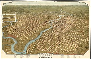
Neighborhoods in Spokane, Washington are officially grouped by the Spokane City Council into three main city council districts: 1, 2, and 3. Each city council district contains multiple, official neighborhoods that are recognized with a neighborhood council. Informally, neighborhoods are colloquially grouped by local geographical, geological, cultural, or historical features The list of neighborhoods below is organized based on the official designations by the City of Spokane. Unofficial neighborhoods and districts are listed within the official neighborhood in which they are located.
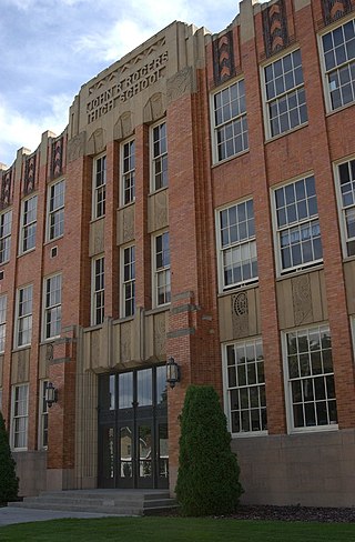
Bemiss is a neighborhood in Spokane, Washington. It is located within City Council District 1, which covers the northeastern section of the city. The neighborhood is bounded by Wellesley Avenue to the north, Market Street to the east, Illinois Avenue and the Spokane River to the south, and Perry Street and Napa Street to the west. It is located to the southeast of the Hillyard neighborhood and is often grouped into greater Hillyard.

Logan is a neighborhood in Spokane, Washington. It is located immediately northeast of Downtown Spokane and is home to Gonzaga University. The Spokane River runs along its eastern and southern edge. Due to its proximity to the city center, Logan is home to some of the oldest and densest areas in the city. It is known for its tree-lined streets, historic buildings and population of college students. In addition to numerous individual properties, there are two historic districts listed on the National Register of Historic Places located within Logan: the Desmet Avenue Warehouse Historic District and the Mission Avenue Historic District.

Browne's Addition, often referred to shorthand as just Browne's, is a neighborhood in Spokane, Washington. It is located directly west of Downtown Spokane and is one of the oldest and densest neighborhoods in the city. The area is known for its numerous historic mansions, many of which have been converted into multi-family apartments. The terrain is flat in the neighborhood despite the degree of topographical relief in the immediate surrounding area. Latah Creek cuts a deep valley to the west, separating Browne's Addition from the Sunset Hill portion of the West Hills neighborhood and the Spokane River gorge drops off dramatically to the north into the Peaceful Valley neighborhood. The South Hill area of Spokane rises to the southwest.
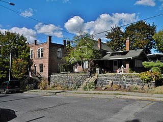
Peaceful Valley is a neighborhood in Spokane, Washington. It sits directly below Downtown Spokane on the Spokane River under its falls. The neighborhood snakes along the thin floodplain on the valley floor of the Spokane River Gorge. It is the smallest neighborhood in the city by both area and population, but due to its central location and unique character it is quite notable. The neighborhood has a working class and bohemian culture.
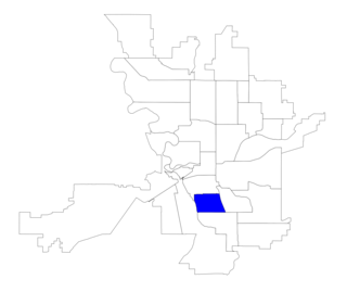
Manito/Cannon Hill is a neighborhood on the South Hill of Spokane, Washington. It is named after the two public parks that dominate its setting: Manito Park and Cannon Hill Park. Manito/Cannon Hill is a predominantly residential neighborhood made up mostly by single-family homes and city park land.
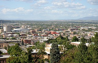
Cliff/Cannon is a neighborhood in Spokane, Washington. It is located immediately south of Downtown, Spokane, and on the lower reaches of the broader South Hill. The neighborhood is home to a medical district with Sacred Heart and Deaconess both having their main hospital campuses along Cliff/Cannon's denser northern edge. To the south the neighborhood becomes more residential. City parks break up the residential zoning of the southern half of Cliff/Cannon. It is adjacent to the Cannon Hill area of the neighboring but separate Manito/Cannon Hill neighborhood. The Marycliff-Cliff Park Historic District, a National Historic District listed on the National Register of Historic Places, is located within the neighborhood.

Latah/Hangman is a neighborhood in Spokane, Washington.

Emerson/Garfield is a neighborhood in Spokane, Washington. It is located immediately north of Downtown Spokane's North Bank and extends out into the inner northwestern portion of the city. Emerson/Garfield is a diverse neighborhood with residential, commercial and civic zones all bordering one another, with density ranging from single-family homes to multi-use buildings. Due to its location in the central area of Spokane, Emerson/Garfield is criss-crossed by numerous arterials and thoroughfares. Along those main roads are numerous commercial and retail districts of importance to both the neighborhood and city as a whole.

Comstock is a neighborhood in Spokane, Washington. It is located on the south side of the city in a broader area commonly known as the South Hill. The neighborhood is primarily single-family residential, and a mix of homes built during the streetcar era and then built during the post-World War II housing boom. The neighborhood is also home to a few commercial districts, including the regionally important Manito Shopping Center, two schools, the eponymous Comstock Park, sports fields and a golf course.

Southgate is a neighborhood in Spokane, Washington. It is located in the southwestern corner of the City of Spokane and part of the broader area known locally as the South Hill. Southgate is one of the newer neighborhoods in the city, with development first taking hold in the post-World War II housing boom and continuing into the present day. It is a mix of single-family residential, multi-family residential and commercial districts. The neighborhood has grown as Spokane has expanded southward, with multiple annexations expanding Southgate and the city since 2000 and as recently as 2016.

North Hill is a neighborhood in Spokane, Washington. As the name suggests, it is atop a hill on the north side of Spokane, within which it is centrally located and crossed by numerous major thoroughfares. It is home to parks, commercial districts and single family residential areas. The historic Garland Theater is located in North Hill, and the city's main north–south arterial, Division Street, is home to a major commercial district along the eastern edge of the neighborhood.
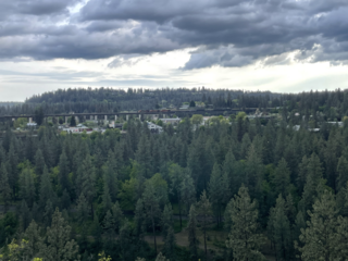
West Hills is a neighborhood in Spokane, Washington. As the name suggests, the neighborhood is located on hillsides to the west of downtown Spokane. The neighborhood also extends far to the west along the West Plains to incorporate the Spokane International Airport and surrounding land. As the city has grown over the decades, the West Hills neighborhood has expanded uphill and onto the plains to the west. That history of incremental growth, combined with the hilly topography of the area cut by numerous watercourses, has broken up the neighborhood into multiple, distinct areas with swaths of undeveloped land mixed in between.

Nevada Heights is a neighborhood in Spokane, Washington, located on the north side of the city. Its southern border is atop a bluff that runs east–west across the north side of the city, which gives the neighborhood its name. Nevada Street, a major north–south arterial, runs through the neighborhood. The neighborhood is largely residential, but also home to large retail districts, medical facilities, schools and parks. Being surrounded by the city of Spokane on all sides, the neighborhood is well integrated into urban area.

Shiloh Hills is a neighborhood in Spokane, Washington, located on the far northeastern side of the city. It is one of the newer areas of the city, initially annexed in the late 1960s with growth continuing into the 21st century. The neighborhood is home to residential, commercial and industrial districts as well as multiple regionally important transportation corridors such as the Division Street "Y".
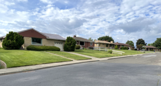
Northwest is a neighborhood in Spokane, Washington, located in the northwestern portion of the city. Largely single-family residential, Northwest is also home to Spokane's VA Medical Center, the Dwight Merkel Sports complex, a large public sports facility, and portions of Riverside State Park along the Spokane River. The neighborhood contains developments that span from the post-World War II housing boom in the east to more contemporary, suburban-style developments in the west. It was also home to Joe Albi Stadium from 1950 until 2022, which served as the Spokane region's main high school sports stadium over its seven decades of use.

Whitman is a neighborhood located on the northeast side of Spokane, Washington. It is named for pioneer missionaries Marcus and Narcissa Whitman.

The Sunset Boulevard Bridge, also known as the Latah Creek Bridge, is a deck arch bridge in the northwestern United States that spans Latah Creek in Spokane, Washington. The bridge connects the neighborhoods of Browne's Addition on the east, and Downtown Spokane just beyond that, with West Hills to the west. Latah Creek, which passes under the bridge, separates the two neighborhoods. It was built 113 years ago in 1911 by the city of Spokane, and was designed by Morton McCartney & J.F. Cunningham, with J.F. Greene serving as the construction engineer.

Garden Springs Creek is a stream of approximately 1.5 miles in length that flows through the West Hills neighborhood of Spokane, Washington into Latah Creek.


