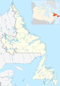
Division No. 1, Subdivision A is an unorganized subdivision on the Avalon Peninsula in Newfoundland and Labrador, Canada. It is in Division No. 1, and lies between Trinity Bay and Placentia Bay.
Baie Verte-Green Bay is a provincial electoral district for the House of Assembly of Newfoundland and Labrador, Canada. As of 2011 it has 8,067 eligible voters. The district was redistributed in 2015.
Lawrence Cove is a sheltered inlet on the north side of Bere Island, West Cork, Ireland, to the west of the village of Rerrin.
Bayview is a collaboration of small fishing communities along the southern island of Twillingate, Newfoundland and Labrador. The communities within Bayview were formerly called Bluff Head Cove, Gillard's Cove, Manuel's Cove and Ragged Point. Older residents of the community still refer to these places separately but street signs only read Bayview and Ragged Point.
Wild Cove is a small community on the north island of Twillingate, Newfoundland and Labrador. South of Wild Cove is Twillingate and north is Crow Head and the famous Long Point Lighthouse. Wild Cove is part of the Town of Twillingate.
The A588 is a road in England, which runs from Poulton-le-Fylde to Lancaster in Lancashire. It is the main route serving the Over Wyre areas of the Fylde.
The A586 is a road in England, which runs from Garstang to Blackpool, in Lancashire.
Indian Cove is a small two-street community just off Route 340 on New World Island in Newfoundland and Labrador, Canada. It is the last community before crossing the causeway to Twillingate. Before the construction of the causeway, there was a ferry that ran from Indian Cove to Twillingate. There is a hair salon and dog grooming services. Education is provided by New World Island Academy in Summerford and grocery shopping can be done in nearby Twillingate.

Comfort Cove-Newstead is a small, but picturesque fishing community Located outside Campbellton, on the east coast of Newfoundland and Labrador, Canada,.
Newfoundland and Labrador Route 330, also known as Road to the Shore or more commonly Gander Bay Road is a highway that extends from Gander, Newfoundland and Labrador across "the loop" passing through towns such as Gander Bay, Carmanville, Musgrave Harbour, and Lumsden to New-Wes-Valley. Here, the highway connects with Route 320, which continues "the loop" down the west shore of Bonavista Bay exiting back to the TCH in Gambo.

Green Bay is the name of two bays in the Canadian province of Newfoundland and Labrador.

Gander Bay is a natural bay located on the island of Newfoundland, in the Canadian province of Newfoundland and Labrador.
This is a list of the extreme points and extreme elevations in Scotland.
Beaver Cove may refer to the following places in Newfoundland and Labrador:

Cape Cove is a settlement in Newfoundland and Labrador located on Fogo island.

Digby Island is a small island immediately west of Kaien Island, which is the location of the city of Prince Rupert, British Columbia. The island is home to the Prince Rupert Airport and the small community of Dodge Cove. The island is named for Henry A. Digby, an officer on HMS Malacca.
Dragon Bay is a natural bay in Newfoundland, Canada. Indrafts include Mooring Cove, Willis Cove, Tickle Cove, and Crew Cove. Dragon bay runs in a westerly direction for more than 3 miles (4.8 km) from the entrance to Facheux Bay. It is narrow and deep throughout, with no anchorage. The south point of the entrance to this bay is Red Rock, the north point is Gray Rock, which has a cave. Little Hole lies 0.75 miles (1.21 km) west of Dragon Bay, and has shelter for small vessels.
Division No. 1, Subdivision C is an unorganized subdivision on the Avalon Peninsula in Newfoundland and Labrador, Canada. It is in Division 1 and contains the unincorporated communities of Cape St. Mary's, Cuslett, Gooseberry Cove, Great Barasway, Lears Cove, Patrick's Cove-Angels Cove, Ship Cove and Stoney House.
Division No. 1, Subdivision U is an unorganized subdivision on the Avalon Peninsula in Newfoundland and Labrador, Canada, in Division 1. It contains the unincorporated communities of Admiral's Cove, Bauline East, Bauline South, Burnt Cove, Devils Kitchen, Flat Rock, St. Michaels and Seal Cove.


