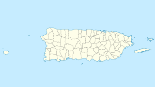
The Rio Grande de Loíza is a river in the island of Puerto Rico. It is the largest river in Puerto Rico by volume. It is situated on the north coast of the island. It flows from south to north and drains into the Atlantic Ocean, a few miles east of San Juan.
The Río Grande River is a river in the U.S. commonwealth of Puerto Rico that flows through the El Yunque National Forest and the town of Río Grande.
The Anton Ruiz River is a river of Humacao and Naguabo in Puerto Rico. It is 6.73 miles long. It begins at Collores and Mambiche creeks.
The Arenas River is a river of Yabucoa, Puerto Rico.
The Camándulas River is a river of Luquillo, Puerto Rico.
The Canovanillas River is a river of Carolina and Loíza, Puerto Rico.
The Canóvanas River is a river of Loíza and Río Grande, Puerto Rico.
The Cubuy River is a river of Puerto Rico.
The Cubuy River is a river of Puerto Rico.
Fajardo River is a river of Fajardo, Puerto Rico. It crosses Ceiba and Fajardo. It is 16.35 miles long.

The Guayanés River, is a river of Peñuelas, Puerto Rico.
The Humacao River is a river of Humacao, Puerto Rico and is in Las Piedras municipality, as well.
The Lachi River is a river of Maunabo, Puerto Rico.
The Prieto River is a river of Naguabo, Puerto Rico.
The Prieto River is a river of Puerto Rico.
The Sabana is a river of Puerto Rico.
The Valenciano River is a river in eastern Puerto Rico which flows through the municipalities of Juncos and Las Piedras, Puerto Rico. After Juncos, the river reaches a confluence on the left bank of the Río Gurabo, which is itself a tributary of the Río Grande de Loíza which flows north into the Atlantic Ocean. Since Hurricane Maria in September 217, the data on river drainage has not been updated.

The Río de la Mina is a river of Río Grande and Luquillo in Puerto Rico. It is near La Mina Trail and Big Tree Trail in Luquillo, Puerto Rico and it is 2.1 miles long.


