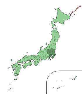
The Kanto region is a geographical area of Honshu, the largest island of Japan. The region includes the Greater Tokyo Area and encompasses seven prefectures: Gunma, Tochigi, Ibaraki, Saitama, Tokyo, Chiba, and Kanagawa. Within its boundaries, slightly more than 45 percent of the land area is the Kanto Plain. The rest consists of the hills and mountains that form the land borders. According to the official census on October 1, 2010 by the Japan Statistics Bureau, the population was 42,607,376, amounting to approximately one third of the total population of Japan. Kanto is the second largest sub-national economy in the world.

Gunma Prefecture is a prefecture of Japan located in the Kantō region. Its capital is Maebashi.
Numata is a city located in Gunma Prefecture, Japan. As of February 2015, the city had an estimated population of 48,840, and a population density of 110 persons per km². Its total area is 443.46 km², making it the largest city in terms of area within Gunma Prefecture.

Tatebayashi is a city located in Gunma Prefecture, Japan. As of February 2015, the city had an estimated population of 75,560, and a population density of 1260 persons per km². Its total area is 60.97 km². Tatebayashi is famous for Azalea Hill Park and Bunbuku Chagama of Morinji Temple.

Tomioka is a city located in Gunma Prefecture, Japan. As of February 2015, the city had an estimated population of 49,873, and a population density of 406 persons per km². Its total area is 122.85 km². It is the location of the Tomioka Silk Mill, a UNESCO World Heritage Site.

Kōzuke Province was a province of Japan in the area of Japan that is today Gunma Prefecture. Kōzuke bordered by Echigo, Shinano, Musashi and Shimotsuke Provinces. Its abbreviated form name was Jōshū (上州). Under the Engishiki classification system, Kōzuke was ranked as one of the 13 "great countries" (大国) in terms of importance, and one of the 30 "far countries" (遠国) in terms of distance from the capital. The provincial capital is located in what is now the city of Maebashi; however, its exact location remains uncertain. The ichinomiya of the province is located in what is now the city of Tomioka.

Ueno is a village located in Gunma Prefecture, Japan. As of October 1, 2019, the village had an estimated population of 1,089 and a population density of 5.99 persons per km². Its total area is 181.85 km². The village has the lowest population density of any municipality in Japan.

Naganohara is a town located in Gunma Prefecture, Japan. As of February 2015, the town had an estimated population of 5,612, and a population density of 41.9 persons per km². Its total area is 133.85 km2. The controversial Yanba Dam project is located within Naganohara.

Itakura is a town located in Gunma Prefecture, Japan. As of February 2015, the town had an estimated population of 11,024, and a population density of 561 persons per km². Its total area is 19.64 km². Itakura's animal mascot is the catfish. It is represented in a bronze statue at Raiden Shrine, as a mikoshi in Itakura's summer festival, and also is emblazoned on the town's manhole covers. Itakura is one of the few places in Japan where catfish is eaten, and it boasts two restaurants specializing in catfish dishes.

Chiyoda is a town located in Gunma Prefecture, Japan. As of February 2015, the town had an estimated population of 11,413, and a population density of 525 persons per km². Its total area is 21.73 km².

Shoda Shoyu Stadium Gunma (正田醤油スタジアム群馬) is a multi-purpose stadium in Maebashi, Japan. It is currently used mostly for football matches. Sponsored by soy sauce maker Shoda Shoyu, which has its headquarters in nearby Tatebayashi, the stadium serves as a home ground of Thespakusatsu Gunma. The stadium holds 15,253 people.
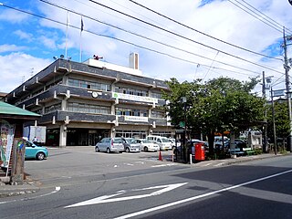
Maebashi is the capital city of Gunma Prefecture, in the northern Kantō region of Japan.

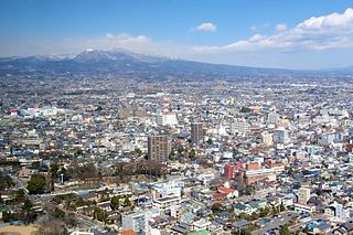
Takasaki is a city located in Gunma Prefecture, Japan. As of October 1, 2019, the city had an estimated population of 368,667, and a population density of 803 persons per km². Its total area is 459.16 square kilometres (177.28 sq mi). Takasaki is famous as the hometown of the Daruma doll, theoretically representing the Buddhist sage Bodhidharma and in modern practice a symbol of good luck.

Isesaki is a city located in Gunma Prefecture, Japan. As of February 2015, the city had an estimated population of 208,705, and a population density of 1500 persons per km². Its total area is 139.44 km².

Thespakusatsu Gunma is a professional football (soccer) club based in Maebashi, Gunma Prefecture in Japan. The club plays in the J3 League, the third division of professional football in Japan.

Arte Takasaki were a football (soccer) club based in Takasaki, Gunma Prefecture, formerly of the Japan Football League. Their team colours were black and red.

National Route 18 is a national highway connecting Takasaki, Gunma and Joetsu, Niigata in Japan.

National Route 145 is a national highway of Japan connecting Naganohara, Gunma and Numata, Gunma in Japan, with a total length of 49.8 km (30.94 mi).

Takasaki Tonyamachi Station is a railway station in Takasaki, Gunma, Japan, operated by East Japan Railway Company.
Gunma 4th district is a single-member constituency of the House of Representatives in the Diet of Japan. It is located in Southern Gunma and consists of the city of Fujioka, the Southern part of Takasaki city as well as Kanna town and Ueno village in Tano county. As of 2009, 292,356 eligible voters were registered in the district.