Şahməmmədli is a village in the Goranboy Rayon of Azerbaijan. The village forms part of the municipality of Goranboy.
Qımırlı is a village in the Qakh Rayon of Azerbaijan. The village forms part of the municipality of Xələftala.
Sofikənd is a village in the Quba Rayon of Azerbaijan. The village forms part of the municipality of Qamqam.
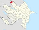
Qədiməlikqışlaq is a village in the Khachmaz Rayon of Azerbaijan. The village forms part of the municipality of Qaracik Zeyid.
Zərdəbərə is a village in the Lerik Rayon of Azerbaijan. The village forms part of the municipality of Nüravud.
Ortaoba is a village in the Khachmaz Rayon of Azerbaijan. The village forms part of the municipality of Yalama.
Hamarmeşə is a village and municipality in the Lerik Rayon of Azerbaijan. It has a population of 673. The municipality consists of the villages of Hamarmeşə, Şifəkəran, and Haran.
Köhnə Orand is a village in the municipality of Nüravud in the Lerik Rayon of Azerbaijan.
Xanlıqlı is a village in the municipality of Haftoni in the Lankaran Rayon of Azerbaijan.
Rəmə is a village in the municipality of Samanlıq in the Gadabay Rayon of Azerbaijan.
Bedağar is a village in the municipality of Qazma in the Balakan Rayon of Azerbaijan.
Çorçorbinə is a village in the municipality of Poştbinə in the Balakan Rayon of Azerbaijan.
Mazımüstü is a village in the municipality of Tülü in the Balakan Rayon of Azerbaijan.
Hetovlar is a village in the municipality of Talalar in the Balakan Rayon of Azerbaijan.
Göyəmtala is a former village in the municipality of Hənifə in the Balakan Rayon of Azerbaijan.
Sıhəkəran is a village in the municipality of Marzəsə in the Astara Rayon of Azerbaijan.
Paşaoba is a village and municipality in the Quba Rayon of Azerbaijan. It has a population of 993.
İstixana is a village and municipality in the Samukh Rayon of Azerbaijan. It has a population of 656.
Qaraboyunlar is a village in the municipality of Çobansığnaq in the Tovuz Rayon of Azerbaijan.
Xatıncan is a village in the municipality of Qalaboyun in the Tovuz Rayon of Azerbaijan.