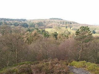
Lickey Hills Country Park is a country park in England. It is 10.3 miles south west of Birmingham and 24 miles north east of Worcester. The 524 acres (212 ha) park is situated just south of Rednal and close to Barnt Green. It is half a mile east of Cofton Hackett. It is one of the oldest parks managed by Birmingham City Council.

The Clent Hills lie 10 miles (16 km) south-west of Birmingham city centre in Clent, Worcestershire, England. The closest towns are Stourbridge and Halesowen, both in the West Midlands conurbation. The Clent Hills range consists of, in order from north-west to south-east: Wychbury Hill, Clent Hill, and Walton Hill. The north Worcestershire range of hills continues eastwards to include Romsley Hill, Waseley Hills and the Lickey Hills.

The Lickey Hills are a range of hills in Worcestershire, England, 11 miles (18 km) to the south-west of the centre of Birmingham near the villages of Lickey, Cofton Hackett and Barnt Green. The hills are a popular country park area and they afford panoramic views over much of the surrounding countryside.

The New Red Sandstone, chiefly in British geology, is composed of beds of red sandstone and associated rocks laid down throughout the Permian to the end of the Triassic, that underlie the Jurassic-Triassic age Penarth Group. The name distinguishes it from the Old Red Sandstone which is largely Devonian in age, and with which it was originally confused due to their similar composition.
The Reading Formation is a geologic formation in southern England. It dates to the Paleogene period, and is part of the Lambeth Group. It overlies the London Basin and is below the Harwich Formation.

Bilberry Hill is one of the Lickey Hills in northern Worcestershire, England, 10.3 miles south west of Birmingham and 24 miles north east of Worcester. It stands above and to the west of the village of Cofton Hackett, and is part of the Lickey Hills Country Park.
The Mercia Mudstone Group is an early Triassic lithostratigraphic group which is widespread in Britain, especially in the English Midlands – the name is derived from the ancient kingdom of Mercia which corresponds to that area. It is frequently encountered in older literature as the Keuper Marl or Keuper Marl Series.

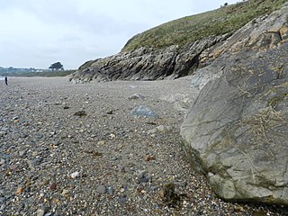
The Llanbedrog Volcanic Group is an Ordovician lithostratigraphic group in northwest Wales. The name is derived from the village of Llanbedrog on the Llyn Peninsula where the strata are exposed.

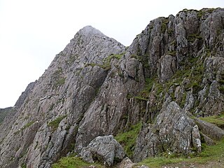
The Snowdon Volcanic Group is an Ordovician lithostratigraphic group in Snowdonia, north-west Wales. The name is derived from Snowdon, the highest peak in Wales where it outcrops. This assemblage of rocks has also been referred to as the Snowdon Volcanic Series.

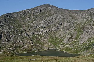
The Llewelyn Volcanic Group is an Ordovician lithostratigraphic group in Snowdonia, north-west Wales. The name is derived from Carnedd Llewelyn, the highest peak in the Carneddau range where it outcrops.

The Sherwood Sandstone Group is a Triassic lithostratigraphic group which is widespread in Britain, especially in the English Midlands. The name is derived from Sherwood Forest in Nottinghamshire which is underlain by rocks of this age. It has economic importance as the reservoir of the Morecambe Bay gas field, the second largest gas field in the UK.

The Exeter Group is a Permian lithostratigraphic group which occurs through East Devon in southwest England. The name is derived from the city of Exeter in Devon which is partly underlain by rocks of this age.
The Cumbrian Coast Group is a Permian lithostratigraphic group which occurs in the western part of Cumbria in northern England.
The Penarth Group is a Rhaetian age (Triassic) lithostratigraphic group which is widespread in Britain. It is named from the seaside town of Penarth near Cardiff in south Wales where strata of this age are exposed in coastal cliffs southwards to Lavernock Point. This sequence of rocks was previously known as the Rhaetic.

The Dent Group is a group of Upper Ordovician sedimentary and volcanic rocks in north-west England. It is the lowermost part of the Windermere Supergroup, which was deposited in the foreland basin formed during the collision between Laurentia and Avalonia. It lies unconformably on the Borrowdale Volcanic Group. This unit was previously known as the Coniston Limestone Group or Coniston Limestone Formation and should not be confused with the significantly younger Coniston Group.

The Exmoor Group is a late Devonian to early Carboniferous lithostratigraphic group in southwest England whose outcrop extends from Croyde in north Devon east across Exmoor to Minehead in west Somerset. The group comprises the following formations the:
The Eycott Volcanic Group is a group of volcanic rock formations of Ordovician age named after the locality of Eycott Hill in the English Lake District. The group overlies the Skiddaw Group and is unconformably overlain by a variety of different Devonian and Carboniferous age rocks.
The Appleby Group is a lithostratigraphical term referring to the succession of Permian Period aeolian and fluviatile rock strata which occur in northwest England and beneath the Irish Sea in the United Kingdom.
This article describes the geology of the Broads, an area of East Anglia in eastern England characterised by rivers, marshes and shallow lakes (‘broads’). The Broads is designated as a protected landscape with ‘status equivalent to a national park’.
The Kendal Group is a Silurian lithostratigraphic group in the southern Lake District and the Howgill Fells of northern England. The name is derived from the town of Kendal in Cumbria. The Group is included within the Windermere Supergroup. The group comprises couplets of siltstone and mudstone along with some turbiditic sandstones and which may exceed a thickness of 4200m. Its lower unit is the Bannisdale Formation above which is the Kirkby Moor Formation. Some of the rocks of the latter were earlier included in the Underbarrow and Scout Hill Flag formations.


