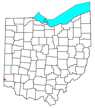
Preble County is a county located in the U.S. state of Ohio. As of the 2020 census, the population was 40,999, down 3.0% from the 2010 census population of 42,270. Its county seat is Eaton. The county was formed on February 15, 1808, from portions of Butler and Montgomery Counties. It is named for Edward Preble, a naval officer who fought in the American Revolutionary War and against the Barbary Pirates.
The Mill Creek is a stream in southwest Ohio. It flows 28.4 miles (45.7 km) southwest and south from its headwaters in Liberty Township of Butler County through central Hamilton County and the heart of Cincinnati into the Ohio River just west of downtown. The section of Interstate 75 through Cincinnati is known as the Mill Creek Expressway.

The Little Miami River is a Class I tributary of the Ohio River that flows 111 miles (179 km) through five counties in southwestern Ohio in the United States. The Little Miami joins the Ohio River east of Cincinnati. It forms parts of the borders between Hamilton and Clermont counties and between Hamilton and Warren counties. The Little Miami River is one of 156 American rivers designated by the U.S. Congress or the Secretary of the Interior as a National Wild and Scenic River and lends its name to the adjacent Little Miami Scenic Trail.

Fairfield Township is one of thirteen townships in Butler County, Ohio, United States. It is located in the south central portion of the county. The population was 22,645 at the 2020 census. Before annexations by the cities of Hamilton and Fairfield, it had an area of about 50 square miles (130 km2).

The Warren County Canal was a branch of the Miami and Erie Canal in southwestern Ohio about 20 miles (32 km) in length that connected the Warren County seat of Lebanon to the main canal at Middletown in the mid-19th century. Lebanon was at the crossroads of two major roads, the highway from Cincinnati to Columbus and the road from Chillicothe to the College Township (Oxford), but Lebanon businessmen and civic leaders wanted better transportation facilities and successfully lobbied for their own canal, part of the canal fever of the first third of the 19th century. The Warren County Canal was never successful, operating less than a decade before the state abandoned it.

Shandon is an unincorporated community in southwestern Morgan Township, Butler County, Ohio, United States. It is located on Paddy's Run, a tributary of the Great Miami River, about four miles west of Ross at the intersection of State Routes 126 and 748 in section 25 of R1ET3N of the Congress Lands. It was originally called Glendower as the town was settled by immigrants from Wales. It was later called New London and this survives in the names of Alert-New London and Hamilton-New London Roads. The town is in the Ross Local School District.
Okeana, originally known as Tariff, is an unincorporated community in central Morgan Township, Butler County, Ohio, United States. It is located on Dry Fork Creek, a tributary of the Great Miami River, on State Route 126 about three miles northwest of Shandon in sections 21 and 26 of R1ET3N of the Congress Lands. It is a mile north of Alert, a mile east of Macedonia, and ten miles southwest of Hamilton. The bulk of addresses served by the Okeana post office are in the Ross Local School District, but parts of the region are in the Southwest Local School District.

Port Union is an unincorporated community in western West Chester Township, Butler County, Ohio, United States, on State Route 747 about three miles north of Springdale and three miles southeast of Hamilton. The town was laid out in 1827 by William Elliott alongside the turning basin for the Miami and Erie Canal and was about midway between Crescentville and Hamilton on the canal. It was originally known as McMaken's Bridge, but took the name its township.. The Cincinnati, Hamilton, and Dayton Railroad later laid tracks through Port Union.

The Lebanon Countryside Trail is a rail trail in Ohio.

Harveys Creek is a tributary of the Susquehanna River in Luzerne County, Pennsylvania, in the United States. It is approximately 14.5 miles (23.3 km) long and flows through Harveys Lake, Lake Township, Lehman Township, Jackson Township, and Plymouth Township. The creek's watershed has an area of 46.3 square miles (120 km2). The creek has four named tributaries, which are known as Bear Hollow Creek, Paint Spring Run, Pikes Creek, and East Fork Harveys Creek. The watershed is designated as a High-Quality Coldwater Fishery and a Migratory Fishery above Pikes Creek and as a Coldwater Fishery and a Migratory Fishery below it. The creek's source is Harveys Lake, the largest natural lake in Pennsylvania.

Black Creek is a long source tributary of Nescopeck Creek so part of the Susquehanna River drainage basin. It is also the second & longer stream of the same name recognized by the USGS GNIS system in Luzerne County, Pennsylvania, in the United States—compared to the Black Creek beyond the ridgeline of the drainage divide, so in the Lehigh River valley and Carbon County. The headwaters of both Black Creeks in Luzerne county are only a few miles apart, and both valleys were traversed by the Lausanne-Nescopeck Turnpike in the first half of the 19th-century.
Talawanda High School (THS) is a public high school in Oxford, Ohio, United States. It is the only high school in the Talawanda School District and serves students in grades 9–12. It was created in 1956 with the consolidation of three Butler County high schools: Somerville and Collinsville High Schools in Milford Township, Hanover HS in Hanover Township, and Stewart and McGuffey High Schools in Oxford Township. The first graduating class was in 1957. Athletic teams are known as the Brave, and the school colors are red, white, and navy blue.

Ithan Creek is a tributary of Darby Creek in Delaware County, Pennsylvania, in the United States. It is approximately 4.2 miles (6.8 km) long and flows through Radnor Township and Haverford Township. The creek's watershed has an area of 7.39 square miles (19.1 km2) and is highly developed. It has three named tributaries: Browns Run, Kirks Run, and Meadowbrook Run.

State Route 732 is a state highway in the U.S. state of Ohio. This two-lane state route begins at SR 129 in Butler County, and extends northward to end at the junction of U.S. Route 127 (US 127) and US 35/SR 122 in Eaton in Preble County, Ohio, traveling 30.94 miles (49.79 km).

U.S. Route 27 (US 27) in Ohio runs for 40.58 miles (65.31 km) between the Kentucky and Indiana state lines: 18.5 miles (29.8 km) in Hamilton County and another 22.1 miles (35.6 km) in Butler County. The route crosses into Ohio and Downtown Cincinnati via the Taylor–Southgate Bridge over the Ohio River. US 27 follows Mehring Way, Central Avenue, Ezzard Charles Drive, and Central Parkway through Downtown Cincinnati. US 27 briefly runs concurrent with Interstate 75 (I-75), exiting at I-74 for another brief concurrency before exiting onto Colerain Road. US 27 then continues northwest eventually to Oxford and then reaches the Indiana border another six miles (9.7 km) northwest at College Corner.

Hammersley Fork is a tributary of Kettle Creek in Potter County and Clinton County, Pennsylvania, in the United States. It is approximately 10.0 miles (16.1 km) long and flows through Warton Township in Potter County and Leidy Township in Clinton County. The watershed of the stream has an area of 32.7 square miles (85 km2). The main rock formation in the watershed is the Pottsville Formation. A number of bridges cross the stream.

Wolfhouse Run is a tributary of Little Fishing Creek in Columbia County, Pennsylvania, in the United States. It is approximately 2.9 miles (4.7 km) long and flows through Pine Township. The watershed of the stream has an area of 2.03 square miles (5.3 km2). The steam is considered to be an Exceptional Value stream and a Coldwater Fishery. However, it is considered to be impaired as well. At least two bridges and one sawmill have been built over or on the stream.
Long Run is a tributary of Nescopeck Creek in Luzerne County, Pennsylvania, in the United States. It is approximately 3.0 miles (4.8 km) long and flows through Butler Township. The watershed of the stream has an area of 4.62 square miles (12.0 km2). Land uses in the watershed include forested land, agricultural land, and barren land. The waters of the stream are slightly acidic, but this is not caused by acid mine drainage. It is considered to be Class A Wild Trout Waters, a Coldwater Fishery, and a Migratory Fishery. The stream has two unnamed tributaries and at least one bridge crosses it.

Roaring Brook is a tributary of the Lackawanna River in Lackawanna County, Pennsylvania, in the United States. It is approximately 21 miles (34 km) long and flows through Covington Township, Madison Township, Moscow, Roaring Brook Township, Elmhurst Township, Dunmore, and Scranton. The watershed of the stream has an area of 56.3 square miles (146 km2). Its named tributaries include Little Roaring Brook, Rock Bottom Creek, White Oak Run, Van Brunt Creek, Bear Brook, and East Branch Roaring Brook. It has a high level of water quality for much of its length. However, it is affected by abandoned mining land, stormwater, and other impacts in its lower reaches. Reservoirs in the watershed include the Hollister Reservoir, the Elmhurst Reservoir, and others. The stream also flows through the Nay Aug Gorge and passes over the Nay Aug Falls, which are on the National Register of Geologic Landmarks. It flows through a concrete channel in its lower reaches. The topography of the watershed contains rolling hills in its upper reaches and the mountainous land of the Moosic Mountains in its lower reaches.
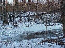
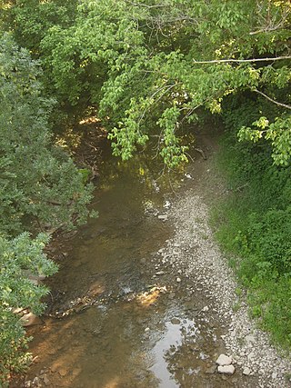
Sevenmile Creek is a stream in Preble County and Butler County, Ohio, in the United States. Sevenmile Creek is a tributary of Great Miami River. Beasley Run and Four Mile Creek (Ohio) is a tributary of the creek.