
Beaver is a city in, and county seat of, Beaver County in southwestern Utah, United States. The population was 3,592 at the 2020 census, up from the 2010 figure of 3,112.

The Feather River is the principal tributary of the Sacramento River, in the Sacramento Valley of Northern California. The river's main stem is about 73 miles (117 km) long. Its length to its most distant headwater tributary is just over 210 miles (340 km). The main stem Feather River begins in Lake Oroville, where its four long tributary forks join—the South Fork, Middle Fork, North Fork, and West Branch Feather Rivers. These and other tributaries drain part of the northern Sierra Nevada, and the extreme southern Cascades, as well as a small portion of the Sacramento Valley. The total drainage basin is about 6,200 square miles (16,000 km2), with approximately 3,604 square miles (9,330 km2) above Lake Oroville.

The Liard River of the North American boreal forest flows through Yukon, British Columbia and the Northwest Territories, Canada. Rising in the Saint Cyr Range of the Pelly Mountains in southeastern Yukon, it flows 1,115 km (693 mi) southeast through British Columbia, marking the northern end of the Rocky Mountains and then curving northeast back into Yukon and Northwest Territories, draining into the Mackenzie River at Fort Simpson, Northwest Territories. The river drains approximately 277,100 km2 (107,000 sq mi) of boreal forest and muskeg.
Lamoille Canyon is the largest valley in the Ruby Mountains, located in the central portion of Elko County in the northeastern section of the state of Nevada, in the western United States. Approximately 12 miles (19 km) in length, it was extensively sculpted by glaciers in previous ice ages.

Middle Park is a high basin in the Rocky Mountains of north-central Colorado in the United States. It is located in Grand County, on the southwest slope of Rocky Mountain National Park, approximately 50 miles (80 km) west of Boulder.

The Snake Range is a mountain range in White Pine County, Nevada, United States. The south-central portion of the range is included within Great Basin National Park, with most of the remainder included within the Humboldt-Toiyabe National Forest. The range reaches a maximum elevation of 13,065 feet (3,982 m) at the summit of Wheeler Peak, the tallest independent mountain within Nevada and the second highest point within the state. The range also contains four of the five highest mountain peaks in Nevada, including all peaks greater than 12,000 feet (3,658 m) except for Boundary Peak.

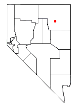
Harker Canyon is a canyon in southeastern Tooele County, Utah, United States, about 10 km (6.2 mi) south of the town of Vernon.
Harker Creek is a stream located in Iowa County, Wisconsin. The upper end of the creek is approximately 10 km (6.2 mi) west-northwest of the county seat, Dodgeville. The creek flows roughly north-south, and is approximately 7.5 km (4.7 mi) in total length. It drains into Flint Creek at its northern end at 248 m (814 ft) above sea level. The lower portion of the creek is paralleled by Mount Hope Road and Berg Road. Lee Creek drains into Harker Creek at 255 m (838 ft) elevation. The upper portion of Harker Creek is surrounded by steep hills that extend as high as 30 m (100 ft) above the creek. At its highest point, the creek is at approximately 390 m (1280 ft) elevation. The southernmost reentrants of the creek are within 400 m (1300 ft) of U.S. Route 18.
Harker Run is a stream located in Wetzel County, West Virginia, United States. The mouth of Harker Run is approximately 300 m (1000 ft) south-southwest of the small village of Earnshaw. The creek flows roughly from southwest to northeast, and is approximately 2.8 km (1.7 mi) in total length. It drains into Long Drain at its northeastern end at 330 m (1080 ft) above sea level. At its highest point, the creek is at approximately 430 m (1400 ft) elevation. The entire length of the stream is paralleled by Harker Run Road.
Harkers Canyon is located 20 km (12 mi) west-southwest of downtown Salt Lake City, in Salt Lake County, Utah, US. The canyon empties into the Salt Lake Valley from its origin in the Oquirrh Mountains. The canyon is oriented primarily from southwest to northeast, with the middle third of the canyon descending from west to east. Harkers Canyon and surrounding land are owned and managed by the Kennecott Utah Copper Corporation and has been mined for copper.
Harkers Canyon is located 8.5 km (5.3 mi) southeast of the town of Tooele, in Tooele County, Utah, USA. Located high in the Oquirrh Mountains, the canyon is oriented north-south, and drains into Middle Canyon at its northern end. Harkers Canyon is about 2.2 km (1.4 mi) long. The top of the canyon at its southern end is at approximately 2900 m (9500 ft) elevation. The mouth of Harkers Canyon is at 1975 m (6480 ft) elevation. Harkers Canyon is in the Rush Valley watershed.

The Tushar Mountains are the third-highest mountain range in Utah after the Uinta Mountains and the La Sal Range. Located in the Fishlake National Forest, Delano Peak, 12,174 ft NAVD 88, is the highest point in both Beaver and Piute counties and has a prominence of 4,689 ft. Delano Peak is named for Columbus Delano (1809–1896), Secretary of the Interior, during the Grant administration. The Tushars receive an ample amount of snow annually even though they are situated within the rainshadow of the Sierra Nevada range in California and the Snake Range located in Nevada.
The Wasatch Plateau is a plateau located southeast of the southernmost part of the Wasatch Range in central Utah. It is a part of the Colorado Plateau.

San Mateo Creek is a stream in Southern California in the United States, whose watershed mostly straddles the border of Orange and San Diego Counties. It is about 22 miles (35 km) long, flowing in a generally southwesterly direction. Draining a broad valley bounded by the Santa Ana Mountains and Santa Margarita Mountains, San Mateo Creek is notable for being one of the last unchannelized streams in Southern California.

The Sevier Desert is a large arid section of central-west Utah, United States, and is located in the southeast of the Great Basin. It is bordered by deserts north, west, and south; its east border is along the mountain range and valley sequences at the perimeter of the Great Basin, with the large north–south Wasatch Range and its associated mountainous landforms. Its eastern border is specifically, the East Tintic, Gilson, and Canyon Mountains; also the massive Pahvant Range.
The Bull Valley Mountains are a 30-mi (48 km) long, mountain range in southwest Utah, located in northwest Washington County. The range is adjacent the Utah border and attached to the Clover Mountains of southeast Nevada. The Great Basin Divide transects the summits of both ranges, with the Escalante Desert north and northeast of the Bull Valley Mountains, and south of the mountains the Colorado River watershed, and specifically the Santa Clara River which drains southeasterly from an escarpment along the mountain range's southeast flank.

The Colorado River is a major river of the western United States and northwest Mexico in North America. Its headwaters are in the Rocky Mountains where La Poudre Pass Lake is its source. Located in north central Colorado it flows southwest through the Colorado Plateau country of western Colorado, southeastern Utah and northwestern Arizona where it flows through the Grand Canyon. It turns south near Las Vegas, Nevada, forming the Arizona–Nevada border in Lake Mead and the Arizona–California border a few miles below Davis Dam between Laughlin, Nevada and Needles, California before entering Mexico in the Colorado Desert. Most of its waters are diverted into the Imperial Valley of Southern California. In Mexico its course forms the boundary between Sonora and Baja California before entering the Gulf of California. This article describes most of the major features along the river.
Currant Creek is a stream in eastern Juab County and southern Utah County in northern Utah, United States.
Coal Creek is a stream in eastern Iron County, Utah, United States.
