Hasler Hundred

Last updated

Coordinates: 50°37′03″N2°07′04″W / 50.6176°N 2.1178°W / 50.6176; -2.1178 Hasler Hundred or Hasilor Hundred was a hundred in the county of Dorset, England, containing the following parishes:

Geographic coordinate system Coordinate system

A geographic coordinate system is a coordinate system that enables every location on Earth to be specified by a set of numbers, letters or symbols. The coordinates are often chosen such that one of the numbers represents a vertical position and two or three of the numbers represent a horizontal position; alternatively, a geographic position may be expressed in a combined three-dimensional Cartesian vector. A common choice of coordinates is latitude, longitude and elevation. To specify a location on a plane requires a map projection.

County Geographical and administrative region in some countries

A county is a geographical region of a country used for administrative or other purposes, in certain modern nations. The term is derived from the Old French conté or cunté denoting a jurisdiction under the sovereignty of a count (earl) or a viscount. The modern French is comté, and its equivalents in other languages are contea, contado, comtat, condado, Grafschaft, graafschap, Gau, etc..

Dorset County of England

Dorset is a county in South West England on the English Channel coast. The ceremonial county comprises the unitary authority areas of Bournemouth, Christchurch and Poole and Dorset. Covering an area of 2,653 square kilometres (1,024 sq mi), Dorset borders Devon to the west, Somerset to the north-west, Wiltshire to the north-east, and Hampshire to the east. The county town is Dorchester which is in the south. After the reorganisation of local government in 1974 the county's border was extended eastward to incorporate the Hampshire towns of Bournemouth and Christchurch. Around half of the population lives in the South East Dorset conurbation, while the rest of the county is largely rural with a low population density.

Arne, Dorset a village located in Purbeck, United Kingdom

Arne is a village and civil parish in the Purbeck district of Dorset, England; situated 4 miles (6.4 km) east of Wareham. The local travel links are located at Wareham railway station. Bournemouth International Airport is 11 miles (18 km) away. The main road through the village is Arne Road connecting Arne to Wareham. The village is situated on the Arne Peninsula, which protrudes into Poole Harbour opposite the town of Poole.

Church Knowle a village located in Purbeck, United Kingdom

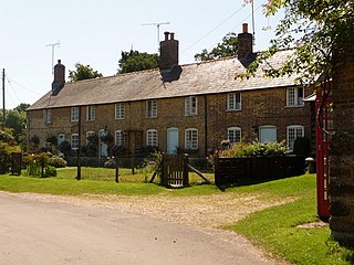
Church Knowle is a village and civil parish on the Isle of Purbeck in the county of Dorset in the south of England.

East Holme village in the United Kingdom

East Holme is a small village and civil parish situated about halfway between Wool and Wareham in Dorset, England. The village is sprawled around a large house called Holme Priory. In 2013 the estimated population of the civil parish was 50.

See also

Sources

The Reverend John Hutchins (1698–1773) was Church of England clergyman, and English topographer, who is best known as a county historian of Dorset.

Related Research Articles

Badbury Hundred was a hundred in the county of Dorset, England, which took its name from the earthwork of Badbury Rings. It contained the following parishes:

Bere Regis Hundred was a hundred in the county of Dorset, England, containing the following parishes:

Brownshall Hundred was a hundred in the county of Dorset, England, containing the following parishes:

Buckland Newton Hundred was a hundred in the county of Dorset, England, containing the following parishes:

Coombs Ditch Hundred was a hundred in the county of Dorset, England, containing the following parishes:

Eggerton Hundred or Eggardon Hundred was a hundred in the county of Dorset, England, containing the following parishes:

Hundredsbarrow Hundred was a hundred in the county of Dorset, England, containing the following parishes:

Knowlton Hundred was a hundred in the county of Dorset, England, containing the following parishes:

Pimperne Hundred was a hundred in the county of Dorset, England, containing the following parishes:

Puddletown Hundred was a hundred in the county of Dorset, England, containing the following parishes:

Redlane Hundred or Redland Hundred was a hundred in the county of Dorset, England, containing the following parishes:

Rushmore Hundred was a hundred in the county of Dorset, England, containing the parish of Winterborne Zelston

St George's Hundred, later often George Hundred, was a hundred in the county of Dorset, England, containing the following parishes:

Sturminster Newton Hundred or Sturminster Newton Castle Hundred was a hundred in the county of Dorset, England, containing the following parishes:

Tollerford Hundred was a hundred in the county of Dorset, England, containing the following parishes:

Uggescombe Hundred was a hundred in the county of Dorset, England, containing the following parishes:

Whiteway Hundred was a hundred in the English county of Dorset, containing the following parishes:

Winfrith Hundred was a hundred in the county of Dorset, England, containing the following parishes:

Yetminster Hundred was a hundred in the county of Dorset, England, containing the following parishes:

Corfe Castle Hundred was a hundred in the county of Dorset, England, containing only the parish of Corfe Castle.