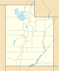
State Route 12 or Scenic Byway 12 (SR-12), also known as "Highway 12 — A Journey Through Time Scenic Byway", is a state highway designated an All-American Road located in Garfield County and Wayne County, Utah, United States.

Boulder Mountain in Utah, USA makes up half of the Aquarius Plateau of South Central Utah in Wayne and Garfield counties. The mountain rises to the west of Capitol Reef National Park and consists of steep slopes and cliffs with over 50,000 acres (200 km²) of rolling forest and meadowlands on the top. The mountain has a nearly flat summit of roughly 70 square miles. The mountain is the highest timbered plateau in North America and is part of the Dixie National Forest.

The Buckskin Gulch, a canyon in southern Utah, is one of the main tributaries of the Paria River, which is itself a minor tributary of the Colorado River. It is the longest and deepest slot canyon in the southwest United States and may be the longest in the world. As such it is one of the premier destinations for slot canyon hikers, and receives a high amount of foot traffic.

Padre Bay is a bay within Lake Powell, on the Colorado River in Kane County and San Juan County, Utah. Its waters reach an elevation of 3704 feet / 1129 meters. Located 13.5 miles northeast of Glen Canyon Dam in Lake Powell, Padre Bay is the largest expanse of open water on the man made lake. Padre Bay is bounded by Alstrom Point and the island of Gunsight Butte on the west and Gooseneck Point on the east. Cookie Jar Butte lies between them on the north shore of the bay. At the southern mouth of the bay, north of Dominguez Butte on the south shore is Padres Butte, formerly an island, now with lower water in the lake the tip of Padre Point. Padres Butte marks the location of the Crossing of the Fathers, which is approximately a mile west of the butte. It currently lies under nearly four hundred feet of water.
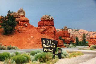
Dixie National Forest is a United States National Forest in Utah with headquarters in Cedar City. It occupies almost two million acres (8,000 km²) and stretches for about 170 miles (270 km) across southern Utah. The largest national forest in Utah, it straddles the divide between the Great Basin and the Colorado River. In descending order of forestland area it is located in parts of Garfield, Washington, Iron, Kane, Wayne, and Piute counties. The majority of forest acreage lies in Garfield County.

Death Hollow is a slot canyon in the Grand Staircase-Escalante National Monument in central Garfield County, Utah, United States.

Horse Canyon is a small canyon near the towns of Boulder and Escalante in the Grand Staircase-Escalante National Monument in central Garfield County, Utah, United States
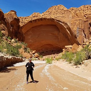
Wolverine Canyon, UT is a canyon near the town of Boulder, Utah. It is small, only 3 miles in length until it meets with Horse Canyon and Little Death Hollow, and then leads down to the Escalante River.
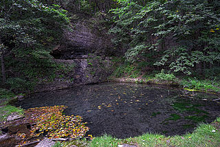
Backbone State Park is Iowa's oldest state park, dedicated in 1919. Located in the valley of the Maquoketa River, it is approximately three miles (5 km) south of Strawberry Point in Delaware County. It is named for a narrow and steep ridge of bedrock carved by a loop of the Maquoketa River originally known as the Devil's Backbone. The initial 1,200 acres (490 ha) were donated by E.M. Carr of Lamont, Iowa. Backbone Lake Dam, a relatively low dam built by the Civilian Conservation Corps (CCC) in the 1930s, created Backbone Lake. The CCC constructed a majority of trails and buildings which make up the park.
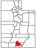
The Kaiparowits Plateau is a large, elevated landform located in southern Utah, in the southwestern United States. Along with the Grand Staircase and the Canyons of the Escalante, it makes up a significant portion of the Grand Staircase-Escalante National Monument. Its extension to the southeast, Fiftymile Mountain, runs nearly to the Colorado River and Lake Powell, and is a prominent part of the northern skyline from the Glen Canyon National Recreation Area.

The Canyons of the Escalante is a collective name for the erosional landforms created by the Escalante River and its tributaries—the Escalante River Basin. Located in southern Utah in the western United States, these sandstone features include high vertical canyon walls, numerous slot canyons, waterpockets, domes, hoodoos, natural arches and bridges. This area—extending over 1,500 square miles (3,885 km2) and rising in elevation from 3,600 ft (1,097 m) to over 11,000 ft (3,353 m)—is one of the three main sections of the Grand Staircase-Escalante National Monument, and also a part of the Glen Canyon National Recreation Area, with Capitol Reef National Park being adjacent to the east.
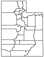
Coyote Gulch is a tributary of the Escalante River, located in Garfield and Kane Counties in southern Utah, in the western United States. Over 25 mi (40 km) long, Coyote Gulch exhibits many of the geologic features found in the Canyons of the Escalante, including high vertical canyon walls, narrow slot canyons, domes, arches, and natural bridges. The upper sections of Coyote Gulch are located within the Grand Staircase-Escalante National Monument while its lower sections are located in the Glen Canyon National Recreation Area.

The historical buildings and structures of Zion National Park represent a variety of buildings, interpretive structures, signs and infrastructure associated with the National Park Service's operations in Zion National Park, Utah. Structures vary in size and scale from the Zion Lodge to road culverts and curbs, nearly all of which were designed using native materials and regional construction techniques in an adapted version of the National Park Service Rustic style. A number of the larger structures were designed by Gilbert Stanley Underwood, while many of the smaller structures were designed or coordinated with the National Park Service Branch of Plans and Designs. The bulk of the historic structures date to the 1920s and 1930s. Most of the structures of the 1930s were built using Civilian Conservation Corps labor.

Cordova Pass lies on the western shoulder of the West Spanish Peak, east of the Culebra Range of the Sangre de Cristo Mountains in southern Colorado, USA. Cordova Pass lies just outside the Spanish Peaks Wilderness, a designated National Wilderness Area in the San Isabel National Forest. Cordova Pass is reached via the Apishapa Road, a leg of the Scenic Highway of Legends. As the National Forest Service does not usually plow the snow, Cordova Pass is normally not accessible from mid-November to late May. Most of the time, the pass may be traversed by passenger vehicles.

The Devils Garden of the Grand Staircase-Escalante National Monument (GSENM) in south central Utah, United States, is a protected area featuring hoodoos, natural arches and other sandstone formations. The United States Geological Survey (USGS) designated the name Devils Garden—without an apostrophe according to USGS naming conventions—on December 31, 1979. The area is also known as the Devils Garden Outstanding Natural Area within the National Landscape Conservation System.

Hell's Backbone Grill is a restaurant located in Boulder, Utah near the Grand Staircase-Escalante National Monument. The restaurant serves its own variation of Pueblo Indian and Southwestern cuisine.

The St. Alban's Bay Culvert is a historic bridge in Garrison Township, Minnesota, United States. It carries the four-lane U.S. Route 169 (US 169) over the head of a stream flowing out of Mille Lacs Lake. It was built from 1938 to 1939 as part of a major New Deal project to create a scenic parkway along the lakeshore. The bridge was listed on the National Register of Historic Places in 2015 as the St. Alban's Bay Culvert at Mille Lacs Lake for having state-level significance in the themes of architecture and politics/government. It was nominated for being a well-preserved example of the Minnesota Highway Department's earliest scenic improvements, its rare status as a highway bridge built by the department's Roadside Development Division—a unit usually focused on overlooks and waysides—and for its fine National Park Service rustic design.

