Related Research Articles

The Continental Divide of the Americas is the principal, and largely mountainous, hydrological divide of the Americas. The Continental Divide extends from the Bering Strait to the Strait of Magellan, and separates the watersheds that drain into the Pacific Ocean from those river systems that drain into the Atlantic and Arctic oceans.

Jasper National Park is a national park in Alberta, Canada. It is the largest national park within Alberta's Rocky Mountains spanning 11,000 km2 (4,200 sq mi). It was established as a national park in 1930 and declared a UNESCO World Heritage Site in 1984. Its location is north of Banff National Park and west of Edmonton. The park contains the glaciers of the Columbia Icefield, springs, lakes, waterfalls and mountains.

The Athabasca River is a river in Alberta, Canada, which originates at the Columbia Icefield in Jasper National Park and flows more than 1,231 km (765 mi) before emptying into Lake Athabasca. Much of the land along its banks is protected in national and provincial parks, and the river is designated a Canadian Heritage River for its historical and cultural importance. The scenic Athabasca Falls is located about 30 km (19 mi) upstream from Jasper.
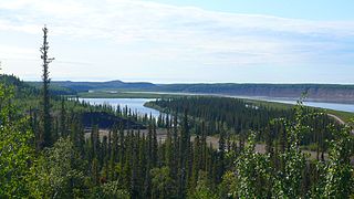
The Mackenzie River is a river in the Canadian boreal forest. It forms, along with the Slave, Peace, and Finlay, the longest river system in Canada, and includes the second largest drainage basin of any North American river after the Mississippi.

Lake Athabasca is in the north-west corner of Saskatchewan and the north-east corner of Alberta between 58° and 60° N in Canada. The lake is 26% in Alberta and 74% in Saskatchewan.
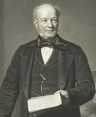
Sir George Simpson was a Scottish explorer and colonial governor of the Hudson's Bay Company during the period of its greatest power. From 1820 to 1860, he was in practice, if not in law, the British viceroy for the whole of Rupert's Land, an enormous territory of 3.9 millions square kilometers corresponding to nearly forty percent of modern-day Canada.

Barrhead is a town in central Alberta, Canada that is surrounded by the County of Barrhead No. 11. It is located along the Paddle River and at the intersection of Highway 33 and Highway 18, approximately 120 km (75 mi) northwest of the City of Edmonton. It is also located along the route of the Express Trail, used by the North West Company, which was originally a First Nations trail. The trail was later widened by George Simpson and John Rowand to save the North West Company over $5,000.

The Slave River is a Canadian river that flows from the confluence of the Rivière des Rochers and Peace River in northeastern Alberta and empties into Great Slave Lake in the Northwest Territories. The river's name is thought to derive from the name for the Slavey group of the Dene First Nations, Deh Gah Got'ine, in the Athabaskan language. The Chipewyan had displaced other native people from this region.
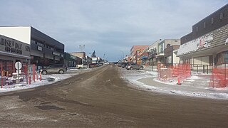
Rocky Mountain House is a town in west-central Alberta, Canada. It is approximately 77 km (48 mi) west of Red Deer at the confluence of the Clearwater and North Saskatchewan Rivers, and at the crossroads of Highway 22 and Highway 11. The surrounding Clearwater County's administration office is located in Rocky Mountain House.

Athabasca Pass is a high mountain pass in the Canadian Rockies on the border between Alberta and British Columbia. In fur trade days it connected Jasper House on the Athabasca River with Boat Encampment on the Columbia River.

The Columbia District was a fur trading district in the Pacific Northwest region of British North America in the 19th century. Much of its territory overlapped with the disputed Oregon Country. It was explored by the North West Company between 1793 and 1811, and established as an operating fur district around 1810. The North West Company was absorbed into the Hudson's Bay Company in 1821 under which the Columbia District became known as the Columbia Department. The Oregon Treaty of 1846 marked the effective end of the Hudson's Bay Company's Columbia Department.
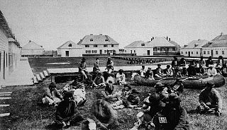
Norway House is a population centre of over 5,000 people, some 30 km (19 mi) north of Lake Winnipeg, on the bank of the eastern channel of Nelson River, in the province of Manitoba, Canada. The population centre shares the name Norway House with the northern community of Norway House and Norway House 17, a First Nation reserve of the Norway House Cree Nation. Thus, Norway House has both a Chief and a Mayor.

The Northern Woods and Water Route is a 2,400-kilometre (1,500 mi) route through northern British Columbia, Alberta, Saskatchewan and Manitoba in Western Canada. As early as the 1950s, community groups came together to establish a northern travel route; this was proposed as the Northern Yellowhead Transportation Route. The Northern Woods and Water Route Association was established in 1974, and encouraged promotion of the route with the promise of an increase in tourist travel. The route was designated in 1974 and is well signed throughout its component highways. The route starts at Dawson Creek as the Spirit River Highway and ends at the Perimeter of Winnipeg, Manitoba, after running through the northern regions of the western provinces. From west to east, the Northern Woods and Water Route (NWWR) incorporates portions of British Columbia Highway 49; Alberta Highways 49, 2A, 2, & 55; Saskatchewan Highways 55 & 9; Manitoba Provincial Road 283 and Trunk Highways 10, 5, 68 & 6. The halfway point of the NWWR is approximately at Goodsoil, Saskatchewan.

The York Factory Express, usually called "the Express" and also the Columbia Express and the Communication, was a 19th-century fur brigade operated by the Hudson's Bay Company (HBC). Roughly 4,200 kilometres (2,600 mi) in length, it was the main overland connection between HBC headquarters at York Factory and the principal depot of the Columbia Department, Fort Vancouver.
Boat Encampment is a ghost town in the East Kootenay region of southeastern British Columbia. The locality was at the tip of the Big Bend on the north shore of the Columbia River. The general vicinity, on the former Big Bend Highway, was by road about 151 kilometres (94 mi) northwest of Golden and 159 kilometres (99 mi) north of Revelstoke.

Frog Portage or Portage du Traite was one of the most important portages on the voyageur route from eastern Canada to the Mackenzie River basin. It allowed boatmen to move from the Saskatchewan River basin to the Churchill River basin. The Churchill then led west to the Mackenzie River basin. The fur trade route ran from Cumberland House, Saskatchewan north up the Sturgeon-Weir River. At its source the 300-yard Frog Portage ran, with a 20-foot drop, to Trade Lake on the Churchill a few miles west of the mouth of Reindeer River. The route then ran at least 250 miles northwest up the Churchill to Methye Portage which led to the Mackenzie basin. For background, see Canadian canoe routes (early).

This article covers the water based Canadian canoe routes used by early explorers of Canada with special emphasis on the fur trade.

Saskatchewan River fur trade The Saskatchewan River was one of the two main axes of Canadian expansion west of Lake Winnipeg. The other and more important one was northwest to the Athabasca Country. For background see Canadian canoe routes (early). The main trade route followed the North Saskatchewan River and Saskatchewan River, which were just south of the forested beaver country. The South Saskatchewan River was a prairie river with few furs.
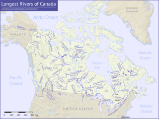
In fur trade days the term Athabasca Country was used for the fur-producing region around Lake Athabasca. The area was important for two reasons. The cold climate produced some of the densest and thickest beaver fur in North America. The number of furs produced was somewhat greater than its only rival, the Saskatchewan River fur trade. Secondly, the great distance from Montreal and Hudson Bay required the highly developed and efficient transportation system that characterized the Hudson's Bay Company in the nineteenth century.
Fur trading on the Assiniboine River and the general area west of Lake Winnipeg began as early as 1731.