North Korea is located in east Asia on the northern half of the Korean Peninsula.

South Korea is located in East Asia, on the southern half of the Korean Peninsula jutting out from the far east of the Asian landmass. The only country with a land border to South Korea is North Korea, lying to the north with 238 kilometres (148 mi) of border running along the Korean Demilitarized Zone. South Korea is mostly surrounded by water and has 2,413 kilometres (1,499 mi) of coastline along three seas; to the west is the Yellow Sea, to the south is the East China Sea, and to the east is the Sea of Japan. Geographically, South Korea's land mass is approximately 100,032 square kilometres (38,623 sq mi). 290 square kilometres (110 sq mi) of South Korea are occupied by water. The approximate coordinates are 37° North, 127° 30 East.

The Yellow Sea is located between China and Korea. The name is given to the northern part of the East China Sea, which is a marginal sea of the Pacific Ocean. It is located between mainland China and the Korean Peninsula. Its name comes from the sand particles from Gobi Desert sand storms that turn the surface of the water golden yellow.

The Sea of Japan is the marginal sea between the Japanese archipelago, Sakhalin, the Korean Peninsula and Russia. The Japanese archipelago separates the sea from the Pacific Ocean. It is bordered by Japan, Korea and Russia. Like the Mediterranean Sea, it has almost no tides due to its nearly complete enclosure from the Pacific Ocean. This isolation also reflects in the fauna species and in the water salinity, which is lower than in the ocean. The sea has no large islands, bays or capes. Its water balance is mostly determined by the inflow and outflow through the straits connecting it to the neighboring seas and Pacific Ocean. Few rivers discharge into the sea and their total contribution to the water exchange is within 1%.

Jilin, is one of the three provinces of Northeast China. Jilin borders North Korea and Russia to the east, Heilongjiang to the north, Liaoning to the south, and Inner Mongolia to the west.

The Tumen River, also known as the Tuman or Duman River, is a 521-kilometre (324 mi) long river that serves as part of the boundary between China, North Korea and Russia, rising on the slopes of Mount Paektu and flowing into Sea of Japan. The river has a drainage basin of 33,800 km2.

The Korean Peninsula is located in East Asia. It extends southwards for about 1,100 km (680 mi) from continental Asia into the Pacific Ocean and is surrounded by the Sea of Japan to the east and the Yellow Sea to the west, the Korea Strait connecting the two bodies of water.

Gyeonggi-do is the most populous province in South Korea. Its name, Gyeonggi means "the area surrounding the capital". Thus Gyeonggi-do can be translated as "province surrounding Seoul". The provincial capital is Suwon. Seoul—South Korea's largest city and national capital—is in the heart of the province but has been separately administered as a provincial-level special city since 1946. Incheon—South Korea's third-largest city—is on the coast of the province and has been similarly administered as a provincial-level metropolitan city since 1981. The three jurisdictions are collectively referred to as Sudogwon and cover 11,730 km2 (4,530 sq mi), with a combined population of 25.5 million—amounting to over half of the entire population of South Korea.

Daegu, formerly spelled Taegu and officially known as the Daegu Metropolitan City, is a city in South Korea, the fourth-largest after Seoul, Busan, and Incheon, and the third-largest metropolitan area in the nation with over 2.5 million residents. Daegu and surrounding North Gyeongsang Province are often referred to as Daegu-Gyeongbuk, with a total population over 5 million. Daegu is located in south-eastern Korea about 80 km (50 mi) from the seacoast, near the Geumho River and its mainstream, Nakdong River in Gyeongsang-do. The Daegu basin, where the city lies, is the central plain of the Yeongnam region. In ancient times, there was a proto-country named Jinhan, to which the current Daegu area belonged. Later, Daegu was part of the Silla Kingdom which unified the Korean Peninsula. During the Joseon Dynasty period, the city was the capital of Gyeongsang-do, which was one of the traditional eight provinces of the country.

Korean shamanism, also known as Shinism or Shindo or Shinism or Muism, is the polytheistic and animistic ethnic religion of Korea which date back to prehistory and consist in the worship of gods and ancestors. When referring specifically to the shamanic practice, the term Muism is used.

Gunsan is a city in North Jeolla Province, South Korea. It is on the south bank of the Geum River just upstream from its exit into the Yellow Sea. It has emerged as a high-tech manufacturing industrial city and an international trade seaport that is approximately 200 km (120 mi) southwest of Seoul on the midwest coast of the Korean Peninsula.

Kaesong is a city in North Hwanghae Province in the southern part of North Korea, a former Directly Governed City and the capital of Korea during the Taebong kingdom and subsequent Goryeo dynasty. The city is near the Kaesong Industrial Region close to the border with South Korea and contains the remains of the Manwoldae palace. Called Songdo while it was the ancient capital of Goryeo, the city prospered as a trade centre that produced Korean ginseng. Kaesong now functions as the DPRK's light industry centre.

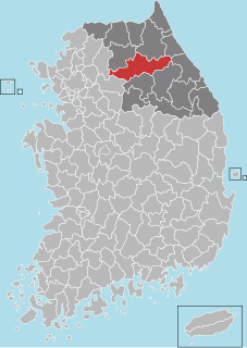
Hongcheon (Hongcheon-gun) is a county and city in Gangwon Province, South Korea. The city lies on the northern bank of the Hongcheon River, southeast of Chuncheon. The terrain of the county is mainly mountainous and contains hot springs in the Hongcheong River valley. The county produces ginseng, corn, and vegetables. As of 2012 the county had a population of 70,401 people in 29,894 households.

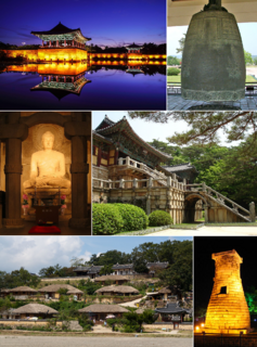
Gyeongju, historically known as Seorabeol, is a coastal city in the far southeastern corner of North Gyeongsang Province in South Korea. It is the second largest city by area in the province after Andong, covering 1,324 km2 (511 sq mi) with a population of 264,091 people Gyeongju is 370 km (230 mi) southeast of Seoul, and 55 km (34 mi) east of Daegu. The city borders Cheongdo and Yeongcheon to the west, Ulsan to the south and Pohang to the north, while to the east lies the coast of the Sea of Japan. Numerous low mountains—outliers of the Taebaek range—are scattered around the city.

Anyang is a city in Gyeonggi Province, South Korea. With a population of approximately 600,000 persons, it is the 20th largest city in South Korea. It is a satellite city of Seoul and located approximately 21 km (13 mi) south of Seoul, and 19 km (12 mi) north of Suwon. It is connected to Seoul via the Seoul Subway Line 1 and Line 4. The City motto of Anyang is "Livable city, Proud citizens". City symbols are 'Podong-i' a grape mascot, Forsythia (flower), Ginkgo (tree), and Eagle.

Paju is a city in Gyeonggi Province, South Korea. Paju was made a city in 1997; it had previously been a county (gun).

Miryang, often spelled Milyang, is a city in Gyeongsangnam-do Province, South Korea. Neighboring cities include Changnyeong to the west, Cheongdo to the north, Ulsan to the east, and Yangsan, Gimhae, and Changwon to the south. The city bird is the Korean magpie, the city tree is the pine, and the city flower is the royal azalea.
The Liaoning bronze dagger culture or Lute-shaped bronze dagger culture is an archeological complex of the late Bronze Age in Korea and China. Artifacts from the culture are found primarily in the Liaoning area of northeast China and in the Korean peninsula. Various other bronze artifacts, including ornaments and weapons, are associated with the culture, but the daggers are viewed as the most characteristic. Liaoning bronzes contain a higher percentage of zinc than those of the neighboring bronze cultures.

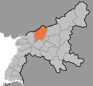
Kaech'ŏn is a city in South P'yŏngan province, North Korea.


