
Moturoa / Rabbit Island is a small island that lies across the southernmost part of Tasman Bay / Te Tai-o-Aorere, on the northern coast of New Zealand's South Island. The long narrow island runs east–west for 8 kilometres (5 mi), and covers 15 km2 (5.8 sq mi).

The Hikurangi Trough is a sea floor feature of the Pacific Ocean off the north-east South Island and the east coast of the North Island of New Zealand. It has been forming for about 25 million years and is turbidite-filled, particularly in its south. This characteristic can be used to distinguish it from the sediment-poor and deeper Kermadec Trench, which is its continuation to the north. Sediment currently passing through the trough represents about 0.5% of the total sediment input to the world oceans. The trough has deep-sea chemosynthetic ecosystems that are unique.

Mount Hikurangi is a 1,752 m (5,748 ft) peak in the eastern corner of New Zealand's North Island, about 80 kilometres (50 mi) north of Gisborne, and 50 kilometres (31 mi) southwest of the East Cape Lighthouse. On a spur of the Raukumara Range in the Waiapu Valley, it is the North Island's highest non-volcanic peak.

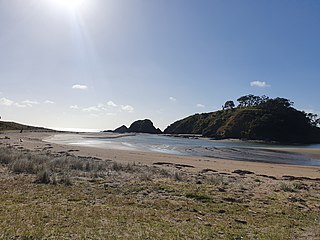
Although not as prominent as its eastern namesake, Northland's Mount Hikurangi is also of note. At 625 m (2,051 ft), this peak overlooks central Northland and is a prominent peak on the skyline at the Bay of Islands, the area of the first permanent European settlement in New Zealand.

The Waitōtara River in New Zealand's North Island stretches approximately 100 kilometres (62 mi) in length from its headwaters in the Matemateāonga Range to its mouth on the South Taranaki Bight. The river takes in significant tributaries such as the Ngutuwera, Makakaho, Pokeka, Omaru and Totara Streams.

Whangarei District is a territorial authority district in the Northland Region of New Zealand that is governed by the Whangarei District Council. The district is made up in area largely by rural land, and includes a fifth of the Northland Region. It extends southwards to the southern end of Bream Bay, northwards to Whangaruru and almost to the Bay of Islands, and westwards up the Mangakahia River valley past Pakotai and almost to Waipoua Forest. It includes the Hen and Chicken Islands and the Poor Knights Islands.
The Hikurangi Plateau is an oceanic plateau in the South Pacific Ocean east of the North Island of New Zealand. It is part of a large igneous province (LIP) together with Manihiki and Ontong Java, now located 3,000 km (1,900 mi) and 3,500 km (2,200 mi) north of Hikurangi respectively. Mount Hikurangi, in Māori mythology the first part of the North Island to emerge from the ocean, gave its name to the plateau.

Whangarei District Council is the territorial authority for the Whangarei District of New Zealand. The council consists of the mayor of Whangarei and 13 ward councillors, and is led by the mayor. Vince Cocurullo has been the mayor since 2022.
Mongonui and Bay of Islands was a parliamentary electorate in the Far North District in the Northland region of New Zealand, from 1871 to 1881. It was represented by three Members of Parliament.

Corang River is a perennial river of the Shoalhaven catchment located in the Southern Tablelands region of New South Wales, Australia.
The Horahora River is a short river of Northland, New Zealand. It is formed from the confluence of the Waitangi River and Taheke River, which meet close to the Pacific Ocean coast 12 kilometres (7.5 mi) northeast of Whangārei. It flows into the Pacific at Ngunguru Bay, three kilometres south of Ngunguru.
The Kaikou River is a river of the Northland Region of New Zealand's North Island. It flows initially north, then east, and finally south, from its source approximately halfway between Dargaville and Kaikohe, before joining with the Moengawahine Stream to become the Hikurangi River.
The Mangakahia River is a river of the Northland Region of New Zealand's North Island. It flows east from its sources in the Mataraua Forest, turning southeastward after about 20 kilometres (12 mi) on joining with the small Awarua River. It is joined by the Opouteke River near Pakotai, then turns east, until it is joined by the Hikurangi River. It then turns south again, passing Titoki and then joining with the Wairua River to form the Wairoa River approximately halfway between Whangārei and Dargaville.
The Māngere River is a river of the Northland Region of New Zealand's North Island. It flows generally westwards from its sources in hills northwest of Whangārei, meeting the Wairua River 10 kilometres (6 mi) northwest of Maungatapere.
The Tauraroa River is a river of the Northland Region of New Zealand's North Island. It flows west from near the North Auckland Peninsula's east coast 15 kilometres southwest of Whangārei, reaching the Manganui River 15 kilometres east of Dargaville.
The Waiotama River is a river of the Northland Region of New Zealand's North Island. It flows northwest from its origins south of Maungatapere to reach the Wairoa River 20 kilometres northeast of Dargaville.
The Wairua River is a river of Northland, New Zealand. It flows south-west from Hikurangi and joins the Mangakahia River between Titoki and Tangiteroria to form the Wairoa River, which runs past Dargaville to the Kaipara Harbour.
Matahiwi is a farming community 55 kilometres (34 mi) upriver from Whanganui, New Zealand, home to the Māori hapū known as Ngā Poutama of the iwi Te Āti Haunui-a-Pāpārangi. The township takes its name from the bush-clad puke (hill) on the western side of the Whanganui River, right above the local marae, whose name translates as "the face on the ridge".

The Waro Limestone Scenic Reserve is a conservation area near Waro near Hikurangi, 16 kilometres (9.9 mi) north of Whangārei on the North Island of New Zealand.

Whakapara is a village and rural community in the Whangarei District, six kilometres north of Hikurangi, twenty-two kilometres north of central Whangārei, and eight kilometres south-east of Hūkerenui, in the Northland Region of New Zealand's North Island. State Highway 1 and the North Auckland railway line run through Whakapara.
