A combe can refer either to a steep, narrow valley, or to a small valley or large hollow on the side of a hill; in any case, it is often understood simply to mean a small valley through which a watercourse does not run. The word "combe" derives from Old English cumb, of the same meaning, and is unrelated to the English word "comb". It derives ultimately from the same Brythonic source as the Welsh cwm, which has the same meaning. Today, the word is used mostly in reference to the combes of southern and southwestern England.

Teignbridge is a local government district in Devon, England. Its council is based in the town of Newton Abbot. The district also includes the towns of Ashburton, Buckfastleigh, Dawlish, Kingsteignton and Teignmouth, along with numerous villages and surrounding rural areas. Teignbridge contains part of the south Devon coastline, including the Dawlish Warren National Nature Reserve. Some of the inland western parts of the district lie within the Dartmoor National Park. It is named after the old Teignbridge hundred.
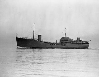
RFA Green Ranger was a Ranger-class fleet support tanker of the Royal Fleet Auxiliary.

Holcombe is a small village in the south of Devon, England, situated between the much larger coastal towns of Teignmouth and Dawlish. The village has very few facilities, although there are 2 pubs/restaurants, The Smuggler's Inn and The Castle Inn. Holcombe is a typical small English village, with thatched cottages and country lanes. Smugglers Lane at the bottom of the village allows safe access under the railway line to a hidden beach.

Longdown is a small village in the parish of Holcombe Burnell, south of the A30 road, about four miles west of Exeter in Devon, England. It has a public house called The Lamb Inn.
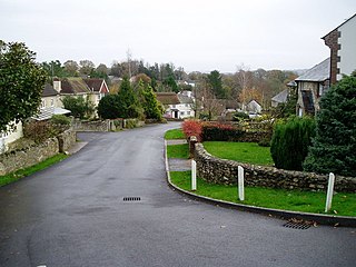
All Saints is a civil parish in East Devon, Devon, England. It has a population of 498 according to the 2001 census. The parish includes the hamlets of All Saints, Smallridge, Churchill, Alston and Waggs Plot. This area also has one cricket pitch, a primary school, pre-school and a church.
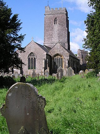
Holcombe Rogus is a village, civil parish and ecclesiastical parish in the English county of Devon. In 2001 the population of the parish was 503.

The de Havilland DH.104 Dove is a British short-haul airliner developed and manufactured by de Havilland. The design, which was a monoplane successor to the pre-war Dragon Rapide biplane, came about from the Brabazon Committee report which, amongst other aircraft types, called for a British-designed short-haul feeder for airlines.

Sampford Peverell is a village and civil parish in Mid-Devon, England. An old Saxon settlement, it was called Sanforda in the 1086 Domesday Book. Its current name reflects its inclusion in the Honour of Peverel, the lands of William Peverel and his family. His great-grandson, Hugh Peverell, is buried in the village church of St John the Baptist. The Grand Western Canal cuts through the village.
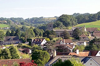
Uplyme is an English village and civil parish in East Devon on the Devon-Dorset border and the River Lym, adjacent to the Dorset coastal town of Lyme Regis. It has a population of approximately 1700 recounted as 1663 at the 2011 census. Uplyme is situated in the electoral ward of Trinity whose population at the above census was 2,521.

Canonsleigh Abbey was an Augustinian priory in the parish of Burlescombe, Devon.

There are eleven disused railway stations on the Exeter to Plymouth line between Exeter St Davids and Plymouth Millbay in Devon, England. At eight of these there are visible remains.

The East Devon Way is a long-distance footpath in England. It runs for 38 miles (61 km) between Exmouth in East Devon and Lyme Regis in Dorset.
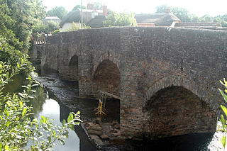
Culmstock is a village and civil parish in Mid Devon, England, centred 10 miles from Tiverton and 6 NE of Cullompton. It is laid out on both sides of the River Culm; the village is joined by a single old narrow stone bridge across the river. The population of the parish at the 2011 Census was 554. The northern boundary of the parish forms part of the Devon – Somerset border and clockwise from there it is surrounded by the Devon parishes of Hemyock, Uffculme, Burlescombe and Holcombe Rogus.

The River Sid, situated in East Devon, is often claimed to be the shortest complete river in England. It flows for 6.5 miles (10.5 km) southwards from a source in Crowpits Covert at a height of 206 metres above sea level. The source is at the head of a goyle or small ravine.

Bicton House, or Bickton House, is a late 18th- or early 19th-century country house, which stands on the campus of Bicton College, Bicton, near Exmouth, East Devon. It is a Grade II* listed building. The park and gardens are Grade I listed in the National Register of Historic Parks and Gardens.

Holcombe Burnell is a civil parish in the Teignbridge district, in Devon, England, the church of which is about 4 miles west of Exeter City centre. There is no village clustered around the church, rather the nearest village within the parish is Longdown. Only the manor house and two cottages are situated next to the church. The former manor house next to the church is today known as Holcombe Burnell Barton having subsequently been used as a farmhouse. The manor was in the historical Hundred of Wonford. In 2011 the parish had a population of 536.
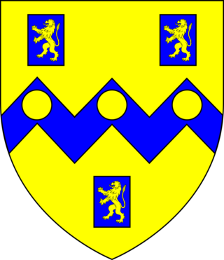
Henry Rolle, 1st Baron Rolle was a British landowner, peer and politician.

Holcombe Rogus is a historic manor in the parish of Holcombe Rogus in Devon, England. The present grade I listed Tudor manor house known as Holcombe Court was built by Sir Roger Bluett c. 1540 and was owned by the Bluett family until 1858 when the estate was sold to Rev. William Rayer. The house is immediately to the west of the parish church. The gardens and grounds are screened off from the public road at the south by a high wall in which is a tall and broad entrance archway which forms the start of the entrance drive.


