See also
| This disambiguation page lists articles about distinct geographical locations with the same name. If an internal link led you here, you may wish to change the link to point directly to the intended article. |
Home Island may refer to:
| This disambiguation page lists articles about distinct geographical locations with the same name. If an internal link led you here, you may wish to change the link to point directly to the intended article. |

Newfoundland and Labrador is the easternmost province of Canada. Situated in the country's Atlantic region, it is composed of the island of Newfoundland and the continental region of Labrador to the northwest, with a combined area of 405,212 square kilometres (156,500 sq mi). In 2018, the province's population was estimated at 525,073. About 92% of the province's population lives on the island of Newfoundland, of whom more than half live on the Avalon Peninsula.

Labrador is a geographic and cultural region within the Canadian province of Newfoundland and Labrador. It is the primarily continental portion of the province and constitutes 71% of the province's area but is home to only 6% of the province's population. It is separated from the island of Newfoundland by the Strait of Belle Isle. It is the largest and northernmost geographical region in Atlantic Canada.

The Gulf of Saint Lawrence is the outlet of the North American Great Lakes via the Saint Lawrence River into the Atlantic Ocean. The gulf is a semi-enclosed sea, covering an area of about 226,000 square kilometres (87,000 sq mi) and containing about 34,500 cubic kilometres (8,300 cu mi) of water, which results in an average depth of 152 metres (499 ft).

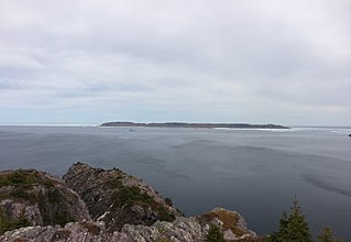
The Strait of Belle Isle is a waterway in eastern Canada that separates the Labrador Peninsula from the island of Newfoundland, in the province of Newfoundland and Labrador.

Quebec, Canada's largest province, occupies a vast territory, most of which is very sparsely populated. With an area of 1,542,056 square kilometres, it is the second largest of Canada's provinces and territories and the tenth largest country subdivision in the world. More than 90 percent of Quebec's area lies within the Canadian Shield, and includes the greater part of the Labrador Peninsula. Quebec's highest mountain is Mont D'Iberville, which is located on the border with Newfoundland and Labrador in the northeastern part of the province in the Torngat Mountains. The addition of parts of the vast and scarcely populated District of Ungava of the Northwest Territories between 1898 and 1912 gave the province its current form.
Division No. 1, Subdivision M is an unorganized subdivision on the Avalon Peninsula in Newfoundland and Labrador, Canada in Division 1. It contains the unincorporated communities of Emerald Vale, Goulds Road, Juniper Stump, Mahers and Turks Water. At several times in the past, census enumerating officers have considered Emerald Vale, Turks Water and Juniper Stump - along with other names such as Riverside Mills - to be part of the loosely defined Makinsons/Hodgewater settlement.

Clarenville is a town on the east coast of Newfoundland in the province of Newfoundland and Labrador, Canada. Clarenville was incorporated in 1951. It is located in the Shoal Harbour valley, fronting an arm of the Atlantic Ocean called Random Sound.
Cape Chidley is a headland located on the eastern shore of Killiniq Island, Canada at the northeastern tip of the Labrador Peninsula.

Conception Bay South is a town located on the southern shore of Conception Bay on the Avalon Peninsula of the island of Newfoundland, Province of Newfoundland and Labrador, Canada. The town is commonly called C.B.S.
Baccalieu Island or Bacalhoo Island is a 5 km2 uninhabited island at the northern extremities of Conception Bay in Subdivision 1G, near the community of Red Head Cove, Newfoundland and Labrador, Canada. It is separated from the island of Newfoundland by Baccalieu Tickle, a small strait and an abundant fishing ground. The island has some trees but mostly rocky.
Victoria is an incorporated town in Conception Bay located approximately midway on the Bay de Verde Peninsula of Newfoundland and Labrador, Canada.

Fortune is a Canadian town located in the province of Newfoundland and Labrador.

Change Islands is an outport community in the Canadian province of Newfoundland and Labrador.

Newfoundland and Labrador is the easternmost province in Canada. The Strait of Belle Isle separates the province into two geographical divisions, Labrador and the island of Newfoundland. The province also includes over seven thousand small islands.

The history of Newfoundland and Labrador covers the period from the arrival of the Archaic peoples. Prior to European colonization, the lands encompassing present-day Newfoundland and Labrador were inhabited for millennia by different groups of indigenous peoples.

Cow Head is a town in the Canadian province of Newfoundland and Labrador. The town had a population of 478 in the Canada 2016 Census.
Dildo Run Provincial Park is a provincial park located on New World Island, Newfoundland and Labrador, Canada. It was opened to the public in 1967. The nearest major town is Twillingate. There are 55 campsites, each with a picnic table, fireplace, garbage can, and room for a vehicle. Fifteen picnic sites offer a view of the ocean. There is also a 1.3 km hiking trail through the forest.
Mainland is a community in the Canadian province of Newfoundland and Labrador, located on the western shore of the Port au Port Peninsula approximately 50 kilometers from the Stephenville International Airport. Mainland is a coastal community, bordered by both the ocean and forest. The main industry in the community has traditionally been fishing, but currently (2016) a large portion of the inhabitants leave the community seasonally to earn income.

Newfoundland is a large island off the east coast of the North American mainland, and the most populous part of the Canadian province of Newfoundland and Labrador. It has 29 percent of the province's land area. The island is separated from the Labrador Peninsula by the Strait of Belle Isle and from Cape Breton Island by the Cabot Strait. It blocks the mouth of the Saint Lawrence River, creating the Gulf of Saint Lawrence, the world's largest estuary. Newfoundland's nearest neighbour is the French overseas community of Saint-Pierre and Miquelon.