Huzi is an administrative ward in the Chamwino District of the Dodoma Region of Tanzania, with a total population of 6,333 according to the 2002 census.
Huzi is an administrative ward in the Chamwino District of the Dodoma Region of Tanzania, with a total population of 6,333 according to the 2002 census.
This is a list of the extreme points of the United Kingdom: the points that are farther north, south, east or west than any other location. Traditionally the extent of the island of Great Britain has stretched "from Land's End to John o' Groats".

The Byrd Glacier is a major glacier in Antarctica, about 136 km (85 mi) long and 24 km (15 mi) wide. It drains an extensive area of the Antarctic plateau, and flows eastward to discharge into the Ross Ice Shelf.
Tucker Glacier is a major valley glacier of Victoria Land, Antarctica, about 90 nautical miles long, flowing southeast between the Admiralty Mountains and the Victory Mountains to the Ross Sea. There is a snow saddle at the glacier's head, just west of Homerun Range, from which the Ebbe Glacier flows northwestward.

Bear Peninsula is a peninsula about 50 nautical miles long and 25 nautical miles wide which is ice-covered except for several isolated rock bluffs and outcrops along its margins, lying 3 nautical miles east of Martin Peninsula on Walgreen Coast, Marie Byrd Land, Antarctica.

Tau Virginis is a single star in the zodiac constellation Virgo. With an apparent visual magnitude of 4.28, it is faintly visible to the naked eye. The distance to Tau Virginis, based upon parallax measurements, is approximately 225 light years with a margin of error of ±3 light years.

Ledaña is a municipality in Cuenca, Castile-La Mancha, Spain. It has a population of 1,882.

Navares de Ayuso is a municipality located in the province of Segovia, Castile and León, Spain. According to the 2004 census (INE), the municipality has a population of 73 inhabitants.

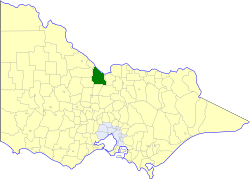
The Shire of Rochester was a local government area in Victoria, Australia, about 190 kilometres (118 mi) north of Melbourne, the state capital, and immediately west and southwest of the town of Echuca. The shire covered an area of 1,934.25 square kilometres (746.8 sq mi), and existed from 1864 until 1994.
Antsatsaka is a municipality in Madagascar. It belongs to the district of Ambanja, which is a part of Diana Region. According to 2001 census the population of Antsatsaka was 10,214.
The Jaeger Table is the ice-covered summit plateau of Dufek Massif, in the Pensacola Mountains of Antarctica, rising to 2,030 metres (6,660 ft) at Worcester Summit.
Fenoarivo is a town and commune in Madagascar. It belongs to the district of Ambalavao, which is a part of Haute Matsiatra Region. The population of the commune was estimated to be approximately 8,000 in 2001 commune census.
The Worcester Range is a high coastal range, about 30 nautical miles long, in Antarctica. It stands between Skelton Glacier and Mulock Glacier on the western side of the Ross Ice Shelf. It is southwest of the Royal Society Range and north of the Conway Range of the Cook Mountains.
São Domingos do Maranhão is a municipality in the state of Maranhão in the Northeast region of Brazil.

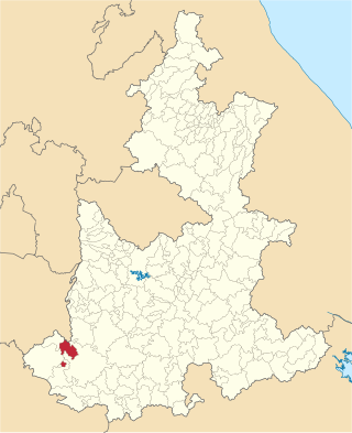
Huehuetlán el Chico (municipality) is a town and municipality in the state of Puebla in south-eastern Mexico.
On the continent of Antarctica, the Aramis Range is the third range south in the Prince Charles Mountains, situated 11 miles southeast of the Porthos Range and extending for about 30 miles in a southwest–northeast direction. It was first visited in January 1957 by Australian National Antarctic Research Expeditions (ANARE) southern party led by W.G. Bewsher, who named it for a character in Alexandre Dumas' novel The Three Musketeers, the most popular book read on the southern journey.

The Goodenough Glacier is a broad sweeping glacier to the south of the Batterbee Mountains, flowing from the west shore of Palmer Land, Antarctica, into George VI Sound and the George VI Ice Shelf.

Castrillo-Tejeriego is a village in Valladolid, Castile-Leon, Spain. The municipality covers an area of 35.98 square kilometres (13.89 sq mi) and as of 2011 had a population of 203 people.
La Plaza is a Chilean village located in Pichilemu, Cardenal Caro Province.
Algur is a village in the southern state of Karnataka, India. It is located in the Sindgi taluk of Bijapur district.