Related Research Articles

An aquifer is an underground layer of water-bearing permeable rock, rock fractures or unconsolidated materials.

The water table is the upper surface of the zone of saturation. The zone of saturation is where the pores and fractures of the ground are saturated with water. It can also be simply explained as the depth below which the ground is saturated.

In the oil and gas industry, the term wireline usually refers to the use of multi-conductor, single conductor or slickline cable, or "wireline", as a conveyance for the acquisition of subsurface petrophysical and geophysical data and the delivery of well construction services such as pipe recovery, perforating, plug setting and well cleaning and fishing. The subsurface geophysical and petrophysical information results in the description and analysis of subsurface geology, reservoir properties and production characteristics.

Hydrogeology is the area of geology that deals with the distribution and movement of groundwater in the soil and rocks of the Earth's crust. The terms groundwater hydrology, geohydrology, and hydrogeology are often used interchangeably.

A hydrograph is a graph showing the rate of flow (discharge) versus time past a specific point in a river, channel, or conduit carrying flow. The rate of flow is typically expressed in cubic meters or cubic feet per second . It can also refer to a graph showing the volume of water reaching a particular outfall, or location in a sewerage network. Graphs are commonly used in the design of sewerage, more specifically, the design of surface water sewerage systems and combined sewers.
An aquifer test is conducted to evaluate an aquifer by "stimulating" the aquifer through constant pumping, and observing the aquifer's "response" (drawdown) in observation wells. Aquifer testing is a common tool that hydrogeologists use to characterize a system of aquifers, aquitards and flow system boundaries.
The Kansas Geological Survey (KGS), a research and service division of the University of Kansas, is charged by statute with studying and providing information on the geologic resources of Kansas. The KGS has no regulatory authority and does not take positions on natural resource issues.
Hydraulic conductivity, symbolically represented as , is a property of vascular plants, soils and rocks, that describes the ease with which a fluid can move through pore spaces or fractures. It depends on the intrinsic permeability of the material, the degree of saturation, and on the density and viscosity of the fluid. Saturated hydraulic conductivity, Ksat, describes water movement through saturated media. By definition, hydraulic conductivity is the ratio of volume flux to hydraulic gradient yielding a quantitative measure of a saturated soil's ability to transmit water when subjected to a hydraulic gradient.
In water-related science and engineering, there are two similar but distinct definitions in use for the word drawdown:
Used in hydrogeology, the groundwater flow equation is the mathematical relationship which is used to describe the flow of groundwater through an aquifer. The transient flow of groundwater is described by a form of the diffusion equation, similar to that used in heat transfer to describe the flow of heat in a solid. The steady-state flow of groundwater is described by a form of the Laplace equation, which is a form of potential flow and has analogs in numerous fields.
A slug test is a particular type of aquifer test where water is quickly added or removed from a groundwater well, and the change in hydraulic head is monitored through time, to determine the near-well aquifer characteristics. It is a method used by hydrogeologists and civil engineers to determine the transmissivity/hydraulic conductivity and storativity of the material the well is completed in.

Geotechnical investigations are performed by geotechnical engineers or engineering geologists to obtain information on the physical properties of soil earthworks and foundations for proposed structures and for repair of distress to earthworks and structures caused by subsurface conditions. This type of investigation is called a site investigation. Additionally, geotechnical investigations are also used to measure the thermal resistivity of soils or backfill materials required for underground transmission lines, oil and gas pipelines, radioactive waste disposal, and solar thermal storage facilities. A geotechnical investigation will include surface exploration and subsurface exploration of a site. Sometimes, geophysical methods are used to obtain data about sites. Subsurface exploration usually involves soil sampling and laboratory tests of the soil samples retrieved.

Groundwater recharge or deep drainage or deep percolation is a hydrologic process, where water moves downward from surface water to groundwater. Recharge is the primary method through which water enters an aquifer. This process usually occurs in the vadose zone below plant roots and, is often expressed as a flux to the water table surface. Groundwater recharge also encompasses water moving away from the water table farther into the saturated zone. Recharge occurs both naturally and through anthropogenic processes, where rainwater and or reclaimed water is routed to the subsurface.
Artificial lift refers to the use of artificial means to increase the flow of liquids, such as crude oil or water, from a production well. Generally this is achieved by the use of a mechanical device inside the well or by decreasing the weight of the hydrostatic column by injecting gas into the liquid some distance down the well. A newer method called Continuous Belt Transportation (CBT) uses an oil absorbing belt to extract from marginal and idle wells. Artificial lift is needed in wells when there is insufficient pressure in the reservoir to lift the produced fluids to the surface, but often used in naturally flowing wells to increase the flow rate above what would flow naturally. The produced fluid can be oil, water or a mix of oil and water, typically mixed with some amount of gas.
Groundwater models are computer models of groundwater flow systems, and are used by hydrologists and hydrogeologists. Groundwater models are used to simulate and predict aquifer conditions.
Well drainage means drainage of agricultural lands by wells. Agricultural land is drained by pumped wells to improve the soils by controlling water table levels and soil salinity.
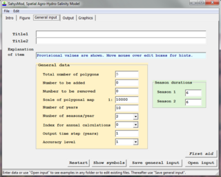
SahysMod is a computer program for the prediction of the salinity of soil moisture, groundwater and drainage water, the depth of the watertable, and the drain discharge in irrigated agricultural lands, using different hydrogeologic and aquifer conditions, varying water management options, including the use of ground water for irrigation, and several crop rotation schedules, whereby the spatial variations are accounted for through a network of polygons.

SaltMod is computer program for the prediction of the salinity of soil moisture, groundwater and drainage water, the depth of the watertable, and the drain discharge (hydrology) in irrigated agricultural lands, using different (geo)hydrologic conditions, varying water management options, including the use of ground water for irrigation, and several cropping rotation schedules. The water management options include irrigation, drainage, and the use of subsurface drainage water from pipe drains, ditches or wells for irrigation.
Hydrogeophysics is a cross-disciplinary area of research that uses geophysics to determine parameters and monitor processes for hydrological studies of matters such as water resources, contamination, and ecological studies. The field uses knowledge and researchers from geology, hydrology, physics, geophysics, engineering, statistics, and rock physics. It uses geophysics to provide quantitative information about hydrogeological parameters, using minimally invasive methods. Hydrogeophysics differs from geophysics in its specific uses and methods. Although geophysical knowledge and methods have existed and grown over the last half century for applications in mining and petroleum industries, hydrogeological study sites have different subsurface conditions than those industries. Thus, the geophysical methods for mapping subsurface properties combine with hydrogeology to use proper, accurate methods to map shallow hydrological study sites.
Multilevel Groundwater Monitoring Systems, also referred to as Multi-Depth Groundwater Monitoring Systems, Multilevel Systems (MLSs), or Engineered Neste Wells, are engineered technologies installed in single boreholes above and/or below the water table to obtain data from different depth intervals. The technologies may consist of various pipes, liners, access ports, sampling pumps, pressure sensors, and sealing mechanisms that are installed temporarily or permanently in boreholes drilled into unconsolidated sediments or bedrock.
References
- https://web.archive.org/web/20071201142040/http://tian.hwr.arizona.edu/yeh/index.html
- http://tian.hwr.arizona.edu/research/HT/examples
| | This hydrology article is a stub. You can help Wikipedia by expanding it. |