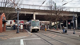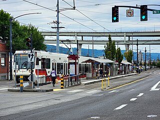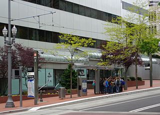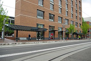
The MAX Yellow Line is a light rail line serving Portland, Oregon, United States. Operated by TriMet as part of the MAX Light Rail system, it connects North Portland, Portland City Center, and Portland State University (PSU). The line serves 17 stations; it runs north–south from Expo Center station to PSU South/Southwest 6th and College station, interlining with the Green and Orange lines within the Portland Transit Mall. Service runs for 21 hours per day with headways of up to 15 minutes. The Yellow Line is the fourth-busiest service in the MAX system; it carried an average 12,960 riders per weekday in September 2019.

Rose Quarter Transit Center is a light rail station in the MAX system and a TriMet bus transit center, and is located in the Rose Quarter area of Portland, Oregon, a part of the Lloyd District. It is served by the Blue, Green and Red Lines. It is currently the 7th stop eastbound on the Eastside MAX as well as the first stop after crossing the Willamette River on the Steel Bridge. Two hundred yards west of the station is the Interstate/Rose Quarter station on the MAX Yellow Line.

Old Town/Chinatown station is a MAX Light Rail station served by the Blue and Red Lines. It is located in the Old Town Chinatown neighborhood in Portland, Oregon and is currently the 6th stop eastbound on the Eastside MAX. It is also the last stop before crossing the Willamette River. It is next to the Portland Downtown Heliport. The station was previously also served by the Yellow Line, from 2004 to 2009, until that line's relocation to the Portland Transit Mall.

Library/Southwest 9th Avenue and Galleria/Southwest 10th Avenue are light rail stops on the MAX Blue and Red Lines in Portland, Oregon. It was the original western terminus and is now the Eastside MAX line's first stop eastbound/last stop westbound in downtown.

Albina/Mississippi station is a light rail station on the MAX Yellow Line in Portland, Oregon, United States. It is the second stop northbound on the Interstate MAX extension. The station is located in the median of Interstate Avenue near the intersection of N Albina Street. The station serves the Lower Albina Industrial District, Emanuel Hospital, and an emerging and redeveloping commercial district. The station is a center platform, with its main artistic theme drawing upon the lively jazz scene that thrived in Albina in the post-World War II era. During planning for Interstate MAX, this station was located at the intersection of Interstate Avenue and Russell Street. The Union Pacific Railroad raised concerns on conflicts between pedestrian and truck traffic at the Russell Street intermodal entrance to Albina Yard, which led designers to shift the station two blocks south.

Overlook Park is a light rail station in Portland, Oregon, United States, served by TriMet as part of the MAX Light Rail system. It is the eighth station southbound on the Yellow Line, which operates between North Portland, downtown Portland and Portland State University. The staggered side platform station is situated between the intersections of Fremont Street and Overlook Boulevard along the median of North Interstate Avenue, near the Interstate Medical Offices of Kaiser Permanente and a park with the same name. It is one of three stations serving North Portland's Overlook neighborhood along with North Prescott Street and North Killingsworth Street. Overlook Park station opened on May 1, 2004, as part of the Interstate MAX extension. Trains serve the station for approximately 21 hours per day on a headway of 15 minutes during most of the day.

North Prescott Street is a light rail station on the MAX Yellow Line in Portland, Oregon. It is the 4th stop northbound on the Interstate MAX extension.

North Lombard Transit Center is a light rail station on the MAX Yellow Line in Portland, Oregon. It is the 7th stop northbound on the Interstate MAX extension.

The MAX Green Line is a light rail line serving the Portland metropolitan area in the U.S. state of Oregon. Operated by TriMet as part of the MAX Light Rail system, it connects Portland State University (PSU), Portland City Center, Northeast Portland, Southeast Portland, and Clackamas. The Green Line travels 15 miles (24.1 km) from the PSU South stations to Clackamas Town Center Transit Center and serves 30 stations. It is the only service that interlines with all of the other MAX services, sharing the Portland Transit Mall segment with the Orange and Yellow lines and part of the Eastside MAX segment with the Blue and Red lines. South of Gateway Transit Center, the Green Line branches off to Clackamas Town Center. Service runs for 21 hours on weekdays and 20 hours on weekends with headways of up to 15 minutes. It is the third-busiest line in the system with an average of 13,030 riders per day on weekdays in September 2024.

Southeast Main Street is a light rail station on the MAX Green Line in Portland, Oregon. It is the first stop southbound on the I-205 MAX branch, following the Green Line's split from the Red and Blue lines at the Gateway Transit Center.

Southeast Powell Boulevard is a light rail station on the MAX Green Line in Portland, Oregon. It is the 3rd stop southbound on the I-205 MAX branch.

Southeast Holgate Boulevard is a light rail station on the MAX Green Line in Portland, Oregon. It is the 4th stop southbound on the I-205 MAX branch. The station is at the intersection of Interstate 205 and Holgate Boulevard. It has a center platform, and has a park-and-ride facility on the west side. Lents Park is located slightly to the southwest of the station.

Lents Town Center/Southeast Foster Road is a light rail station on the MAX Green Line in Portland, Oregon. It is the 5th stop southbound on the I-205 MAX branch. The station is at the intersection of Interstate 205 and Foster Road. It is located in the Lents neighborhood's town center business district. It also provides access to the Springwater Corridor, which was once a transit line to the suburbs and is now a dedicated bikeway through southeast Portland.

Southeast Flavel Street is a light rail station on the MAX Green Line in Portland, Oregon. It is the sixth stop southbound on the I-205 MAX branch. The station is located at SE Flavel Street, adjacent to Interstate 205, and has a center platform. Johnson Creek flows beneath the interstate and railway tracks, slightly north of the station.

Southeast Fuller Road is a light rail station on TriMet's MAX Green Line in Portland, Oregon, located between SE 82nd Avenue and Interstate 205. It is the 7th stop southbound on the Interstate 205 MAX branch. The station has a center platform and is surrounded by a park and ride facility.

Union Station/Northwest 6th & Hoyt and Union Station/Northwest 5th & Glisan are light rail stations on the MAX Green, Orange and Yellow Lines in Portland, Oregon. They are the first stops southbound on the Portland Transit Mall MAX extension. The Union Station/Northwest 6th & Hoyt Street station is served only by the Green and Yellow Lines, and the Union Station/Northwest 5th & Glisan Street station is served only by the Green and Orange Lines. Originally, from the opening of these stations in 2009 until 2015, the Yellow Line served both, but in September 2015 the then-new Orange Line replaced the Yellow Line at all southbound stations on the transit mall.

Southwest 6th & Madison Street and City Hall/Southwest 5th & Jefferson Street stations are a pair of light rail stations on the MAX Green, Orange and Yellow Lines in Portland, Oregon. It is the fifth stop southbound on the Portland Transit Mall extension.

The PSU Urban Center stations are light rail stations on the MAX Green, Orange and Yellow Lines in downtown Portland, Oregon, United States, located adjacent to the PSU Urban Center, of Portland State University. The northbound platform is the PSU Urban Center/Southwest 6th & Montgomery station, and the southbound platform is the PSU Urban Center/Southwest 5th & Mill station. The stations opened on August 30, 2009, and for the next three years they were temporarily the southern passenger terminus of the Portland Transit Mall MAX extension, awaiting construction of the PSU South stations. The latter opened on September 2, 2012, and the change made PSU Urban Center the second stop northbound and the next-to-last stop southbound on the Portland Mall MAX lines.

Southeast Bybee Boulevard is a light rail station in Portland, Oregon, United States, served by TriMet as part of the MAX Light Rail system. It is the 14th station southbound on the Orange Line, which runs between Portland City Center, Southeast Portland, and Milwaukie. The island platform station adjoins Union Pacific Railroad (UP) freight tracks to the east and McLoughlin Boulevard to the west. It is accessed from the Bybee Bridge, which spans over the platform and connects Portland's Sellwood-Moreland and Eastmoreland neighborhoods. Nearby destinations include Westmoreland Park, Eastmoreland Golf Course, Crystal Springs Rhododendron Garden, and Reed College.

South Waterfront/South Moody, formerly South Waterfront/Southwest Moody, is a combined light rail and bus station located at 698 Southwest Porter Street in the South Waterfront neighborhood of Portland, Oregon, at the west end of the Tilikum Crossing bridge. It is serviced by the MAX Orange Line and TriMet buses. Portland Streetcar travels through it but does not service it.


