Turnpike often refers to:

Shelby County is a county located in the far eastern portion of the U.S. state of Texas. As of the 2020 census, its population was 24,022. Its county seat is Center. The county was established in 1835 as a municipality of Mexico and organized as a county in 1837. It is named for Isaac Shelby, a soldier in the American Revolution who became the first governor of Kentucky.

Interstate 69 (I-69) is an Interstate Highway in the United States currently consisting of eight unconnected segments. The longest segment runs from Evansville, Indiana, northeast to the Canadian border in Port Huron, Michigan, and includes the original continuous segment from Indianapolis, Indiana, to Port Huron of 355.8 miles (572.6 km). The remaining separated segments are variously completed and posted or not posted sections of an extension southwest to the Mexican border in Texas. Of this extension—nicknamed the NAFTA Superhighway because it would help trade with Canada and Mexico spurred by the North American Free Trade Agreement (NAFTA)—seven pieces in Laredo, Texas; Pharr, Texas; Brownsville, Texas; Corpus Christi, Texas; Houston, Texas; northwestern Mississippi; and Memphis, Tennessee, have been built or upgraded and signposted as I-69. Indiana completed the fifth segment that extends I-69 through that state in August 2024.

U.S. Route 79 is a United States highway in the Southern United States. The route is officially considered and labeled as a north–south highway, but its path is actually more of a diagonal northeast–southwest highway. The highway's northern/eastern terminus is in Russellville, Kentucky, at a junction with U.S 68. Its southern/western terminus is in Round Rock, Texas, at an interchange with Interstate 35, ten miles (16 km) north of Austin. US 79, US 68, and Interstate 24/US 62 are the primary east–west access points for the Land Between the Lakes recreation area straddling the Kentucky/Tennessee border.
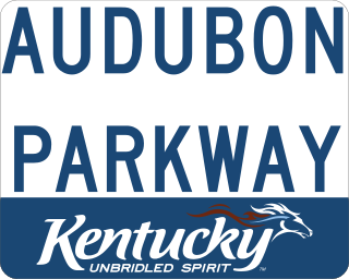
The Audubon Parkway is a freeway and former toll road connecting the cities of Henderson and Owensboro, Kentucky. Named for John James Audubon, an early American naturalist, the Audubon's western terminus is at US 41; the eastern terminus is US 60. The road opened on December 18, 1970, at a cost of $23.5 million and, at 23.4 miles (37.7 km), is the shortest of the seven roads in the state's parkway system. It is also the only road in the parkway system that has not had the name of a Kentucky politician attached to it. The road carries the unsigned designation of Kentucky Route 9005 (AU 9005). A white and gold shield was used along the Audubon Parkway until 2006, when a new, standardized blue-on-white marker was introduced for all of Kentucky's parkways.

The Wendell H. Ford Western Kentucky Parkway is a 98.5-mile-long (158.5 km) freeway running from Elizabethtown to near Nortonville, Kentucky. It intersects with Interstate 65 (I-65) at its eastern terminus, and I-69 at its western terminus. It is one of seven highways that are part of the Kentucky parkway system. The road was renamed for Wendell H. Ford, a former Kentucky governor and United States senator, in 1998. Previously, it was simply the Western Kentucky Parkway, and often called the "WK Parkway" or "the WK" because of the initials that were once used on its signs prior to the 1998 renaming. The parkway carries the unsigned designation Kentucky Route 9001 for its entire length.
The Ronald Reagan Highway or Ronald Reagan Memorial Highway may refer to the following roads named after U.S. President Ronald Reagan:
The Loop is a 21.4-mile-long (34.4 km) beltway around Texarkana, TX and Texarkana, AR, which are twin cities in the U.S. states of Arkansas and Texas. Consisting of a section of Interstate 49 (I-49) in Arkansas, and Loop 151 and a section of I-369 and U.S. Route 59 (US 59) in Texas, it forms a three-quarter loop around the east, south and west sides of the city. The Loop is built to Interstate Highway standards.
Interstate 169 may refer to any of four currently designated or future highways which are or would be auxiliary routes of Interstate 69,
Purple Heart Trail can refer to:
John F. Kennedy Memorial Highway or JFK Memorial Highway may refer to:

Interstate 369 (I-369) is an incomplete north–south auxiliary Interstate Highway currently within Texarkana, Texas. Once complete, the freeway will run approximately 117 miles (188 km) through Northeast Texas beginning at an interchange with I-69 east of Tenaha and head northward to Carthage, Marshall, Jefferson, and Atlanta to its current northern terminus at I-30. For its entire length, I-369 will generally share its alignment with US 59.
This page is based on this
Wikipedia article Text is available under the
CC BY-SA 4.0 license; additional terms may apply.
Images, videos and audio are available under their respective licenses.