
A ring road is a road or a series of connected roads encircling a town, city or country. The most common purpose of a ring road is to assist in reducing traffic volumes in the urban centre, such as by offering an alternate route around the city for drivers who do not need to stop in the city core. Ring roads can also serve to connect suburbs to each other, allowing efficient travel between them.

Interstate 24 (I-24) is an Interstate Highway in the Midwestern and Southeastern United States. It runs diagonally from I-57, 10 miles (16 km) south of Marion, Illinois, to Chattanooga, Tennessee, at I-75. It travels through Illinois, Kentucky, Tennessee, and Georgia. As an even-numbered Interstate, it is signed as an east–west route, though the route follows a more southeast–northwest routing, passing through Nashville, Tennessee. The numbering deviates from the standard Interstate Highway System grid, lying further north than its number would indicate west of Nashville. The short segment within Georgia bears the unsigned designation State Route 409 (SR 409).

Interstate 40 (I-40) is a major east–west transcontinental Interstate Highway in the southeastern and southwestern portions of the United States. At a length of 2,556.61 miles (4,114.46 km), it is the third-longest Interstate Highway in the country, after I-90 and I-80. From west to east, it passes through California, Arizona, New Mexico, Texas, Oklahoma, Arkansas, Tennessee, and North Carolina. Its western terminus is at I-15 in Barstow, California, while its eastern terminus is at a concurrency with U.S. Route 117 (US 117) and North Carolina Highway 132 (NC 132) in Wilmington, North Carolina. Major cities served by the interstate include Flagstaff, Arizona; Albuquerque, New Mexico; Amarillo, Texas; Oklahoma City, Oklahoma; Little Rock, Arkansas; Memphis, Nashville, and Knoxville in Tennessee; and Asheville, Winston-Salem, Greensboro, Durham, Raleigh, and Wilmington in North Carolina.
Interstate 270 is the designation for four Interstate Highways in the United States, all of which are related to Interstate 70:
Interstate 635 may refer to:
Interstate 495 (I-495) is the designation for the following five Interstate Highways in the United States, all of which are related to I-95:
Interstate 675 may refer to:
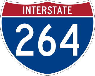
Interstate 264 (I-264) is an Interstate Highway in the US state of Virginia. It serves as the primary east–west highway through the South Hampton Roads region in southeastern Virginia. The route connects the central business districts of Chesapeake, Portsmouth, Norfolk, and Virginia Beach and serves as the most direct link between those cities and the resort beaches along Virginia's Atlantic coast.
A Beltline is a short-line railway operating in and around a city, principally to transfer freight between long-haul railroads and/or other modes of transportation. The term may also refer to:
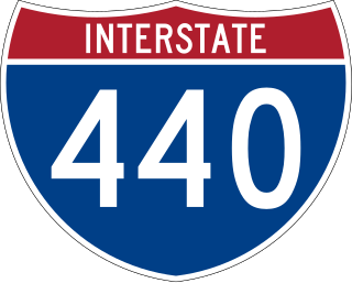
Interstate 440 (I-440), also known as the Raleigh Beltline, the Cliff Benson Beltline, or locally as The Beltline, is an Interstate Highway in the US state of North Carolina. I-440 is a 16.4-mile-long (26.4 km) partial beltway that nearly encircles central Raleigh. I-440 begins in west Raleigh at an interchange with I-40 as a continuation of U.S. Highway 64 (US 64)/US 1 and traverses a primarily residential area in west Raleigh. The freeway makes a turn toward the east, crossing US 70, Six Forks Road, and Wake Forest Road. US 1 branches north off I-440 at US 401, becoming US 401/US 1. I-440 turns toward the southeast and follows a brief concurrency with U.S. Highway 64 Business before intersecting I-87/US 64/US 264. US 64 and I-87 are concurrent with I-440 along the remainder of the road's southwesterly routing. Exit 16 is the last exit on I-440, where I-440 splits to join either I-40 eastbound or I-40 westbound.
Interstate 440 (I-440) is an east–west auxiliary Interstate Highway that runs through Nashville, Tennessee. It serves as a southern bypass around downtown Nashville, and is located on average about three miles (4.8 km) from the center of the city. I-440 is also known locally as the Four-Forty Parkway, and is designated as the Debra K. Johnson Memorial Parkway. At a length of 7.64 miles (12.30 km), I-440 runs between I-40 and I-24, and connects to I-65 and multiple U.S. Routes. Combined, I-440 and Briley Parkway, a controlled-access segment of State Route 155 (SR 155), form a noncontiguous inner beltway around downtown Nashville.

Interstate 440 (I-440) and Highway 440 (AR 440), in the central part of the US state of Arkansas, form a partial freeway loop of 14.16 miles (22.79 km) connecting U.S. Highway 67 (US 67), US 167, and I-40 with I-30 and I-530 near Little Rock. I-440, known as the East Belt Freeway during planning and construction, travels through much of the area's industrial core in the eastern part of the metropolitan area, near Clinton National Airport and the Port of Little Rock. The route is mostly a six-lane freeway. North of I-40, the route continues as AR 440 until it reaches US 67/US 167 in Jacksonville. This section is known as the North Belt Freeway.
The North Carolina Highway System consists of a vast network of Interstate, United States, and state highways, managed by the North Carolina Department of Transportation. North Carolina has the second largest state maintained highway network in the United States because all roads in North Carolina are maintained by either municipalities or the state. Since counties do not maintain roads, there is no such thing as a "county road" within the state.
Wade Avenue is an arterial in The Triangle region of North Carolina that links Interstate 40, Interstate 440, and downtown Raleigh. The roadway is internally designated as Secondary Road 1728 (SR 1728) from I-40 to Glenwood Avenue, however it is not signed as such. The short piece east of Glenwood Avenue carries U.S. Route 70 and North Carolina Highway 50.
Dr. Martin Luther King Jr. Expressway may refer to:
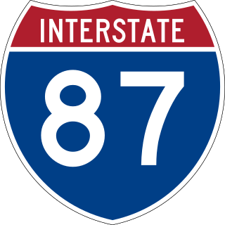
Interstate 87 (I-87) is a partially completed Interstate Highway in the US state of North Carolina, the shortest designated primary Interstate Highway at 12.90 miles (20.76 km) long. The completed portion is in eastern Wake County, between Raleigh and Wendell; the majority of the completed route is known as the Knightdale Bypass, while the remaining three miles (4.8 km) follows the Raleigh Beltline (I-440). It is planned to continue northeast through Rocky Mount, Williamston, and Elizabeth City, ending in Norfolk, Virginia. It is signed as north–south, in keeping with the sign convention for most odd-numbered interstates, but the route goes primarily east–west, with the eastern direction aligning to the north designation. The entire route is concurrent with US Highway 64 (US 64), with portions also concurrent with I-440 and US 264.