Interstate 490 may refer to the following Interstate Highways in the United States:
- Interstate 490 (New York) in Rochester, New York
- Interstate 490 (Ohio) in Cleveland, Ohio
- Interstate 490 (Illinois) currently being built west of Chicago
Interstate 490 may refer to the following Interstate Highways in the United States:

Interstate 90 (I-90) is an east–west transcontinental freeway and the longest Interstate Highway in the United States at 3,021 miles (4,862 km). It begins in Seattle, Washington, and travels through the Pacific Northwest, Mountain West, Great Plains, Midwest, and the Northeast, ending in Boston, Massachusetts. The highway serves 13 states and has 15 auxiliary routes, primarily in major cities such as Chicago, Cleveland, Buffalo, and Rochester.

Northeast Ohio is a geographic and cultural region that comprises the northeastern counties of the U.S. state of Ohio. Definitions of the region consist of 16 to 23 counties between the southern shore of Lake Erie and the foothills of the Appalachian Mountains, home to over 4.5 million people. It is anchored by the metropolitan area of Cleveland, the most populous city in the region with over 372,000 residents in 2020. Other metropolitan centers include Akron, Canton, Mansfield, Sandusky, and Youngstown. Northeast Ohio includes most of the area known historically as the Connecticut Western Reserve.
Interstate 290 may refer to the following Interstate Highways in the United States:

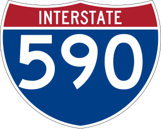
Interstate 590 (I-590) is a north–south auxiliary Interstate Highway that serves the immediate southeastern suburbs of the city of Rochester, New York, in the United States. It extends for 5.31 miles (8.55 km) from an interchange with I-390 in Brighton to the Can of Worms, a complex interchange connecting I-590 to I-490 just inside the Rochester city line. I-590 makes up the southeast quadrant of the Rochester Outer Loop, which continues west on I-390 and north past the Can of Worms on New York State Route 590 (NY 590). The highway is a spur route of I-90; the connection between the two is made via both I-390 and I-490.

Interstate 490 (I-490) is an auxiliary Interstate Highway that serves the city of Rochester, New York, in the United States. It acts as a northerly alternate route to the New York State Thruway (I-90), leaving it at exit 47 in the town of Le Roy and rejoining the highway at exit 45 in the town of Victor 37.4 miles (60.2 km) to the east. I-490 connects with I-390 and New York State Route 390 (NY 390) on the western side of Rochester and I-590 and NY 590 on the east side of the city at an interchange known as the Can of Worms. The highway comprises the southernmost portion of the Inner Loop, a beltway around the interior of Rochester. Outside the city, I-490 serves several suburban villages, such as Churchville and Pittsford.

Interstate 490 (I-490) is a 2.43-mile (3.91 km) auxiliary Interstate Highway in Cleveland, Ohio. The western terminus is a junction with I-90 and I-71 on Cleveland's west side. After spanning the Cuyahoga River, I-490 reaches its eastern terminus at a junction with East 55th Street, just east of I-77.

New York State Route 390 (NY 390) is a north–south freeway located along the western edge of the city of Rochester, New York, in the United States. The route, a northward continuation of Interstate 390 (I-390), extends for 8.00 miles (12.87 km) from I-490 in Gates to the Lake Ontario State Parkway in Greece, less than 1 mile (1.6 km) from the Lake Ontario shoreline. Between I-490 and NY 104, NY 390 makes up the north–south segment of the northwest quadrant of the Rochester Outer Loop, a series of freeways encircling Rochester. At NY 104, the Outer Loop departs NY 390 and follows NY 104 east into the city.
Interstate 80N may refer to:

Interstate 90 (I-90) runs east–west across the northern tier of the US state of Ohio. Much of it is along the Ohio Turnpike, but sections outside the turnpike pass through Cleveland and northeast into Pennsylvania.

The Frederick Douglass–Susan B. Anthony Memorial Bridge is a triple steel arch bridge carrying Interstate 490 (I-490) over the Genesee River and New York State Route 383 in downtown Rochester, New York. The bridge, officially completed on June 18, 2007, replaced a 50-year-old multi-girder bridge situated in the same location.
Purple Heart Trail can refer to:

Interstate 80N is a former designation in Ohio. It ran along what is now the following highways :

The transportation system of Cleveland is a network that includes several modes of transportation including sidewalks, roads, public transit, bicycle paths and regional and international airports.