Ise/Orun

Last updated

Ise/Orun
LGA
CountryFlag of Nigeria.svg  Nigeria
State Ekiti State
Government
  Coordinating Director and the Head of the Local Government CouncilL.S Oladunjoye
Time zone UTC+1 (WAT)
Ise/Orun

Ise/Orun is a Local Government Area of Ekiti State, Nigeria. Its headquarters are in the town of Ise Ekiti. [1] [2]

Contents

Ise/Orun Local Government Area, one of Ekiti State's 16 operational LGAs, is located in Ise Ekiti Town and houses its administrative headquarters. It is included in the state's Ekiti South senatorial district along with the local government areas of Ekiti South-West, Ikere, Emure, Ekiti East, and Gbonyin (Aiyekire). [3]

The ten wards operating under the area council are represented by the 11 elected councilors of this local government region. The local government council is in charge of the LGA's public administration.

It has an area of 432 km2 and a population of 113,754 at the 2006 census. [4]

The postal code of the area is 361. [5]

Economy

Ise/Orun LGA is known for its farming, with a range of crops like maize, cassava, and pepper cultivated there. Additionally, the region is home to a variety of markets where residents of the LGA can buy and sell a wide range of goods. The LGA also has significant blacksmithing, textile weaving,Cocoa, Timber and hunting industries. [6]

Geography/Climate

In Ise-Ekiti, the dry season is hot, muggy, and partially cloudy whereas the wet season is warm, unpleasant, and overcast. The temperature rarely falls below 58°F or rises over 95°F throughout the year, usually fluctuating between 64°F and 90°F. [7]

With an average daily high temperature of 88°F, the hot season lasts for 2.3 months, from January 22 to April 1. With an average high of 89°F and low of 72°F, March is the hottest month of the year in Ise-Ekiti. [8]

With an average daily maximum temperature below 82°F, the chilly season lasts for 4.0 months, from June 16 to October 15. With an average low of 69°F and a high of 81°F, August is the coolest month of the year in Ise-Ekiti. [9]

With a total area of 432 square kilometers and an average temperature of 27 degrees Celsius, Ise/orun LGA is quite large. In the LGA, the average humidity is 64% and the average wind speed is 11 km/h. [10] [6]

Related Research Articles

<span class="mw-page-title-main">Ningi, Nigeria</span> Place in Bauchi State, Nigeria

Ningi is a town, a local government area, and an emirate in Bauchi State, Nigeria. The Ningi emirate comprises two local government areas, Ningi and Warji, with a combined area of 5,250 km2 and a population of 501,912 according to the 2006 Census. The Ningi local government area covers an area of 4,625 km2 with a population of 387,192 at the 2006 Census. The area is inhabited mostly by hausa people, Duwa, Ningawa.Yunusa Muhammadu Danyaya is the current Emir of Ningi.

<span class="mw-page-title-main">Gboko</span> LGA in Benue state

Gboko is a Local Government Area in Benue state, North-central Nigeria. It is headquartered in the town of Gboko.

Ikere-Ekiti, also known as Ikere or Ikerre, is a city in Ekiti State of Nigeria. It is an agricultural and mine centre. According to the 1963 and 1991 census, the population was 114,780 and 60,257 respectively, but the 2006 census recorded it to be 147,355.

Oye is a town and headquarter of Oye Local Government Area in Ekiti State, Nigeria. Oye Local Government Area was carved out from the defunct Ekiti North Local Government on 17 May 1989.

Ankpa is a Local Government Area in Kogi State, Nigeria. Its headquarters are in the town of Ankpa on the A233 highway in the west of the area at7°22′14″N7°37′31″E.

Emure is a town in the Ekiti State of Nigeria. It is also called Emure Ekiti. It became much better known in the US after the king of Emure's grandson Adewale Ogunleye made it into the NFL for the Chicago Bears.

Ido-Osi is a town located in Ekiti State, Nigeria.

<span class="mw-page-title-main">Ijero Ekiti</span> Town in Oyo state, Nigeria

Ijero Ekiti is a town in Ekiti State of Nigeria in West Africa. Ijero Ekiti is situated in the northwest part of Ekiti State. Ijero Ekiti is the Local Government Headquarters of Ijero. The main language spoken by the indigenes of Ijero Ekiti is Ekiti dialect and the Yoruba language.

Shelleng is a Local Government Area (LGA) of Adamawa State, North-east Nigeria.

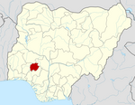
Efon is a Local Government Area of Ekiti State, Nigeria. Its headquarters are in the town of Efon-Alaaye.

Ekiti South-West is a Local Government Area (LGA) of Ekiti State, Nigeria. Its headquarters are in the town of Ilawe Ekiti. It has an area of 346 km2 and a population of 165,277 at the 2006 census.

Ekiti West is a Local Government Area of Ekiti State, Nigeria. Its headquarters is in the town of Aramoko.

Irepodun/Ifelodun is a Local Government Area of Ekiti State, Nigeria. Irepodun/Ifelodun is predominantly a homogeneous society and carefully populated by Yoruba speaking people of the South West of Nigeria. It has an area of 356 km2 and a population of 129,149 at the 2006 census. The major religions of the people are Christianity and Islam while a percentage of the people are traditional religion worshippers.

Akko is a local government area of Gombe, Gombe State, Nigeria. Its headquarters is in Kumo town on the A345 highway south of the state capital Gombe, about 40 km away. Kumo (headquarter) is a cosmopolitan communities of more than 30 differents tribes, ranging from the dominant Fulani tribe to Tangale, Tera, Hausa and other minorities.

Kaltungo is one among the 11 Local Governments Area of Gombe State, Nigeria. Its headquarters is in the town of Kaltungo in the western part of the Local Government Area on the A345 highway at 9°48′51″N11°18′32″E.

Nafada is one of the eleven Local Government Areas (LGA) of Gombe State, Nigeria. Its headquarter is in the town of Nafada in the east of the area at 11°05′44″N11°19′58″E, on the Gongola River which traverses the area. According to the 2006 census, the LGA covers 1,586 square kilometers and has a population of 138,185 people. Nafada has ten wards namely: Nafada East, Nafada Central, Nafada West, Jigawa, Birnin Fulani East, Birnin Bolewa, Birnin Fulani West, Gudukku, Barwo/Nasarawo and Barwo Winde.

Ingawa is a Local Government Area in Katsina State, Nigeria. Its headquarters is in the town of Ingawa.

Dan Musa is a Local Government Area in Katsina State, Nigeria. Its headquarters is in the town of Dan Musa.

Karu is a Local Government Area in Nasarawa State, central Nigeria. It is close in proximity to the Federal Capital Territory of Nigeria. It has an area of 2,640 km2. Karu local government has its headquarters in New Karu town. It was originally built to house the capital's civil servants and lower income families, but had no running water or good sanitation system. Karu has grown in population beyond its original planned capacity. Ensure Administrative convenience and bring government closer to the grass root people, Karshi Development Area was created with its administrative secretariat at Uke.

<span class="mw-page-title-main">Keffi</span> LGA and Town in Nasarawa State, Nigeria

Keffi Local Government Area and also is a traditional or commercial town in Nasarawa north central Nigeria Its headquarters are in the town of Keffi. Keffi is 50 kilometers from Abuja. Nasarawa State university is located in Keffi sitting along Keffi-Akwanga express way.

References

  1. LGAs in Ekiti State
  2. places (1970-01-01). "Towns & Villages in Ise/Orun « Ekiti State « Nigeria". Towns & Villages. Retrieved 2023-08-20.
  3. "Ise/Orun Local Government Area". www.finelib.com. Retrieved 2023-08-20.
  4. Nigeria, Media (2022-04-29). "History Of Ise/Orun LGA, Ekiti State". Media Nigeria. Retrieved 2023-08-20.
  5. "Post Offices- with map of LGA". NIPOST. Archived from the original on 2009-10-07. Retrieved 2009-10-20.
  6. 1 2 "Ise / Orun Local Government Area". www.manpower.com.ng. Retrieved 2023-08-20.
  7. "Ise-Ekiti Climate, Weather By Month, Average Temperature (Nigeria) - Weather Spark". weatherspark.com. Retrieved 2023-08-20.
  8. "Ise-Orun, Ekiti, Nigeria 10-Day Weather Forecast - The Weather Channel | Weather.com". The Weather Channel. Retrieved 2023-08-20.
  9. "Weather for Ise-Ekiti, Ise/Orun, NG". www.foreca.com. Retrieved 2023-08-20.
  10. Vizzuality. "Ise/Orun, Ekiti, Nigeria Deforestation Rates & Statistics | GFW". www.globalforestwatch.org. Retrieved 2023-08-20.