Darwin most often refers to:
Bass or Basses may refer to:

Johnston is an electoral division of the Legislative Assembly in Australia's Northern Territory. It was first created in 2001, replacing the abolished seat of Jingili, and is named after Commodore Eric Johnston, a former Administrator of the Northern Territory. Johnston is an urban electorate, covering only 5 km2 and taking in the Darwin suburbs of Jingili, Moil, Wagaman and part of Alawa. There were 5,556 people enrolled within the electorate as of August 2020.
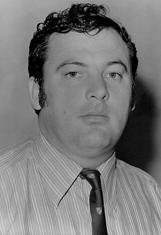
Paul Anthony Edward Everingham is a former Australian politician who was the head of government of the Northern Territory of Australia from 1977 to 1984, serving as the second and last Majority Leader (1977–1978) and the first Chief Minister of the Northern Territory from 1978 to 1984. He represented the northern Darwin seat of Jingili in the Northern Territory Legislative Assembly from 1974 to 1984. He was then elected to the federal House of Representatives, representing the Northern Territory between 1984 and 1987.

The Shire of Balonne is a local government area in South West Queensland, Australia, over 500 kilometres (310 mi) from the state capital, Brisbane. It covers an area of 31,104 square kilometres (12,009.3 sq mi), and has existed as a local government entity since 1879. It is headquartered in its main town, St George.
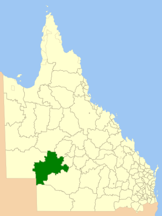
The Shire of Barcoo is a local government area in Central West Queensland, Australia.
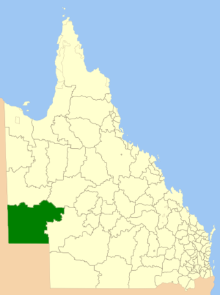
The Shire of Diamantina is a local government area in Central West Queensland, bordering South Australia and the Northern Territory. Its administrative centre is in the town of Bedourie.

The Shire of Douglas is a local government area in Far North Queensland. It is located on the coast north of the city of Cairns. The shire, administered from the town of Mossman, covers an area of 2,428 square kilometres (937.5 sq mi), and existed as a local government entity from 1880 until 2008, when it was amalgamated with the City of Cairns to become the Cairns Region. Following a poll in 2013, the Shire of Douglas was re-established on 1 January 2014.

The Shire of Burke is a local government area in North West Queensland, Australia. The shire lies on the south coast of the Gulf of Carpentaria and abuts the border with the Northern Territory. It covers an area of 39,864 square kilometres (15,391.6 sq mi), and has existed as a local government entity since 1885. The major town and administrative centre of the shire is Burketown.
Elliott is a town in Northern Territory of Australia. It is almost halfway between Darwin and Alice Springs on the Stuart Highway. The town is in the Yapurkulangu ward of the Barkly Region. At the 2016 census, Elliott had a population of 339.
Jingili was an electoral division of the Legislative Assembly in Australia's Northern Territory. One of the Legislative Assembly's original electorates, it was first contested at the 1974 election. It was abolished in 2001 and replaced by the new seat of Johnston.
Jingulu, also spelt Djingili, is an Australian language spoken by the Jingili people in the Northern Territory of Australia, historically around the township of Elliot. The language is an isolate branch of the Mirndi languages.
The Jingili or Jingulu are an indigenous Australian people of the Northern Territory.
The Warlmanpa are an indigenous Australian people of the Northern Territory.
Gippsland is a primary sub-provincial division of the Australian state of Victoria.
This is a list of electoral results for the Electoral division of Jingili in Northern Territory elections.
A by-election for the seat of Jingili in the Northern Territory Legislative Assembly was held on 15 December 1984. The by-election was triggered by the resignation of CLP Chief Minister Paul Everingham to seek election to the Federal House of Representatives. The seat of Jingili had been held by Everingham since its creation in 1974.
This page is based on this
Wikipedia article Text is available under the
CC BY-SA 4.0 license; additional terms may apply.
Images, videos and audio are available under their respective licenses.