Related Research Articles

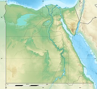
The geography of Egypt relates to two regions: North Africa and West Asia.

The Nile is a major north-flowing river in northeastern Africa. It flows into the Mediterranean Sea. The Nile is the longest river in Africa. It has historically been considered the longest river in the world, though this has been contested by research suggesting that the Amazon River is slightly longer. Of the world's major rivers, the Nile is one of the smallest, as measured by annual flow in cubic metres of water. About 6,650 km (4,130 mi) long, its drainage basin covers eleven countries: the Democratic Republic of the Congo, Tanzania, Burundi, Rwanda, Uganda, Kenya, Ethiopia, Eritrea, South Sudan, Sudan, and Egypt. In particular, the Nile is the primary water source of Egypt, Sudan and South Sudan. The Nile is an important economic driver supporting agriculture and fishing.
The Qattara Depression is a depression in northwestern Egypt, specifically in the Matruh Governorate. The depression is part of the Western Desert of Egypt. The Qattara Depression lies below sea level, and its bottom is covered with salt pans, sand dunes, and salt marshes. The depression extends between the latitudes of 28°35' and 30°25' north and the longitudes of 26°20' and 29°02' east.

The Libyan Desert is a geographical region filling the northeastern Sahara Desert, from eastern Libya to the Western Desert of Egypt and far northwestern Sudan. On medieval maps, its use predates today's Sahara, and parts of the Libyan Desert include the Sahara's most arid and least populated regions; this is chiefly what sets the Libyan Desert apart from the greater Sahara. The consequent absence of grazing, and near absence of waterholes or wells needed to sustain camel caravans, prevented Trans-Saharan trade between Kharga close to the Nile, and Murzuk in the Libyan Fezzan. This obscurity saw the region overlooked by early European explorers, and it was not until the early 20th century and the advent of the motor car before the Libyan Desert started to be fully explored.

Brigadier Ralph Alger Bagnold, OBE, FRS, was an English 20th-century desert explorer, geologist and soldier.

Cape Juby is a cape on the coast of southern Morocco, near the border with Western Sahara, directly east of the Canary Islands.

The Sahara is a desert spanning across North Africa. With an area of 9,200,000 square kilometres (3,600,000 sq mi), it is the largest hot desert in the world and the third-largest desert overall, smaller only than the deserts of Antarctica and the northern Arctic.

The Eastern Desert is the part of the Sahara Desert that is located east of the Nile River. It spans 223,000 square kilometres (86,000 sq mi) of northeastern Africa and is bordered by the Gulf of Suez and the Red Sea to the east, and the Nile River to the west. It extends through Egypt, Eritrea, Ethiopia, and the Sudan. The Eastern Desert consists of a mountain range which runs parallel to the coast, wide sedimentary plateaus extending from either side of the mountains and the Red Sea coast. The rainfall, climate, vegetation and animal life sustained in the desert varies between these different regions. The Eastern Desert has been a mining site for building materials, as well as precious and semi-precious metals, throughout history. It has historically contained many trade routes leading to and from the Red Sea, including the Suez Canal.
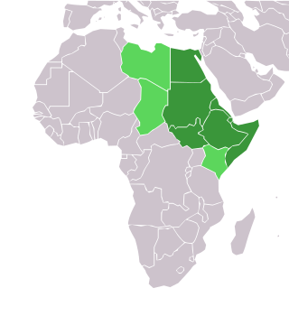
Northeast Africa, or Northeastern Africa, or Northern East Africa as it was known in the past, encompasses the countries of Africa situated in and around the Red Sea. The region is intermediate between North Africa and East Africa, and encompasses the Horn of Africa, as well as Egypt, Libya, South Sudan and Sudan. The region has a very long history of habitation with fossil finds from the early hominids to modern human and is one of the most culturally and linguistically diverse regions of the world, being the home to many civilizations and located on an important trade route that connects multiple continents.

Jaghbub is a remote desert village in the Al Jaghbub Oasis in the eastern Libyan Desert. It is actually closer to the Egyptian town of Siwa than to any Libyan town of note. The oasis is located in Butnan District and was the administrative seat of the Jaghbub Basic People's Congress. The town remains highly obscure, in spite of the substantial colonial history the city holds. The town was the birthplace of Idris of Libya on 12 March 1890.

Wadi El Natrun is a depression in northern Egypt that is located 23 m (75 ft) below sea level and 38 m (125 ft) below the Nile River level. The valley contains several alkaline lakes, natron-rich salt deposits, salt marshes and freshwater marshes.
William Boyd Kennedy Shaw OBE was a British desert explorer, botanist, archaeologist and soldier. During the Second World War he served with the British Army's Long Range Desert Group, and the Special Air Service Regiment. He was known, variously as Bill Shaw or Bill Kennedy-Shaw, but preferred the latter form of his name, which he always used in his writings.

The wildlife of Egypt is composed of the flora and fauna of this country in northeastern Africa and southwestern Asia, and is substantial and varied. Apart from the fertile Nile Valley, which bisects the country from south to north, the majority of Egypt's landscape is desert, with a few scattered oases. It has long coastlines on the Mediterranean Sea, the Gulf of Suez, the Gulf of Aqaba and the Red Sea. Each geographic region has a diversity of plants and animals each adapted to its own particular habitat.

Friedrich Bassler was a German hydraulic engineer.

The Qattara Depression Project or Qattara Project is a macro-engineering project concept in Egypt. Rivalling the Aswan High Dam in scope, the intention is to develop the hydroelectric potential of the Qattara Depression by creating an artificial lake.
The Sahara Sea was the name of a hypothetical macro-engineering project which proposed flooding endorheic basins in the Sahara with waters from the Atlantic Ocean or Mediterranean Sea. The goal of this unrealised project was to create an inland sea that would cover the substantial areas of the Sahara which lie below sea level, bringing humid air, rain, and agriculture deep into the desert.
The Al Jaghbub Oasis is a protected area in northeastern Libya lying close to the border with Egypt. It adjoins the desert village of Jaghbub which is inhabited by Berbers with a population of about 400.
In Egypt, the Western Desert is an area of the Sahara that lies west of the river Nile, up to the Libyan border, and south from the Mediterranean Sea to the border with Sudan. It is named in contrast to the Eastern Desert which extends east from the Nile to the Red Sea. The Western Desert is mostly rocky desert, though an area of sandy desert, known as the Great Sand Sea, lies to the west against the Libyan border. The desert covers an area of 680,650 km2 (262,800 sq mi) which is two-thirds of the land area of the country. Its highest elevation is 1,000 m (3,300 ft) in the Gilf Kebir plateau to the far south-west of the country, on the Egypt-Sudan-Libya border. The Western Desert is barren and uninhabited save for a chain of oases which extend in an arc from Siwa, in the north-west, to Kharga in the south. It has been the scene of conflict in modern times, particularly during the Second World War.

The trans-Saharan slave trade, also known as the Arab slave trade, was a slave trade in which slaves were mainly transported across the Sahara. Most were moved from sub-Saharan Africa to North Africa to be sold to Mediterranean and Middle Eastern civilizations; a small percentage went in the other direction.
Oric Bates was an American archaeologist and author. Bates worked at multiple institutions including the Boston Museum of Fine Arts where he served as the director of the Egyptian Department and the Peabody Museum of Archaeology and Ethnography where he was a curator in African ethnology. Notable works by Bates include "The Eastern Libyans," "A Madcap Cruise," and Siwan Superstitions." Bates also led expeditions in Libya and Sudan.
References
- ↑ "Obituary: Dr. John Ball". The Geographical Journal. 98 (5/6): 301–303. 1941. ISSN 0016-7398. JSTOR 1787469.
- ↑ Newbold, D. (1941). "Dr. JOHN BALL. A PERSONAL MEMOIR". Sudan Notes and Records. 24: 209–212. ISSN 0375-2984. JSTOR 41716451.
- ↑ Ball, John (1927). "Problems of the Libyan Desert". The Geographical Journal. 70 (1): 21–38. doi:10.2307/1781881. JSTOR 1781881.
- ↑ Ball, John (1933). "The Qattara Depression of the Libyan Desert and the Possibility of Its Utilization for Power-Production". The Geographical Journal. 82 (4): 289–314. doi:10.2307/1785898. JSTOR 1785898.
The geography and geology of south-eastern Egypt (1912) by John Ball, published at Cairo by Government Press
| International | |
|---|---|
| National | |
| People | |
| Other | |
| | This article about an English scientist is a stub. You can help Wikipedia by expanding it. |