Related Research Articles

In modern mapping, a topographic map or topographic sheet is a type of map characterized by large-scale detail and quantitative representation of relief features, usually using contour lines, but historically using a variety of methods. Traditional definitions require a topographic map to show both natural and artificial features. A topographic survey is typically based upon a systematic observation and published as a map series, made up of two or more map sheets that combine to form the whole map. A topographic map series uses a common specification that includes the range of cartographic symbols employed, as well as a standard geodetic framework that defines the map projection, coordinate system, ellipsoid and geodetic datum. Official topographic maps also adopt a national grid referencing system.

The Cascade Range or Cascades is a major mountain range of western North America, extending from southern British Columbia through Washington and Oregon to Northern California. It includes both non-volcanic mountains, such as many of those in the North Cascades, and the notable volcanoes known as the High Cascades. The small part of the range in British Columbia is referred to as the Canadian Cascades or, locally, as the Cascade Mountains. The highest peak in the range is Mount Rainier in Washington at 14,411 feet (4,392 m).

The Geological Survey of Canada is a Canadian federal government agency responsible for performing geological surveys of the country developing Canada's natural resources and protecting the environment. A branch of the Earth Sciences Sector of Natural Resources Canada, the GSC is the country's oldest scientific agency and was one of its first government organizations.

Joanna Cassidy is an American actress. She is known for her roles as the replicant Zhora Salome in Blade Runner (1982) and Dolores in Who Framed Roger Rabbit (1988). She has won a Golden Globe Award, was nominated for three Emmy Awards and also was nominated for a Saturn Award and Screen Actors Guild Awards.

The West Canada Creek is a 76-mile-long (122 km) river in upstate New York, United States. West Canada Creek is an important water way in Hamilton, Oneida, and Herkimer counties, draining the south part of the Adirondack Mountains before emptying into the Mohawk River near the Village of Herkimer. The name "Canada" is derived from an Iroquoian word for "village" (Kanata).
The Allan Hills are a group of hills at the end of the Transantarctic Mountains System, located in Oates Land and Victoria Land regions of Antarctica.
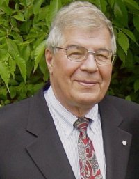
Raymond Alexander Price, is a Canadian geologist. He has used his research on the structure and tectonics of North America’s lithosphere to produce extensive geological maps. He has also provided guidance for nuclear fuel waste disposal and reports on the human contribution to Global warming.
The Alberta Geological Survey (AGS), founded in 1921, is the official provincial geological survey of Alberta, Canada and currently operates as a division within the Alberta Energy Regulator. The AGS provides geological information and advice about the geology of Alberta to the Government of Alberta, the Alberta Energy Regulator (AER), industry, and the public to support the exploration, sustainable development, regulation, and conservation of Alberta's resources.

The Santa Teresa Hills are a range of mountains in Santa Clara County, California, located primarily in the city of San Jose. They separate the San Jose neighborhoods of Almaden Valley to the west and Santa Teresa to the east.

The United States Geological Survey (USGS), founded as the Geological Survey, is an agency of the United States government whose work spans the disciplines of biology, geography, geology, and hydrology. The agency was founded on March 3, 1879, to study the landscape of the United States, its natural resources, and the natural hazards that threaten it. The agency also makes maps of extraterrestrial planets and moons based on data from U.S. space probes.
A series of small volcanic earthquakes measuring less than 4.0 on the Richter magnitude scale took place in the sparsely populated Nazko area of the Central Interior of British Columbia, Canada, from October 9, 2007, to June 12, 2008. They occurred just west of Nazko Cone, a small tree-covered cinder cone that last erupted about 7,200 years ago.
Cassidy Glacier is a glacier 7 nautical miles (13 km) long and 2 nautical miles (4 km) wide, flowing northeast into upper Taylor Glacier between Depot Nunatak and the northwest end of the Quartermain Mountains, in Victoria Land. The descriptive names "South-West Arm" and "South Arm" were applied to this glacier and to the part of Ferrar Glacier south of Knobhead, respectively, by the British National Antarctic Expedition, 1901–04. Subsequent mapping has shown that the glacier described here is part of the Taylor Glacier system.
Mount Cassidy is a mountain, 1,917 metres (6,290 ft) high, which forms a salient angle in the northeast part of Prentice Plateau, Olympus Range, McMurdo Dry Valleys. Rude Spur descends from the east side of the mountain. It was named by the Advisory Committee on Antarctic Names (2004) after Dennis S. Cassidy, Curator of the Antarctic Marine Geology Research Facility and Core Library, Florida State University, Tallahassee, from 1962 to 1991.
Deville Glacier is a glacier flowing along the south side of the Laussedat Heights into Andvord Bay, on the west coast of Graham Land. The glacier is shown on an Argentine government chart of 1952. It was named by the UK Antarctic Place-Names Committee in 1960 for Edouard G. Deville, Surveyor-General of Canada, 1885–1924, who introduced and developed photogrammetric methods of survey in Canada from 1888 onward.
Elephant Moraine is an isolated moraine, 3 nautical miles (6 km) long, located 27 nautical miles (50 km) west of Reckling Peak, to the west of the head of Mawson Glacier in Victoria Land, Antarctica. The moraine, described in some reports as an ice core moraine, is situated along a long, narrow patch of bare ice that extends west from Reckling Peak for 60 nautical miles (110 km). The feature was noted in U.S. satellite imagery of 1973, and in aerial photographs obtained subsequently, by William R. MacDonald of the United States Geological Survey, who originally described it to William A. Cassidy as "a possible nunatak having an outline similar to an elephant." Several United States Antarctic Research Program field parties led by Cassidy collected meteorites at this moraine during the 1979–80 ANSMET season, including the Martian meteorite EETA 79001. The descriptive name was approved by the Advisory Committee on Antarctic Names in 1989.

Eliason Glacier is a glacier 5 nautical miles (9 km) long close west of Mount Hornsby, flowing south from Detroit Plateau into the ice piedmont north of Larsen Inlet, Nordenskjöld Coast in northern Graham Land, Antarctica. It was mapped from surveys by the Falkland Islands Dependencies Survey (1960–61), and was named by the UK Antarctic Place-Names Committee after the Eliason motor sledge, invented in 1942 in Sweden, now made in Canada, and used in Arctic Canada since 1950 and in the Antarctic since 1960.
The 1989 Ungava earthquake occurred at 09:24 local time on 25 December to the north of Lac Bécard in a remote part of the Ungava Peninsula in northern Quebec. It had a magnitude of 6.3 on the surface wave magnitude scale and 6.2–6.5 on the moment magnitude scale and a maximum felt intensity of only IV (Light) on the Mercalli intensity scale, due to its remoteness from any inhabited areas. The mainshock was preceded by a magnitude 5.1 foreshock ten hours earlier. It was the first earthquake in eastern North America known to be associated with ground rupture.

Black Mountain is a lava capped mesa in Pima County, Arizona, that rises 1,000 feet above its base to an altitude of 3,700 feet (1,128 m). It is a northeast trending ridge, 5,600 feet in length, located along Mission Road nine miles southwest of Tucson. It is on the San Xavier Indian Reservation, 3.18 miles southwest of the Mission San Xavier del Bac. The Sierrita Mountains rise to the southwest and the Santa Cruz River is about four miles to the east.
Irish Canyon is a valley in Moffat County in northwestern Colorado at 6,099 feet [CONVERT?] in elevation according to United States Geological Survey (USGS). The Bureau of Land Management states that the elevations rise from 6,100 to 8,636 feet. It is a scenic canyon and somewhat remote. It is designated both as the Irish Canyon Natural Area and the Irish Canyon Area of Critical Environmental Concern.
References
- Geological Survey of Canada: Directory of Geoscience Expertise Archived 2013-07-02 at the Wayback Machine
| International | |
|---|---|
| National | |
| Other | |
| | This article about a Canadian scientist is a stub. You can help Wikipedia by expanding it. |