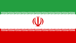
Kaftar Ali Chay is a river in northwest Iran, [1] [2] located at lat 38.24, long45.62e.

A river is a natural flowing watercourse, usually freshwater, flowing towards an ocean, sea, lake or another river. In some cases a river flows into the ground and becomes dry at the end of its course without reaching another body of water. Small rivers can be referred to using names such as stream, creek, brook, rivulet, and rill. There are no official definitions for the generic term river as applied to geographic features, although in some countries or communities a stream is defined by its size. Many names for small rivers are specific to geographic location; examples are "run" in some parts of the United States, "burn" in Scotland and northeast England, and "beck" in northern England. Sometimes a river is defined as being larger than a creek, but not always: the language is vague.

Iran, also called Persia, and officially the Islamic Republic of Iran, is a country in Western Asia. With over 81 million inhabitants, Iran is the world's 18th most populous country. Comprising a land area of 1,648,195 km2 (636,372 sq mi), it is the second largest country in the Middle East and the 17th largest in the world. Iran is bordered to the northwest by Armenia and the Republic of Azerbaijan, to the north by the Caspian Sea, to the northeast by Turkmenistan, to the east by Afghanistan and Pakistan, to the south by the Persian Gulf and the Gulf of Oman, and to the west by Turkey and Iraq. The country's central location in Eurasia and Western Asia, and its proximity to the Strait of Hormuz, give it geostrategic importance. Tehran is the country's capital and largest city, as well as its leading economic and cultural center.

In geography, latitude is a geographic coordinate that specifies the north–south position of a point on the Earth's surface. Latitude is an angle which ranges from 0° at the Equator to 90° at the poles. Lines of constant latitude, or parallels, run east–west as circles parallel to the equator. Latitude is used together with longitude to specify the precise location of features on the surface of the Earth. On its own, the term latitude should be taken to be the geodetic latitude as defined below. Briefly, geodetic latitude at a point is the angle formed by the vector perpendicular to the ellipsoidal surface from that point, and the equatorial plane. Also defined are six auxiliary latitudes which are used in special applications.
The river rises in the hills near Kandalaj, flows past the town of Daryan, [3] inShabestar County and empties into Lake Urmia. The river is around 1778m above sea level.

Daryan is a village in Guney-ye Markazi Rural District, in the Central District of Shabestar County, East Azerbaijan Province, Iran. At the 2006 census, its population was 3,954 in 1207 families.

Shabestar County is a county in East Azerbaijan Province in Iran. The capital of the county is Shabestar. At the 2011 census, the county's population was 124,499, in 37,358 families. The county is subdivided into three districts: the Central District, Tasuj District, and Sufian District. The county has nine cities: Shabestar, Khamaneh, Sharafkhaneh, Shendabad, Sis, Vayqan, Sufian, Tasuj, and Kuzeh Kanan.

Lake Urmia is an endorheic salt lake in Iran. The lake is located between the provinces of East Azerbaijan and West Azerbaijan in Iran, and west of the southern portion of the Caspian Sea. At its greatest extent, it was the largest lake in the Middle East and the sixth-largest saltwater lake on Earth, with a surface area of approximately 5,200 km2 (2,000 sq mi), a length of 140 km (87 mi), a width of 55 km (34 mi), and a maximum depth of 16 m (52 ft). The lake has shrunk to 10% of its former size due to damming of the rivers that flow into it, and the pumping of groundwater from the surrounding area.