
Chhorambu is a village and Village Development Committee in Khotang District in the Sagarmatha Zone of eastern Nepal. At the time of the 1991 Nepal census it had a population of 2,376 persons living in 428 individual households.
Baksila is a village and Village Development Committee in Khotang District in the Sagarmatha Zone of eastern Nepal. At the time of the 1991 Nepal census it had a population of 3,996 persons living in 796 individual households. Baksila is located at five hours walk from Diktel, headquarters of Khotang District. Surrounded by Baspani, Sungdel, Dipsung, Rakha Saptewor and Kharmi, this village split into nine wards geographically
Bamrang is a town under Diktel Municipality in Khotang District in the Sagarmatha Zone of eastern Nepal. This VDC was merged into Diktel to form municipality in May, 2014. At the time of the 1991 Nepal census it had a population of 3,067 persons living in 585 individual households.
Indrayani Pokhari is a town and Village Development Committee in Khotang District in the Sagarmatha Zone of eastern Nepal. At the time of the 1991 Nepal census it had a population of 3,589 persons living in 697 individual households.
Kharmi is a town and Village Development Committee in Khotang District in the Sagarmatha Zone of eastern Nepal. At the time of the 1991 Nepal census it had a population of 3,807 persons living in 723 individual households.
Khidima is a village and Village Development Committee in Khotang District in the Sagarmatha Zone of eastern Nepal. At the time of the 1991 Nepal census it had a population of 2,349 people living in 415 individual households.
Khotang Bazar is a village and Village Development Committee in Khotang District in Province No. 1 in eastern Nepal. At the time of the 1991 Nepal census, it had a population of 2,433 persons living in 458 individual households.....
Laphyang is a town under Diktel Municipality in Khotang District in the Sagarmatha Zone of eastern Nepal. This VDC was merged into Diktel to form municipality in May, 2014. At the time of the 1991 Nepal census it had a population of 2,915 persons living in 498 individual households.
Rakha Dipsung is a village and Village Development Committee in Khotang District in the Sagarmatha Zone of eastern Nepal. At the time of the 1991 Nepal census it had a population of 972.
Ratancha Majhagaun is a town and Village Development Committee in Khotang District in the Sagarmatha Zone of eastern Nepal. At the time of the 1991 Nepal census it had a population of 3,176 persons living in 591 individual households.
Simpani is a town and Village Development Committee in Khotang District in the Sagarmatha Zone of eastern Nepal. At the time of the 1991 Nepal census it had a population of 3,597 persons living in 676 individual households. According to Simpani VDC record in 2008, its total population is 5713.
Sungdel is a village and Village Development Committee in Khotang District in the Sagarmatha Zone of eastern Nepal. At the time of the 1991 Nepal census it had a population of 2,846 persons living in 585 individual households.Its situated at northern east belt of khotang district. Currently, there is a high school, Shree surya Ma. Vi, and four other primary schools as means of education. Peoples running their own hydropower.Mojority of people are Koyee Rai. It is the only one place where Koyee people speaks their mothertone language Koyee. This language is also known as sungdele bhasa. Most of people depends on farming.The highest hill in khotang district Loure is situated in Sungdel. Sungdel is famous for wild bee honey.
Waplukha is a Village Development Committee in Khotang District in the Sagarmatha Zone of eastern Nepal. At the time of the 1991 Nepal census it had a population of 2,571 persons living in 484 individual households.
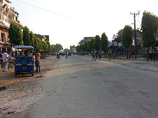
Sagarmatha Highway is a National Highway of Nepal that connects Khotang District to Saptari District via Udayapur District. At Kadmaha the Sagarmatha Highway joins Mahendra Highway which also called East-West National Highway which runs across the Terai geographical regions of Nepal.

Halesi Tuwachung is a municipality out of two municipalities in Khotang District of Province No. 1 of Nepal. It is in western part of the district and about 40 km far from Diktel, the headquarter of the district. It is named after the famous Halesi Mahadev.

Khotehang is a rural municipality (gaunpalika) out of eight rural municipality located in Khotang District of Province No. 1 of Nepal. There are a total of 10 municipalities in Khotang in which 2 are urban and 8 are rural.
Diprung is a rural municipality (gaunpalika) out of eight rural municipality located in Khotang District of Province No. 1 of Nepal. There are a total of 10 municipalities in Khotang in which 2 are urban and 8 are rural.
Jantedhunga is a rural municipality (gaunpalika) out of eight rural municipality located in Khotang District of Province No. 1 of Nepal. There are a total of 10 municipalities in Khotang in which 2 are urban and 8 are rural.
Lamidanda is a rural municipality (gaunpalika) out of eight rural municipality located in Khotang District of Province No. 1 of Nepal. There are a total of 10 municipalities in Khotang in which 2 are urban and 8 are rural.


