Notes and references
18°32′S27°07′E / 18.533°S 27.117°E
| | This Zimbabwe location article is a stub. You can help Wikipedia by expanding it. |
Kamativi is a small mining town in Matabeleland North province, Zimbabwe. The Kamativi tin mine is located next to the town, is the reason for the town's extistance, and gave the town its name. The name Kamativi is derived from the word "mativi" which means "sides", "embankments" or "valleys", with the diminutive prefix "ka" - though not grammatically correct - makes the name "little valleys".
In the years around 1800 AD the local Namibia and Tonga people are believed to have used this region as a trade centre for salt and fish to the visiting Rozvi people from the North and Nguni people from the South, then later with the Portuguese missionaries.
Kamativi is located 28 km off the Bulawayo to Victoria Falls Road along Binga Road. There are three schools in the area: Kamativi Primary, St. Theresa Primary and Kamativi Secondary.
18°32′S27°07′E / 18.533°S 27.117°E
| | This Zimbabwe location article is a stub. You can help Wikipedia by expanding it. |

Traralgon is a town located in the east of the Latrobe Valley in the Gippsland region of Victoria, Australia and the most populous city in the City of Latrobe and the region. The urban population of Traralgon at the 2021 census was 26,907. It is the largest and fastest growing city in the greater Latrobe Valley area, which has a population of 77,168 at the 2021 Census and is administered by the City of Latrobe.
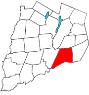
Maryland is a town in Otsego County, New York, United States. The population was 1,897 at the 2010 census. It was named for the U.S. state of the same name. The Town of Maryland is on the county's southern border. It is northeast of the City of Oneonta.

Christiansburg is a town in Montgomery County, Virginia, United States.The population was 21,041 at the 2010 census. It is the county seat of Montgomery County. Christiansburg, Blacksburg and the city of Radford are the three principal municipalities of the Blacksburg–Christiansburg Metropolitan Statistical Area, which encompasses those municipalities, all of Montgomery County, and three other counties.

Hooksett is a town in Merrimack County, New Hampshire, United States. The population was 14,871 at the 2020 census, up from 13,451 at the 2010 census. The town is located between Manchester, the state's largest city, and Concord, the state capital. A prominent landmark is Robie's Country Store, a National Historic Landmark and a frequent stop for presidential candidates during the New Hampshire primary.

Collingwood is a town in the north-west corner of the South Island of New Zealand along Golden Bay / Mohua. The town is an ecotourism destination due to its proximity to Kahurangi National Park and Farewell Spit Nature Reserve.

Henderson is a major suburb of West Auckland, in the North Island of New Zealand. It is 13 kilometres (8.1 mi) west of Auckland city centre, and two kilometres (1.2 mi) west of the Whau River, a southwestern arm of the Waitematā Harbour. The suburb is located within the Henderson-Massey Local Board of the Waitākere Ward, one of the thirteen administrative divisions of Auckland Council.
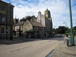
Loftus is a market town and civil parish in the Redcar and Cleveland borough of North Yorkshire, England. The town is located north of the North York Moors and sits between Whitby and Skelton-in-Cleveland.
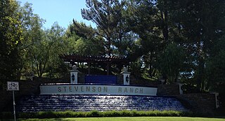
Stevenson Ranch is an unincorporated community in the Santa Clarita Valley of Los Angeles County, California. Stevenson Ranch is set in the foothills of the Santa Susana Mountains and lies west of Interstate 5 and the city of Santa Clarita. Stevenson Ranch encompasses about 6.4 square miles (17 km2). About 1,000 acres (4.0 km2) are set aside as parks, recreation areas, and open space. A master-planned community, it was approved by the county in 1987. The population was 20,178 at the time of the 2020 census. For statistical purposes, the Census Bureau has designated it a census-designated place (CDP).

The Gap is a north-western suburb in the City of Brisbane, Queensland, Australia. In the 2021 census, The Gap had a population of 17,318 people.

Rosebery is an inner southern suburb of Sydney, in the state of New South Wales, Australia. It is 6 kilometres south of the Sydney central business district and is part of the local government areas of the City of Sydney and the Bayside Council.

Panamint City is a ghost town in the Panamint Range, near Death Valley, in Inyo County, California, US. It is also known by the official Board of Geographic Names as Panamint. Panamint was a boom town founded after silver and copper were found there in 1872. By 1874, the town had a population of about 2,000. Its main street was one mile (1.6 km) long. Panamint had its own newspaper, the Panamint News. Silver was the principal product mined in the area. The town is located about three miles northwest of Sentinel Peak. According to the National Geographic Names Database, NAD27 latitude and longitude for the locale are 36°07′06″N117°05′43″W, and the feature ID number is 1661185. The elevation of this location is identified as being 6,280 feet AMSL. The similar-sounding Panamint Springs, California, is located about 25.8 miles at 306.4 degrees off true north near Panamint Junction.

Nawalparasi District, part of which belongs to Gandaki Province and part to Lumbini Province, was one of the seventy-five districts of Nepal before being divided into Parasi District and Nawalpur District in 2015.

Woolsington is a village in, and civil parish of, Newcastle upon Tyne, England. It is located north-west of the city centre, covering a large geographical area. It was also formerly an electoral ward, although the ward was slightly larger than the civil parish, extending slightly further south. The parish also includes Newbiggin Hall, Woolsington village and Newcastle Airport. It had a population of 11,160 as of the 2011 Census.

Durbanville is a town in the Western Cape province of South Africa, part of the greater Cape Town metropolitan area. Durbanville is a semi-rural residential suburb on the north-eastern outskirts of the metropolis surrounded by farms producing wine and wheat.

Maclean is a town in Clarence Valley local government area in the Northern Rivers region of New South Wales, Australia. It is on the Clarence River and near the Pacific Highway. At the 2021 census, Maclean had a population of 2,778, total urban area including Townsend and Gulmarrad is more than 8,304. The Maclean, Yamba and Iluka area known as the Lower Clarence had a combined population of 17,533. Its industries are tourism, sugar cane production, farming and river-prawn trawling. Together with Grafton, Maclean is the shared administrative centre for the Clarence Valley Council local government area.

Mount Pleasant is a town situated in the Barossa Council, just north of the Adelaide Hills region of South Australia, 55 kilometres east-north-east of the state capital, Adelaide. It is located in the Barossa Council and Mid Murray Council local government areas, and is at an altitude of 440 metres above sea level. Rainfall in the area averages 687 mm per annum.

Didy is a rural commune in Madagascar. It belongs to the district of Ambatondrazaka, which is a part of Alaotra-Mangoro Region. The population of the commune was estimated to be 33,039 in 2018.
Choya is a village and municipality in the Andalgalá Department of Catamarca Province in northwestern Argentina. The town is located on National Route 47. It is located along the Río Choya.

Goldsborough is a locality in the Cairns Region, Queensland, Australia. In the 2016 census, Goldsborough had a population of 929 people.