
Rizal, officially the Province of Rizal, is a province in the Philippines located in the Calabarzon region in Luzon. Its capital is the city of Antipolo. It is about 16 kilometers (9.9 mi) east of Manila. The province is named after José Rizal, one of the main national heroes of the Philippines. It is bordered by Metro Manila to the west, Bulacan to the north, Quezon to the east and Laguna to the southeast. The province also lies on the northern shores of Laguna de Bay, the largest lake in the country. Rizal is a mountainous province perched on the western slopes of the southern portion of the Sierra Madre mountain range.

Pasig, officially the City of Pasig, is a highly urbanized city in the National Capital Region of the Philippines. According to the 2020 census, it has a population of 803,159 people.
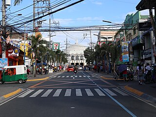
Antipolo, officially the City of Antipolo, is a component city and capital of the province of Rizal, Philippines. According to the 2020 census, it has a population of 887,399 people. It is the most populous city in Rizal Province and in Calabarzon region, and the seventh most-populous city in the Philippines. It is also the most populated city under the component city status.

Cainta, officially the Municipality of Cainta, is a municipality in the province of Rizal, Philippines. According to the 2020 census, it has a population of 376,933 people.

Taytay, officially the Municipality of Taytay, is a municipality in the province of Rizal, Philippines. According to the 2020 census, it has a population of 386,451 people. It is the 2nd most populous municipality in the country, after Rodriguez, Rizal. It is also known as the Garments Capital of the Philippines.

Sta. Lucia Mall is a shopping mall owned by Sta. Lucia Realty & Development Inc. It is situated at the intersection of Marikina–Infanta Highway, and Felix Avenue, located at Barangay San Isidro, Cainta, Rizal, Philippines, beside Robinsons Metro East and near the tripoint boundary of these two areas and Marikina.

Francisco P. Felix Memorial National High School is a secondary public high school located at Municipal Compound, Brgy. Sto. Domingo, Cainta, Rizal, Philippines. The school was founded in 1973 and is recognized as the "Division Leader School" in Rizal.

Ortigas Avenue is a 12.1 km (7.5 mi) highway connecting eastern Metro Manila and western Rizal in the Philippines. It is one of the busiest highways in Metro Manila, serving as the main thoroughfare of the metro's east–west corridor, catering mainly to traffic to and from Rizal.

Marikina–Pasig station is an elevated Light Rail Transit (LRT) station located on the LRT Line 2 (LRT-2) system in San Roque, Marikina, near the tripoint boundary of Pasig, Metro Manila and Cainta, Rizal. The station is situated on the stretch of Marikina–Infanta Highway near the intersection of Gil Fernando Avenue–Felix Avenue and is named after the cities of Marikina and Pasig which the station straddles between.

The Manila East Road, also known as National Road and National Highway, is a two-to-four lane primary and secondary highway connecting Metro Manila to the provinces of Rizal and Laguna in the Philippines.

Robinsons Metro East, is a shopping mall owned by Robinsons Malls. Robinsons Metro East is situated along Marikina–Infanta Highway, located at Barangay Dela Paz in Pasig, Metro Manila, Philippines, near the tripoint boundary of Marikina, Metro Manila and Cainta, Rizal Province. The mall opened on August 31, 2001, and is currently the 3rd largest mall in the Philippines owned by Robinsons Malls.

The Diocesan Shrine and Parish of Our Lady of Light, commonly known as Cainta Church, is a Roman Catholic parish church located along Andres Bonifacio Avenue in Barangay San Andres, Cainta, Rizal, in the Philippines. The church also operates a neighboring school, Cainta Catholic College. From its time of erection as a parish in 1760 until 1983, it belonged to the Archdiocese of Manila. It was placed under the newly created Diocese of Antipolo in 1983, which is now headed by Ruperto C. Santos. It belongs to the Vicariate of Our Lady of Light.

Manggahan High School, formerly known as Rizal High School Annex-Manggahan and mistakenly known as Manggahan National High School, is a public high school in Karangalan Village, Brgy. Manggahan, Pasig.

Santo Rosario de Pasig Church, formerly known as Immaculate Conception Parish, is a Roman Catholic church in Pasig, Philippines. It is under the jurisdiction of the Diocese of Pasig. The jurisdiction of the parish is as follows: Santolan (North), Marikina River (West), Maybunga San Miguel (South), Cainta, Rizal (East). The church enshrines the 19th century Virgin Mary, said to be different among others, for she has a moon underneath her feet.

Capitol Commons is a mixed-use development in Oranbo, Pasig, Metro Manila, Philippines. It is a redevelopment of the former Rizal Provincial Capitol complex located in the village of Oranbo adjacent to the Ortigas Center financial district. The 10-hectare (25-acre) site being developed by Ortigas & Company Limited Partnership, the same developer behind Ortigas Center, features Pasig's first high-end shopping center called Estancia at Capitol Commons. Once completed, the P25-billion mixed-use commercial, residential and office development will have 35,000 square meters (380,000 sq ft) of retail space, 20,000 square metres (220,000 sq ft) of office space for knowledge process outsourcing (KPO) companies, and 280,000 square meters (3,000,000 sq ft) of residential units. The development is also home to the Capitol Commons Park, which takes up fifty percent of the development.
F.P. Felix Avenue, also called by its former name Imelda Avenue, is a four-lane major road which connects Marcos Highway to Ortigas Avenue Extension. It is one of the busiest roads in Cainta, Rizal, Philippines. The road is named after Francisco P. Felix, a former mayor of Cainta, served from 1935 until he died in 1980. It also serves as a boundary of Cainta and Pasig. Felix Avenue was highly accessible by jeepneys, taxis, UV express, tricycles, and private vehicles.
Karangalan Village is a residential area located at Barangay San Isidro, in Cainta, Rizal, Philippines. The village is home to the regional office of Department of Education for Calabarzon.

Karangalan Village is a residential area located at Barangays Manggahan and Dela Paz in Pasig.

In early Philippine history, the Tagalog bayan of Cainta was a fortified upriver polity that occupied both shores of an arm of the Pasig River. It was located not far from where the Pasig River meets the Lake of Ba-i and is presumed to be the present site of the municipality of Cainta, Rizal.

Circulo Verde is a mixed-use development in Quezon City, Metro Manila, the Philippines. It is a primarily residential enclave on a meander of the Marikina River in the village of Bagumbayan on Quezon City's border with Pasig. The 12.47-hectare (30.8-acre) riverfront community is a redevelopment of the former cement plant owned by Concrete Aggregates Corp., a subsidiary of Ortigas & Company. It is one of the four major estates owned and developed by the company in Metro Manila, which in 2019 maintained a combined land bank of 50 hectares across the Eastern Manila cities of Mandaluyong, Pasig and Quezon City.