This page is based on this
Wikipedia article Text is available under the
CC BY-SA 4.0 license; additional terms may apply.
Images, videos and audio are available under their respective licenses.

Aspley is a suburb of the City of Brisbane, Queensland, Australia. It is located about 13 kilometres (8.1 mi) north and about a half-hour drive north of the Brisbane central business district. It is positioned on flat ground south of Cabbage Tree Creek, centred on Little Cabbage Tree Creek and on the surrounding hills to the east and south.

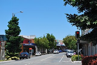
Chermside is a major suburb of City of Brisbane, Queensland, Australia. The suburb is situated just 9km north of the city and is one of Brisbane's fastest developing suburbs. Chermside is known as a mini CBD of Brisbane. It is home to the largest Westfield shopping centre in Australia.

Wooloowin is a suburb in the City of Brisbane, Queensland, Australia.

Kedron State High School is a Queensland public secondary school which is located in the inner-northern suburb of Wooloowin in Brisbane, Australia. The school was opened in 1956, to meet the needs of the rapidly expanding North Brisbane population whose children were members of the post-World War II baby boomer generation.

Brisbane Forest Park, is located on parts of the D'Aguilar Range. The large nature reserve lies on the western boundary of City of Brisbane into the Moreton Bay Region, Queensland, Australia, in Enoggera Reservoir, adjacent to The Gap and between the Mount Coot-tha Reserve on the Taylor Range and higher peaks to the north. Brisbane Forest Park supports plants and animals and is essential to their survival. The main entrance is located in the suburb of The Gap although there are a number of other access points.

Kalinga is a suburb of Brisbane in the City of Brisbane, Queensland, Australia.

Everton Park is a suburb of Brisbane, Queensland, Australia.
It is about eight kilometres north of the Brisbane CBD. This suburb is predominantly residential, with more than a quarter of the population residing in semi-detached and higher density dwellings. Everton Park is a Neighbourhood Watch area.

Wilston is a suburb of the City of Brisbane, Queensland, Australia.

Enoggera is a suburb of Brisbane, in Queensland, Australia 6 kilometres (3.7 mi) north-west of the Brisbane CBD. The west of the suburb is dominated by Enoggera Hill.

Upper Kedron is an outer suburb in the City of Brisbane, Queensland, Australia.

Everton is an electoral district of the Legislative Assembly in the Australian state of Queensland.

Gympie Road is a major road in the northern suburbs of Brisbane, Queensland, Australia. The road forms part of the main road route from the Brisbane Central Business District (CBD) to the northern suburbs, Sunshine Coast and east coast of Queensland.
Sandgate Road is a major road in Brisbane, Queensland, Australia. It provides part of the road connection between Redcliffe and the Brisbane CBD. It is designated state route 26 throughout most of its length.
Windsor was an electoral district of the Legislative Assembly in the Australian state of Queensland from 1912 to 1992.

The Town of Hamilton is a former local government area of Queensland, Australia, located in north-eastern Brisbane.
The Shire of Kedron is a former local government area of Queensland, Australia, located in northern Brisbane. It existed between 1879 and 1925.

The Kedron Division is a former local government area of Queensland, Australia, located in northern Brisbane.
The electoral district of Toombul was a Legislative Assembly electorate in the state of Queensland, Australia.
