Britain most often refers to:
English usually refers to:
Link or Links may refer to:

Breckland is a local government district in Norfolk, England. Its council is based in Dereham, although the largest town is Thetford. The district also includes the towns of Attleborough, Swaffham and Watton, along with numerous villages and surrounding rural areas.
Rose Bowl or Rosebowl may refer to:
Little Britain may refer to:
Mitford and Launditch Hundred was an old grouping of parishes for administrative purposes in the County of Norfolk, England. It is located around East Dereham and is bordered by Walsingham Hundred, Aylsham Hundred, Horsham St. Faith Hundred, Forehoe Hundred, Wayland Hundred, Swaffham Hundred and Freebridge Lynn Hundred.

Bridge of Muchalls is an entirely residential hamlet in Aberdeenshire, Scotland by the North Sea. It is on the A90 dual carriageway about three miles north of Stonehaven and to the south of Muchalls Castle.

Kempstone Hill is a landform in Aberdeenshire, Scotland within the Mounth Range of the Grampian Mountains. The peak elevation of this mountain is 132 metres above mean sea level. This hill has been posited by Gabriel Jacques Surenne, Archibald Watt and C.Michael Hogan as the location for the noted Battle of Mons Graupius between the Romans and the indigenous Caledonians. The major Roman Camp of Raedykes is situated about three kilometres to the west. From Kempstone Hill there are fine views to the North Sea facing east and slightly to the north of Muchalls Castle. There is a UK trigpoint installation on Kempstone Hill.
Megray Hill is a low-lying coastal mountainous landform in Aberdeenshire, Scotland within the Mounth Range of the Grampian Mountains. The peak elevation of this mountain is 120 metres above mean sea level. This hill has been posited as a likely location for the noted Battle of Mons Graupius between the Romans and the indigenous Caledonians. The major Roman Camp of Raedykes is situated about three kilometres to the west. From Megray Hill there are expansive views to the North Sea facing east. The summit affords scenic views of the historic harbour of Stonehaven.
The Hill of Muchalls is a coastal mountainous landform situated approximately 1.4 kilometres west of the Bridge of Muchalls in Aberdeenshire, Scotland within the Mounth Range of the Grampian Mountains. The peak elevation of this mountain is 120 metres above mean sea level. From Megray Hill there are expansive views to the North Sea facing east. The summit affords scenic vies of the historic harbour of Stonehaven.
Limpet Burn is a watercourse in Aberdeenshire, Scotland whose discharge is deemed part of the North Sea coastal drainage. Prominent geographic features in the vicinity of Limpet Burn are Megray Hill and Kempstone Hill. Notable buildings in proximity to Limpet Burn are Ury House, Muchalls Castle and Chapel of St. Mary and St. Nathalan. Part of the watershed of Limpet Burn has been suggested by some as the site of the first recorded battle in the history of Scotland, the Battle of Mons Graupius.

Great Dunham is a village situated in the Breckland District of Norfolk and covers an area of 818 hectares with an estimated population of 325, including Kempstone and increasing to a measured population of 344 at the 2011 Census. The village lies 1.5 miles (2.4 km) north of its sister village Little Dunham and 7 miles (11 km) by road north east from Swaffham.

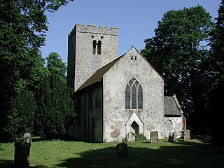
Kempstone is a village situated in Breckland District of Norfolk and covers an area of 331 hectares with an estimated population of 18 as of UK census 2001 At the 2011 Census the population remained less 100 and is included in the civil parish of Great Dunham. The village lies 1.2 miles (1.9 km) south of Litcham and 9.3 miles (15.0 km) by road east from Dereham.
Kempson is a surname. Notable people with the surname include:
This page is based on this
Wikipedia article Text is available under the
CC BY-SA 4.0 license; additional terms may apply.
Images, videos and audio are available under their respective licenses.


